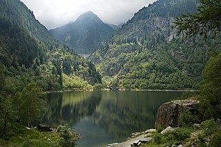
The Ossola is an area of Italy situated to the north of Lago Maggiore. It lies within the Province of Verbano-Cusio-Ossola. Its principal river is the Toce, and its most important town Domodossola.
Alpe Ciamporino is the name of a ski resort and summer hiking region in the Lepontine Alps, by the Simplon Pass region in Italy. It is located near San Domenico di Varzo village, north of the Piedmont region, by the Swiss border with Wallis canton.

Baceno is a comune (municipality) in the Province of Verbano-Cusio-Ossola in the Italian region Piedmont, located about 140 kilometres (87 mi) northeast of Turin and about 40 kilometres (25 mi) northwest of Verbania, on the border with Switzerland.
The Schwarzhorn is a mountain of the Lepontine Alps, located on the Swiss-Italian border, between the Binntal (Valais) and the Valle Dèvero (Piedmont). It lies north of the Scherbadung.
Schwarzhorn may refer to mountains/peaks in:

The Binn Valley is a valley of the Alps, located on the north side of the Lepontine Alps in the Swiss canton of Valais. The valley is drained by the Binna, a tributary of the Rhone, at Grengiols. The valley is named after Binn, the main settlement. Other villages or localities are Ausserbinn, Heiligkreuz and Fäld.

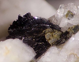
Cervandonite is a rare arsenosilicate mineral. It has a chemical formula (Ce,Nd,La)(Fe3+
,Fe2+
,Ti4+
,Al)
3SiAs(Si,As)O
13 or (Ce,Nd,La)(Fe3+
,Fe2+
,Ti,Al)
3O
2(Si
2O
7)(As3+
O
3)(OH). It has a monoclinic crustal structure with supercell (Z=6), the crystal structure was established as a trigonal subcell, with space group R3m and a = 6.508(1)Ǻ, c = 18.520(3) Ǻ, V 679.4(2) Ǻ3, and Z=3. It was first described by Buhler Armbruster in 1988, but it has proven to be problem due to the extreme scarcity of single crystals and its unusual replacement of silicon and arsenic. Cervandonite is named after the location where it was first described, Pizzo Cervandone (Scherbadung), Italy in the Central Alps.

The Antigorio Valley is one of the Alpine valleys radiating from the Ossola Valley, in the region of Piedmont, northern Italy.
The Neveazzurra (Blue-snow) is a winter sports area in the Italian Alps, in Verbanio Cusio Ossola province (Piedmont). 150 kilometers of trails, 50 lifts from 1,000 to 3,000 meters and the opportunity to practice a wide variety of winter sports: alpine skiing, cross country skiing, off-piste skiing, downhill skiing, snow park, ice skating and ice climbing, free -Ride and heli-skiing.

Pizzo Diei is a mountain of the Lepontine Alps in Piedmont, northern Italy. It is located in the Alpe Veglia Nature Park in the commune of Varzo, and has a slightly lower sister peak, the pyramidal shaped Monte Cistella. The mountain is a popular ski mountaineering peak and its summit offers fine views of the Monte Rosa Massif.
CoEur is a Christian devotional and hiking route in Italy and Switzerland. Its Italian subtitle, Nel cuore dei cammini d'Europa, translates as "In the heart of Europe's paths".

The Alta Valle Antrona Natural Park is a nature reserve in Piedmont, in Italy.

The Alpe Veglia and Alpe Devero Natural Park was established in 1995 and is in the Ossola valley, in the Province of Verbania, Italy.

The Punta della Rossa is a mountain of the Lepontine Alps on the Swiss-Italian border. The name of the mount, in both languages, refers to the red colour of the rocks on this mountain.
Veglia is the Italian name for Krk, a Croatian island.
The Val Formazza is a valley in the Lepontine Alps, in the Piedmontese Province of Verbano-Cusio-Ossola, Italy. Bordering Switzerland, it represents the northernmost part of Val d'Ossola and Piedmont.

The Punta dei Camosci, or Bättelmatthorn, is a mountain of the Lepontine Alps, with an elevation of 3,046 metres (9,993 ft). It is located on the Swiss-Italian border, between the Piedmontese Province of Verbano-Cusio-Ossola in Italy and Canton Valais in Switzerland.
Monte Cazzola is a mountain of Piedmont, Italy, with an elevation of 2,330 metres (7,644 ft). Part of the Lepontine Alps, it is located in the Valle Devero, inside the Alpe Veglia and Alpe Devero Natural Park.

The Punta d'Orogna is a mountain of Piedmont, Italy, with an elevation of 2,447 metres (8,028 ft). Part of the Lepontine Alps, it closes the Valle Devero to the south, and is located inside the Alpe Veglia and Alpe Devero Natural Park.

Monte Corbernas is a mountain of Piedmont, Italy, with an elevation of 2,578 metres (8,458 ft). Part of the Lepontine Alps, it is located in the Valle Devero, inside the Alpe Veglia and Alpe Devero Natural Park.


