
The Lepontine Alps are a mountain range in the north-western part of the Alps. They are located in Switzerland and Italy.

The Oberhalbstein Alps or Platta Group are a mountain range in the Alps of eastern Switzerland and northern Italy. They are considered to be part of the Central Eastern Alps. The Oberhalbstein Alps are separated from the Lepontine Alps in the west by the Splügen Pass; from the Plessur Alps in the north by the river Albula; from the Albula Alps in the east by the Septimer Pass and the river Gelgia; from the Bernina Range in the south by the Val Bregaglia.

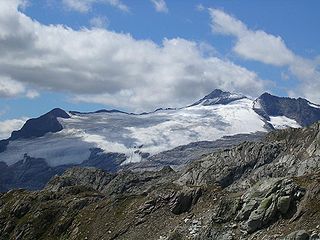
Monte Cistella is a mountain roughly in the middle of the Lepontine Alps.

The Biellese Alps are a sub-range of the Pennine Alps located between Piemonte and Aosta Valley (Italy).
The Basòdino is a mountain in the Lepontine Alps on the border between Italy and Switzerland. It is the second highest peak in the canton of Ticino, after the Rheinwaldhorn.
The Cima di Jazzi is a mountain of the Pennine Alps, located on the Swiss-Italian border, just north of Monte Rosa. It overlooks Macugnaga on its east (Italian) side. The west (Swiss) side is entirely covered by glaciers.
The Wasenhorn is a mountain of the Lepontine Alps, located on the border between Switzerland and Italy. It lies halfway between Brig and Varzo, just north of Monte Leone, in the Simplon Pass area. Politically the Wasenhorn is split between the municipalities of Ried-Brig and Varzo.

Pizzo Quadro is a mountain of the Lepontine Alps on the Swiss-Italian border. With an elevation of 2,793 metres above sea level, it is the highest summit of the range lying south of the Wandfluhhorn and the Guriner Furggu. Pizzo Quadro is located between the localities of San Rocco di Prèmia (Piedmont) and Campo (Ticino).

Monte Tamaro is a mountain of the Lugano Prealps, overlooking Lake Maggiore in the Swiss canton of Ticino. Reaching a height of 1,962 metres above sea level, it is the highest summit of the chain located between Lake Maggiore and Lake Lugano, which also includes Monte Lema. It is also the most prominent summit of the canton.

Monte Lema is a mountain of the Lugano Prealps, located on the border between Switzerland and Italy. Its summit can easily reached by cable car from the village of Miglieglia (Ticino).

SOIUSA is a proposal for a new classification system of the Alps from the geographic and toponomastic point of view. It was designed by Sergio Marazzi, Italian researcher and author of the Orographic Atlas of the Alps SOIUSA. His book was presented with the patronage of the Italian Alpine Club on 23 Jan 2006, but has yet to receive any formal acceptance.

The Western Rhaetian Alps are a mountain range in the central part of the Alps.

The Alpi Cusiane are a sub-range of the Pennine Alps located in Piemonte (Italy).

The Lugano Prealps are a mountain range in the western part of the Alps. They are located in Canton Ticino and Lombardy.

The Partizione delle Alpi is a classification of the mountain ranges of the Alps, that is primarily used in Italian literature, but also in France and Switzerland. It was devised in 1926.

Pizzo Diei is a mountain of the Lepontine Alps in Piedmont, northern Italy. It is located in the Alpe Veglia Nature Park in the commune of Varzo, and has a slightly lower sister peak, the pyramidal shaped Monte Cistella. The mountain is a popular ski mountaineering peak and its summit offers fine views of the Monte Rosa Massif.

Monte Politri or Bric Rosso is a 3,026 m a.s.l. mountain of the Cottian Alps, located in Italy.

Punta Tempesta is a 2,679 m a.s.l. mountain of the Cottian Alps, located in Italy.

The Monte Zeda is a mountain in the Lepontine Alps belonging to the Province of Verbano-Cusio-Ossola (Italy).
The Ligurian Prealps are a mountain range in northwestern Italy. They belong to the Ligurian Alps and are located between the regions of Piemonte and Liguria. Their highest summit is the monte Armetta, at an elevation of 1,739 metres (5,705 ft).

