The Sangre de Cristo Mountains are the southernmost subrange of the Rocky Mountains. They are located in southern Colorado and northern New Mexico in the United States. The mountains run from Poncha Pass in South-Central Colorado, trending southeast and south, ending at Glorieta Pass, southeast of Santa Fe, New Mexico. The mountains contain a number of fourteen thousand foot peaks in the Colorado portion, as well as all the peaks in New Mexico which are over twelve thousand feet.

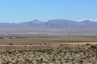
The Mohave Valley is a valley located mostly on the east shore of the south-flowing Colorado River in northwest Arizona. The valley extends into California's San Bernardino County; the northern side of the valley extends into extreme southeast Clark County, Nevada. The main part of the valley lies in southwest Mohave County, Arizona and is at the intersection of the southeast Mojave and northwest Sonoran deserts.

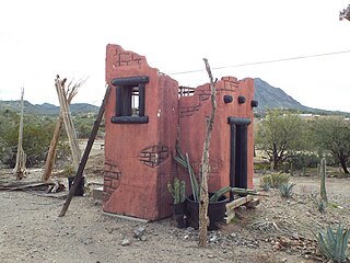
The Tucson Mountains are a minor mountain range west of Tucson, Arizona. The Tucson Mountains, including Wasson Peak, are one of four notable mountain ranges surrounding the Tucson Basin. The Santa Catalina Mountains lie to the northeast, the Rincon Mountains are to the east of Tucson, and the Santa Rita Mountains lie to the south. Additionally the Sierrita Mountains lie due south, the Roskruge Mountains lie to the west across Avra Valley, the Silver Bell Mountains lie to the northwest, and the Tortolita Mountains lie to the north across the Santa Cruz Valley.

The Chemehuevi Mountains are found at the southeast border of San Bernardino County in southeastern California adjacent the Colorado River. Located south of Needles, California and northwest of the Whipple Mountains, the mountains lie in a north-south direction in general, and are approximately 15 miles in length.
Botsvatn or Bossvatn is a lake in the municipality of Bykle in Agder county, Norway. The 14.6-kilometre (9.1 mi) long, narrow reservoir is located just to the southeast of the large lake Blåsjø and northeast of the lake Ytre Storevatnet. The lake holds water for the Brokke Hydroelectric Power Station, located in nearby Valle municipality. The water from the lake can flow out into the nearby river Otra, but only when water is released from the dam.
Kpeve is a small town located in the Volta Region of Ghana and divided into Kpeve Old Town, which is part of the Afadjato South District and Kpeve New Town which is part of the South Dayi District, the administrative district capital of South Dayi district.

The Sierra Pelona, also known as the Sierra Pelona Ridge or the Sierra Pelona Mountains, is a mountain ridge in the Transverse Ranges in Southern California. Located in northwest Los Angeles County, the ridge is bordered on the north by the San Andreas fault and lies within and is surrounded by the Angeles National Forest.

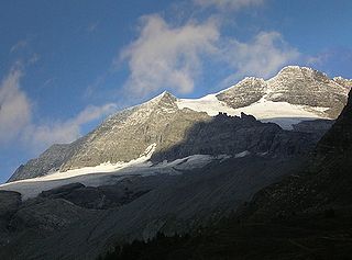
Monte Leone is the highest mountain of the Lepontine Alps and is located on the border between Switzerland and Italy. The mountain stands on the extreme west of the Lepontine Alps, a few kilometres east of Simplon Pass.
The Gila Mountains of Graham County are a mountain range in central-east Arizona. It borders the Gila River and Gila Valley on the valley's northeast in north-central Graham County; also the San Carlos Indian Reservation. The mountain range sits on the southern perimeter of the White Mountains and is located in the southeast area of Arizona's transition zone.

The Growler Mountains is a 23-mile, (37-km) long north-south trending mountain range of far western Pima County, Arizona that lies 12 miles (19 km) west of Ajo, Arizona. This desert region of southern Arizona lies in the north and central Sonoran Desert, and is one of the drier desert areas of North America.
The Dome Rock Mountains are a mountain range in southern La Paz County, Arizona. The range borders the Colorado River on the west and the Colorado River Indian Reservation on the northwest located in the Lower Colorado River Valley. Quartzsite, Arizona lies on the eastern foothills of the range.

The Little Ajo Mountains is a mountain range in southern Arizona, in extreme western Pima County, Arizona. The city of Ajo sits on the northeast of this small mountain range. Both the mountain range and city take their name from the Spanish word for garlic.
The Äusser Rothorn is a mountain of the Swiss Pennine Alps, overlooking Saas-Balen in the canton of Valais. It lies at the western end of the Rothorngrat, descending from the Senggchuppa.

The Silver Bell Mountains are a northwest–southeast trending mountain range in north–central Pima County, Arizona. The range lies 14 miles (23 km) west of Marana, Arizona, located on Interstate-10, northwest of Tucson.
The Little Rincon Mountains are a small range of mountains, lying to the east of the Rincon Mountains, at Tucson, of eastern Pima County, Arizona. The range is located in northwest Cochise County and is part of the western border of the San Pedro River and Valley, the major valley and river of western Cochise County. The river is northward flowing to meet the Gila River; its headwaters are south of the US-Mexico border in northern Sonora. A small part of the Little Rincon range's southwest lies in Pima County.

The Alamo Hueco Mountains are a 15-mile (24 km) long mountain range, located in the southeast of the New Mexico Bootheel region, southeast Hidalgo County, New Mexico, adjacent the border of Chihuahua state, Mexico. The range lies near the southern end of the mountains bordering the extensive north–south Playas Valley; the Little Hatchet and Big Hatchet Mountains are adjacent, and mostly attached north; the mountain range series, ends south into the flatland plains of the Chihuahuan Desert. The much smaller Dog Mountains are adjacent south.

The Sevier Desert is a large arid section of central-west Utah, United States, and is located in the southeast of the Great Basin. It is bordered by deserts north, west, and south; its east border is along the mountain range and valley sequences at the perimeter of the Great Basin, with the large north–south Wasatch Range and its associated mountainous landforms. Its eastern border is specifically, the East Tintic, Gilson, and Canyon Mountains; also the massive Pahvant Range.

The New River Mountains are a small 14-mi (23 km) long, mountain range in central Arizona, and on the north border of the Phoenix valley; the range is located on the southwest perimeter of the Arizona transition zone. The range is a sub-part of landforms extending south from the Black Hills of Yavapai County. Rivers and canyons border east and west; the south of the range is located in Maricopa County, the location of much of the Phoenix metropolitan area.
The Moccasin Mountains is an 11-mile-long (18 km) mountain range located at the Arizona–Utah border in Mohave County, Arizona, and a small north section in Kane County, Utah.

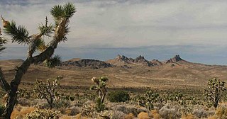
Castle Mountains National Monument is a U.S. National Monument located in the eastern Mojave Desert and northeastern San Bernardino County, in the state of California.


