Thuringia, officially the Free State of Thuringia, is a state of central Germany, covering 16,171 square kilometres (6,244 sq mi), the sixth smallest of the sixteen German states. It has a population of about 2.1 million.

The Thuringian Forest, is a mountain range in the southern parts of the German state of Thuringia, running northwest to southeast. Skirting from its southerly source in foothills to a gorge on its north-west side is the Werra valley. On the other side of the Forest is an upper outcrop of the North German Plain, the Thuringian Basin, which includes the city Erfurt. The south and south-east continuation of the range is the highland often called the Thuringian-Vogtlandian Slate Mountains.

The Saale, also known as the Saxon Saale and Thuringian Saale, is a river in Germany and a left-bank tributary of the Elbe. It is not to be confused with the smaller Franconian Saale, a right-bank tributary of the Main, or the Saale in Lower Saxony, a tributary of the Leine.

The Unstrut is a river in Germany and a left tributary of the Saale.
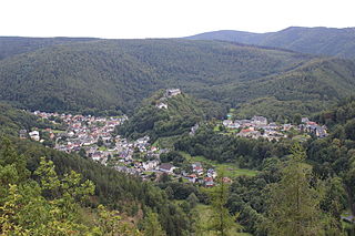
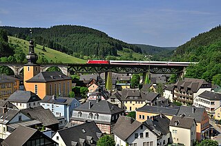
Schwarzburg is a municipality in the valley of the Schwarza in the district Saalfeld-Rudolstadt in Thuringia, in central Germany.
Gräfenroda is a village and a former municipality in the Ilm-Kreis district, in Thuringia, Germany. Since 1 January 2019, it has been part of the municipality of Geratal. It was the administrative seat of the former Verwaltungsgemeinschaft Oberes Geratal.
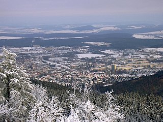
Ilmenau is a town in Thuringia, central Germany. It is the largest town within the Ilm district with a population of 38,600, while the district capital is Arnstadt. Ilmenau is located approximately 33 km south of Erfurt and 135 km north of Nuremberg within the Ilm valley at the northern edge of the Thuringian Forest at an elevation of 500 metres.
Ludwigsstadt is a town in the district of Kronach, in the Upper Franconian region of Bavaria, Germany.
Schwarza may refer to several places and rivers in Germany and Austria:

Lichte is a village and a former municipality in the district of Sonneberg in Thuringia, Germany, close to the Thuringian Rennsteig. Formerly in the district Saalfeld-Rudolstadt, it is part of the town Neuhaus am Rennweg since January 2019.

The Selbitz is a river of Bavaria and Thuringia, Germany.

The Thuringian Highland, Thuringian Highlands or Thuringian-Vogtlandian Slate Mountains is a low range of mountains in the German state of Thuringia.

The Rennsteig is a ridge walk as well as an historical boundary path in the Thuringian Forest, Thuringian Highland and Franconian Forest in Central Germany. The long-distance trail runs for about 170 km from Eisenach and the Werra valley in the northwest to Blankenstein and the Selbitz river in the southeast.

The Großheringen–Saalfeld railway, also known as the Saalbahn, is a 153 kilometre-long double-track main line in the German state of Thuringia. It connects the Thuringian Railway at Großheringen with the Franconian Forest Railway (Frankenwaldbahn) at Saalfeld and is part of the north–south main line, Munich–Nuremberg–Halle / Leipzig–Berlin. It is electrified at 15 kV. 16.7 Hz.

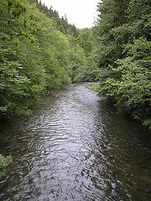
The Lichte is a right tributary of the Schwarza in Thuringia, Germany, and is 17 kilometres (11 mi) long.

The Piesau is a right tributary of the river Lichte in Thuringia, Germany. It is approximately 7 km (4.3 mi) long. The name is derived from the municipality of Piesau.
The Ascherbach is a left tributary of the Lichte in Thuringia, Germany, and is 4 km long.

The Kieselbach is a right tributary of the Lichte in Thuringia, Germany, and is 4 km (2.5 mi) long.
The Kieferle, near Steinheid in the county of Sonneberg, is a mountain, 867.2 m above sea level (NHN), in the Thuringian Highland and the second highest mountain of this range, which forms the eastern part of the Thuringian Forest.