
The 2006 Tour de Suisse was the 70th edition of the Tour de Suisse road cycling stage race, which took place from 10 to 18 June 2006. The race consisted of nine stages, covering a total of 1,468 km (912 mi), starting in Baden and finishing in Bern.

Leukerbad is a municipality in the district of Leuk in the canton of Valais in Switzerland.
Damian Grichting is a Swiss curler.
Werner Perathoner is an Italian former Alpine skier, who specialized in downhill and super-G disciplines.
"Stranger in the Village" is an essay by African-American novelist James Baldwin about his experiences in Leukerbad, Switzerland, after he nearly suffered a breakdown. The essay was originally published in Harper's Magazine, October 1953, and later in his 1955 collection, Notes of a Native Son.

The Wildstrubel is a mountain of the Alps, straddling the border between the Swiss cantons of Bern and Valais. It forms a large glaciated massif, about 15 km wide, extending between the Rawil Pass and the Gemmi Pass. Along with the Muverans, the Diablerets and the Wildhorn, the Wildstrubel is one of the four distinct mountain massifs of the Bernese Alps that lie west of the Gemmi Pass. The massif of the Wildstrubel is at the centre between the valleys of Simmental (BE), Engstligental (BE) and the Rhone (VS), the exact location of the tripoint being the summit of the Schneehorn. It comprises several distinct summits, including the Wetzsteinhorn, the Rohrbachstein, the Weisshorn, the Pointe de la Plaine Morte, Mont Bonvin, the Trubelstock and the Schneehorn. The main crest with the almost equally high summits of the Mittelgipfel and the Grossstrubel forms an amphitheatre oriented eastward which ends at the Steghorn and the Daubenhorn. This area encloses the Wildstrubel Glacier. To the southwest, the Wildstrubel overlooks the high plateau of the Plaine Morte Glacier, which also includes an unnamed lake below the Schneehorn.

The Flüela Schwarzhorn is a mountain of the Albula Alps, overlooking the Flüela Pass, in the canton of Graubünden. With a height of 3,146 metres above sea level, it is the highest point of the Albula Alps north of the Fuorcla da Grialetsch. From the Flüela Pass a trail leads to the summit.
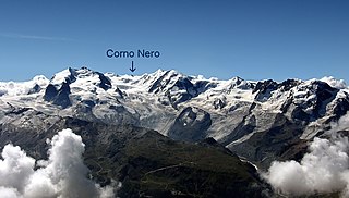
The Schwarzhorn is a mountain of the Swiss Pennine Alps, overlooking the Augstbord Pass in the canton of Valais. It lies on the range between the Turtmanntal and the Mattertal.

The Majinghorn is a mountain of the Bernese Alps, located east of Leukerbad in the canton of Valais. It lies between the Ferdenrothorn and the Torrenthorn, on the chain that separates the valley of Leukerbad from the Lötschental.

The Schwarzhorn is a mountain of the Bernese Alps, located between Brienz and Grindelwald in the Bernese Oberland. With a height of 2,928 metres above sea level, it is the highest summit of the group north of the Grosse Scheidegg Pass. The Schwarzhorn is also the highest point in the municipality of Brienz.
The Schwarzhorn is a mountain of the Lepontine Alps, located on the Swiss-Italian border, between the Binntal (Valais) and the Valle Dèvero (Piedmont). It lies north of the Scherbadung.
Schwarzhorn may refer to mountains/peaks in:

The Parpaner Schwarzhorn is a mountain of the Plessur Alps, overlooking Parpan in the canton of Graubünden. It lies north of the Parpaner Weisshorn.
The Schwarzhorn is a mountain of the Swiss Lepontine Alps, located west of Vals in the canton of Graubünden. It lies on the range between the Lumnezia and the Valser Tal, south of the Faltschonhorn.
The Schwarzhorn is a mountain on the border of Switzerland and Liechtenstein in the Rätikon range of the Eastern Alps. With a height of 2,573 metres (8,442 ft) or 2,574 metres (8,445 ft) above sea level, it is the second highest summit in Liechtenstein.

The Schwarzhorn is a mountain in South Tyrol, Italy. It belongs to the Fiemme Mountains and is 2,439 m high.
The Schwarzhorn is a 4,321-metre-high summit in the Italian Alps just next to the Swiss border.

Tilisuna-Schwarzhorn is a mountain in the Sulzfluh sub-range of the Rätikon mountain range in the Austrian state Vorarlberg. It has elevation 2,460 m (AA), with a long ridge from north to south and wide scarps east and west. Besides the main summit, there is a second summit called Kleines Schwarzhorn. Both summits are separated by the col Fürkele. The alpine club hut Tilisunahütte (2208 m) is located near the Tilisuna-Schwarzhorn.
The 1993 European Curling Championships were held from December 6 to 11 at the Sportzentrum in Leukerbad, Switzerland.
