Bezina is a settlement in the Municipality of Slovenske Konjice in eastern Slovenia. It lies on the regional road leading north from Slovenske Konjice to Oplotnica. The area is part of the traditional region of Styria. The municipality is now included in the Savinja Statistical Region.

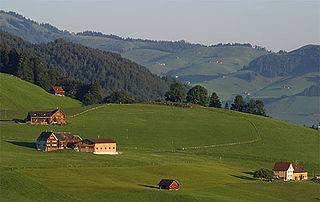
Blato is a small settlement in the Municipality of Slovenske Konjice in eastern Slovenia. It lies under the northeastern slopes of Mount Konjice, just southeast of Slovenske Konjice itself. The area is part of the traditional region of Styria. The municipality is now included in the Savinja Statistical Region.
Brdo is a settlement in the Municipality of Slovenske Konjice in eastern Slovenia. Traditionally the entire area around Slovenske Konjice was part of Styria. It is now included in the Savinja Statistical Region.
Gabrovlje is a settlement on the left bank of the Dravinja River north of Slovenske Konjice in eastern Slovenia. The area is part of the traditional region of Styria. The entire Municipality of Slovenske Konjice is now included in the Savinja Statistical Region of Slovenia.
Gabrovnik is a settlement in the Municipality of Slovenske Konjice in eastern Slovenia. It lies in the hills northeast of Slovenske Konjice. The area is part of the traditional region of Styria. The municipality is now included in the Savinja Statistical Region.
Lipoglav is a settlement in the hills south of Loče in the Municipality of Slovenske Konjice in eastern Slovenia. The area was traditionally part of Styria. The entire Municipality of Slovenske Konjice is now included in the Savinja Statistical Region of Slovenia.
Konjiška Vas is a settlement in the Municipality of Slovenske Konjice in eastern Slovenia. It lies at the foot of the eastern end of the Mount Konjice hills southeast of Slovenske Konjice. The area is part of the traditional region of Styria. The municipality is now included in the Savinja Statistical Region.
Prežigal is a small settlement in the Municipality of Slovenske Konjice in eastern Slovenia. It lies on the left bank of the Dravinja River east of Slovenske Konjice itself. Traditionally the area was part of Styria. The municipality is now included in the Savinja Statistical Region.
Perovec is a small settlement in the Municipality of Slovenske Konjice in eastern Slovenia. It lies north of Draža Vas, just east of the Slovenian A1 motorway. The area is part of the traditional region of Styria. The municipality is now included in the Savinja Statistical Region.
Preloge pri Konjicah is a small settlement in the Municipality of Slovenske Konjice in eastern Slovenia. It lies west of the town of Slovenske Konjice in the traditional region of Styria. The municipality is now included in the Savinja Statistical Region.
Sojek is a small settlement in the Municipality of Slovenske Konjice in eastern Slovenia. It lies dispersed on the southern slopes of the Mount Konjice hills southwest of Slovenske Konjice. The area of the entire Municipality of Slovenske Konjice was traditionally part of the Styria region and is now included in the Savinja Statistical Region.
Stare Slemene is a settlement in the Municipality of Slovenske Konjice in eastern Slovenia. The area is part of the traditional region of Styria. The municipality is now included in the Savinja Statistical Region.
Strtenik is a small settlement in the hills north of Slovenske Konjice in eastern Slovenia. The area is part of the traditional region of Styria. The entire Municipality of Slovenske Konjice is now included in the Savinja Statistical Region.

Škalce is a settlement in the Municipality of Slovenske Konjice in eastern Slovenia. It lies in the hills just north of Slovenske Konjice itself. The area is part of the traditional region of Styria. The municipality is now included in the Savinja Statistical Region.
Tepanje is a village in the Municipality of Slovenske Konjice in eastern Slovenia. The area is part of the traditional region of Styria. The municipality is now included in the Savinja Statistical Region.
Tepanjski Vrh is a settlement west of Tepanje in the Municipality of Slovenske Konjice in eastern Slovenia. The area is part of the traditional region of Styria and is now included in the Savinja Statistical Region.
Tolsti Vrh is a settlement in the Municipality of Slovenske Konjice in eastern Slovenia. It lies on the southern slopes of the Mount Konjice hills south of the town of Slovenske Konjice. The area is part of the traditional region of Styria. The municipality is now included in the Savinja Statistical Region.
Vešenik is a settlement in the Municipality of Slovenske Konjice in eastern Slovenia. It lies in the hills immediately northeast of Slovenske Konjice. The area is part of the traditional region of Styria. When statistical regions were created in Slovenia in 2007, the Municipality of Slovenske Konjice was included in the Savinja Statistical Region.

Zgornja Pristava is a settlement in the Municipality of Slovenske Konjice in eastern Slovenia. It lies south and west of Slovenske Konjice and its territory extends to the top of Mount Konjice. The area is part of the traditional region of Styria. The municipality is now included in the Savinja Statistical Region.
Dedni Vrh pri Vojniku is a settlement in the Municipality of Vojnik in eastern Slovenia. It lies just south of Frankolovo off the main road from Vojnik towards Slovenske Konjice. The area was traditionally part of Styria. It is now included with the rest of the municipality in the Savinja Statistical Region.