Sengbédou

Last updated
Sengbédou
Sub-prefecture and town
Guinea adm location map.svg
Red pog.svg
Sengbédou
Location in Guinea
Coordinates: 8°34′N9°19′W / 8.567°N 9.317°W / 8.567; -9.317
CountryFlag of Guinea.svg  Guinea
Region Nzérékoré Region
Prefecture Macenta Prefecture
Time zone GMT (UTC+0)

Sengbédou is a town and sub-prefecture in the Macenta Prefecture in the Nzérékoré Region of south-eastern Guinea. [1]

Town settlement that is bigger than a village but smaller than a city

A town is a human settlement. Towns are generally larger than villages but smaller than cities, though the criteria to distinguish them vary considerably between different parts of the world.

Sub-prefectures of Guinea

The sub-prefectures are the third-level administrative divisions in Guinea. As of 2009 there were 303 rural communes of Guinea and 38 urban communes, 5 of which compose the Conakry greater urban area; Kaloum, Dixinn, Matam, Ratoma and Matoto.

Macenta Prefecture Prefecture in Nzérékoré Region, Guinea

Macenta is a prefecture located in the Nzérékoré Region of Guinea. The capital is Macenta. The prefecture covers an area of 7,056 km.² and has an estimated population of 278,456.

Related Research Articles

Nzérékoré Region Region in Guinea

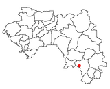
The Nzérékoré Region is a region in the southern part of Guinea. Its capital and largest city is Nzérékoré. It is one of the eight regions of Guinea. It is bordered by the countries of Sierra Leone, Liberia, and Ivory Coast, and the Guinean regions of Kankan and Faranah.

Niagassola Sub-prefecture and town in Kankan Region, Guinea

Niagassola is a town and sub-prefecture in the Siguiri Prefecture in the Kankan Region of north-eastern Guinea.It is located near the border with Mali. It has no electricity and three water pumps.

Salillas de Jalón is a municipality located in the province of Zaragoza, Aragon, Spain. According to the 2004 census (INE), the municipality has a population of 344 inhabitants. It belongs to the county of Valdejalón.

Tamita Sub-prefecture and town in Boké Region, Guinea

Tamita is a town and sub-prefecture in the Boffa Prefecture in the Boké Region of western Guinea. As of 2014 it had a population of 14,443 people.

Kindoyé Sub-prefecture and town in Faranah Region, Guinea

Kindoyé is a town and sub-prefecture in the Dabola Prefecture in the Faranah Region of Guinea. As of 2014 it had a population of 6,495 people.

Koba, Mamou Sub-prefecture and town in Mamou Region, Guinea

Koba is a town and sub-prefecture in the Dalaba Prefecture in the Mamou Region of western Guinea.

Mitty, Guinea Sub-prefecture and town in Mamou Region, Guinea

Mitty, Guinea is a town and sub-prefecture in the Dalaba Prefecture in the Mamou Region of western Guinea.

Marela Sub-prefecture and town in Faranah Region, Guinea

Marela is a town and sub-prefecture in the Faranah Prefecture in the Faranah Region of Guinea. As of 2014 it had a population of 32,638 people.

Passayah Sub-prefecture and town in Faranah Region, Guinea

Passayah is a town and sub-prefecture in the Faranah Prefecture in the Faranah Region of Guinea. As of 2014 it had a population of 19,849 people.

Yombiro Sub-prefecture and town in Faranah Region, Guinea

Yombiro is a town and sub-prefecture in the Kissidougou Prefecture in the Faranah Region of Guinea. As of 2014 it had a population of 14,340 people.

Pilimini Sub-prefecture and town in Labé Region, Guinea

Pilimini is a town and sub-prefecture in the Koubia Prefecture in the Labé Region of northern Guinea.

Termesse Sub-prefecture and town in Boké Region, Guinea

Termesse is a town and sub-prefecture in the Koundara Prefecture in the Boké Region of northern Guinea. As of 2014 it had a population of 15,264 people.

Daro, Guinea Sub-prefecture and town in Nzérékoré Region, Guinea

Daro, Guinea is a town and sub-prefecture in the Macenta Prefecture in the Nzérékoré Region of south-eastern Guinea.

NZébéla Sub-prefecture and town in Nzérékoré Region, Guinea

N'Zébéla is a town and sub-prefecture in the Macenta Prefecture in the Nzérékoré Region of south-eastern Guinea.

Ourémai Sub-prefecture and town in Nzérékoré Region, Guinea

Ourémai is a town and sub-prefecture in the Macenta Prefecture in the Nzérékoré Region of south-eastern Guinea.

Sérédou Sub-prefecture and town in Nzérékoré Region, Guinea

Sérédou is a town and sub-prefecture in the Macenta Prefecture in the Nzérékoré Region of south-eastern Guinea.

Vassérédou Sub-prefecture and town in Nzérékoré Region, Guinea

Vassérédou is a town and sub-prefecture in the Macenta Prefecture in the Nzérékoré Region of south-eastern Guinea.

Kaalan, Guinea Sub-prefecture and town in Labé Region, Guinea

Kaalan is a town and sub-prefecture in the Labé Prefecture in the Labé Region of northern-central Guinea.

Guéckédou Sub-prefecture and town in Nzérékoré Region, Guinea

Guéckédou or Guékédou is a town in southern Guinea near the Sierra Leone and Liberian borders. It had a population of 79,140 in 1996 (census) but has grown massively since the civil wars and, as of 2008, it is estimated to be 221,715. It was a centre of fighting during the Second Liberian Civil War and the Sierra Leone Civil War in 2000 and 2001.

References

  1. "Subprefectures of Guinea". Statoids. Retrieved April 19, 2009.

Coordinates: 8°34′N9°19′W / 8.567°N 9.317°W / 8.567; -9.317

Geographic coordinate system Coordinate system

A geographic coordinate system is a coordinate system that enables every location on Earth to be specified by a set of numbers, letters or symbols. The coordinates are often chosen such that one of the numbers represents a vertical position and two or three of the numbers represent a horizontal position; alternatively, a geographic position may be expressed in a combined three-dimensional Cartesian vector. A common choice of coordinates is latitude, longitude and elevation. To specify a location on a plane requires a map projection.