
Udaipur district is one of the 50 districts of Rajasthan state in western India. The historic city of Udaipur is the administrative headquarters of the district. The district is part of the Mewar region of Rajasthan.

Pali district is a district in Rajasthan, India. The city of Pali is its administrative headquarters. Pali is also known as the Industrial/Textile City and has been a hub for merchant activities for centuries. It has a rich heritage and culture, including beautiful Jain temples and other elaborate monuments.

Nagaur District is one of the 50 districts of the state of Rajasthan in western India. Panchayati Raj was introduced here. It is the fifth largest district in Rajasthan and the area of the district is 17,718 km2 (6,841 sq mi). The city of Nagaur is the district headquarters.

Jodhpur district is a district in the State of Rajasthan in western India. The city of Jodhpur is the administrative headquarters of the district.
Sirohi District is a district of Rajasthan state in western India. The city of Sirohi is the district headquarters.
Nana is a village in the Bali, tehsil of Pali District of the Rajasthan state in India. It is located three kilometres from the railway station of the same name on the Ahmedabad-Ajmer railway line. Virampura, Bhagal, Chamunderi, Velar, Bhimana, Amalia, Serla, Chimanpura are nearly village. Pindwada-Bali road is just passing near by Nana. Virampura is close to Nana just one km. Nana just became sub-block division declared. Nana police station is also located at railway station just two km from town.nearby city is pindwara 20 km, Sumerpur 40 km, Sheoganj 40 km, Shirohi 42 km, Aburoad 70 km from Nana. nearest airport is udaipur 120 km away. and jodhpurs is 200 km. District headquarter pali is 100 km from Nana.
Marwar Junction is a census town and tehsil headquarter in Pali district in the Indian state of Rajasthan. This is an important railway junction on Ahemdabad - Delhi mainline in Pali district.
Rani is a town and municipality and tehsil of Pali district in the Indian state of Rajasthan. It lies on the banks of Sukri River, a tributary of the Luni River. It is an important railway station on Ahmedabad-Delhi railway line. Some nearby villages are Beejowa,Itendra Medtian,etc.
Uniara is a town and a municipality in Tonk district in the Indian state of Rajasthan. It is a tehsil of the Tonk district.

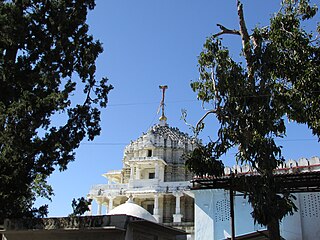
Bali is a town and a municipality in Pali district in the state of Rajasthan, India. The town is situated on the left bank of the Mithari River. This walled town was the headquarters of a district having the same name in the Jodhpur State. Bali is a tehsil and panchayat samiti with the same name. Bali is also a sub-divisions among the 10 sub-divisions of the Pali district. It is known for its fort. Nearest towns are Falna & Sadri and nearest villages are Kot Baliyan, Shri Sela and Boya.
Khimel is an Indian village situated between Rani and Falna rail station in the Pali District of Rajasthan state. Khimel is divided into two parts: the village and dhani. Khimel is a village in Bali Tehsil in Pali District of Rajasthan, India. It belongs to Jodhpur Division. It is located 60 km towards South from District headquarters Pali. 22 km from Bali. 362 km from State capital Jaipur Khimel Pin code is 306115 and postal head office is Rani Sadar Bazar. Khimel have a small railway station where only local trains halts. Khimel receives 24/7 electricity. This region is called Gorwar and popular language is Marwari. Falna, Bali, Sadri, Sumerpur are the nearby Cities to Khimel.
Mundara is a village located in the Bali tehsil of Pali district of Rajasthan state, located on the Bali-Sadri Road (SH-16).
Hemawas is a village in Pali tehsil of Pali district in Rajasthan state of India. It is located to the immediate south of the city of Pali. The nearby Hemawas Dam, completed in 1911, lies on the Bandi river.
Sumerpur Tehsil is one of the 10 tehsils in the Pali district of Indian state Rajasthan.
Bagrinagar or Bagri is a village and gram Panchayat in Sojat tehsil of Pali district of Rajasthan state in India.
Barwa is a village located in the Bali tehsil of Pali district of Rajasthan state, in the Aravalli Range.
Kheri Leela is a small village in Makrana tehsil, Nagaur district, Rajasthan, India.
Dhani is a village located in the Bali tehsil in the Pali district of Rajasthan. It is located near Bali town on state highway SH 62 between Khudala and Khimel in a valley on the western side of the Aravalli Range. Dhani is easily accessed by Western Railway Ahmedabad Delhi route near from Falna and Rani Station. Dhani is famous village in Marwar for Making of Mojari-Shoes. The first lady sarpanch in this village is Nalini kanwar wife of ranveer Singh bhati she was very active in all village activities she make a village very much well as compared to other village.
Netra is a panchayat village in the state of Rajasthan, India. Administratively, Netra is under Sumerpur Tahsil of Pali District in Rajasthan. The village of Netra is located on National Highway 14, 8 km by road northeast of the town of Sumerpur, and 65 km by road south-southwest of the city of Pali.

Kotra is a tehsil of Udaipur district in Rajasthan, India, consisting of 262 revenue villages and 31 panchayats. The tehsil is bordered to the north by Pali and Sirohi districts, to the east by Gogunda and Jhadol tehsils, and to the south by Gujarat state. The tehsil headquarter is located in the village of Kotra, southwest of the Udaipur at a distance of 57 km and 120 km by road.

