
Hobart is the capital and most populous city of the Australian island state of Tasmania. Home to almost half of all Tasmanians, it is the least populated Australian state capital city, and second smallest if territories are taken into account, after Darwin, Northern Territory. Hobart is located in Tasmania's south-east on the estuary of the River Derwent, making it the most southern of Australia's capital cities. Its skyline is dominated by the 1,271-metre (4,170 ft) Mount Wellington, and its harbour forms the second-deepest natural port in the world, with much of the city's waterfront consisting of reclaimed land. The metropolitan area is often referred to as Greater Hobart, to differentiate it from the City of Hobart, one of the five local government areas that cover the city.

Tasmania is an island state of Australia. It is located 240 km (150 mi) to the south of the Australian mainland, separated by Bass Strait. The state encompasses the main island of Tasmania, the 26th-largest island in the world, and the surrounding 334 islands. The state has a population of about 540,000 people as of March 2020. The state capital and largest city is Hobart, with around 40 percent of the population living in the Greater Hobart area.
Councils of Tasmania are the 29 administrative districts of the Australian state of Tasmania. Local government areas (LGAs), more generally known as councils, are the tier of government responsible for the management of local duties such as road maintenance, town planning and waste management.

Port Phillip , is a horsehead-shaped bay on the central coastline of southern Victoria, Australia, and opens into the Bass Strait through a narrow channel known as The Rip. The bay is surrounded mostly by metropolitan Greater Melbourne in its main eastern portion north of the Mornington Peninsula, and the city of Greater Geelong in the much smaller western portion north of the Bellarine Peninsula. Geographically, the bay covers 1,930 square kilometres and the shore stretches roughly 264 km (164 mi), with the volume of water around 25 cubic kilometres (6.0 cu mi). Most of the bay is navigable, although it is extremely shallow for its size—the deepest portion is only 24 metres (79 ft), and half the bay is shallower than 8 m (26 ft).
The history of Tasmania begins at the end of the most recent ice age when it is believed that the island was joined to the Australian mainland. Little is known of the human history of the island until the British colonisation in the 19th century.

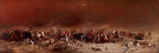
Risdon Cove is a cove located on the east bank of the Derwent River, approximately 7 kilometres (4 mi) north of Hobart, Tasmania. It was the site of the first British settlement in Van Diemen's Land, now Tasmania, the smallest Australian state. The cove was named by John Hayes, who mapped the river in the ship Duke of Clarence in 1794, after his second officer William Bellamy Risdon.

The University of Tasmania (UTAS) is a public research university primarily located in Tasmania, Australia. Founded in 1890, it is Australia's fourth oldest university. Christ College, one of the university's residential colleges, was founded in 1846 and is the oldest tertiary institution in the country. It is a sandstone university and a member of the international Association of Commonwealth Universities and the Association of Southeast Asian Institutions of Higher Learning.

Clarence City Council is a local government body in Tasmania, and one of the five municipalities that constitutes the Greater Hobart Area. The Clarence local government area has a population of 56,945, covering the eastern shore of the Derwent River from Otago to the South Arm Peninsula and the smaller localities of Cambridge, Richmond, and Seven Mile Beach.

Geilston Bay is a suburb of Hobart between Risdon Vale, Shag Bay, and Lindisfarne, in the City of Clarence located on the Eastern Shore of the Derwent River.

Taroona is a major residential suburb approximately 15 minutes drive from the centre of Hobart, Tasmania on the scenic route between Hobart and Kingston. Although on the edges of the City of Hobart, Taroona is actually part of the municipality of Kingborough.
The modern history of the Australian city of Hobart in Tasmania dates to its foundation as a British colony in 1804. Prior to British settlement, the area had been occupied for at least 8,000 years, but possibly for as long as 35,000 years, by the semi-nomadic Mouheneener tribe, a sub-group of the Nuenonne, or South-East tribe. The descendants of the indigenous Tasmanians now refer to themselves as 'Palawa'.

Risdon is a suburb of Hobart, capital city of Tasmania. It is west of Risdon Vale.

Warrane is a suburb of Hobart, Tasmania, Australia, within the City of Clarence local government area. It is approximately 5 kilometres (3 mi) from Hobart's CBD. It is located between Rosny Park and Mornington and runs parallel to the Tasman Highway.

HMS Nelson was a 126-gun first rate ship of the line of the Royal Navy, launched on 4 July 1814 at Woolwich Dockyard, but then laid up incomplete at Portsmouth until 1854, when work began with a view to commissioning her for service in the Crimean War, but this ended before much work had been done, and the ship returned to reserve.
Palawa kani is a constructed language created by the Tasmanian Aboriginal Centre as a composite Tasmanian language, based on reconstructed vocabulary from the limited accounts of the various languages once spoken by the eastern Aboriginal Tasmanians. The centre wishes to keep the language private until it is established in the community, and claims copyright. However, languages are not copyrightable under Australian or international law.
Electrolytic Zinc or the Electrolyic Zinc Company of Australasia was the company that operated a zinc refinery on the banks of the Derwent River in Risdon in Hobart in Tasmania between 1916 and 1984.
The Tasmanian Heritage Register is the statutory heritage register of the Australian state of Tasmania. It is defined as a list of areas currently identified as having historic cultural heritage importance to Tasmania as a whole. The Register is kept by the Tasmanian Heritage Council within the meaning of the Tasmanian Historic Cultural Heritage Act 1995. It encompasses in addition the Heritage Register of the Tasmanian branch of the National Trust of Australia, which was merged into the Tasmanian Heritage Register. The enforcement of the heritage's requirements is managed by Heritage Tasmania.

East Risdon State Reserve is an IUCN Category II protected area on the eastern shore of the Derwent River in Clarence City, Hobart, Tasmania. It takes its name from the nearby suburb of Risdon.
Angela McGowan is an Australian archaeologist known for her work on Aboriginal and European heritage and culture in Tasmania, Australia. McGowan predominantly worked in Heard Island, off the coast of Antarctica and Tasmania,
John Pirie was a schooner and the smallest of the ships in the First Fleet of South Australia that carried colonists and supplies to the Colony of South Australia in 1836. It was the first ship to set sail for the South Australian Company, only three days after the Letters Patent establishing the Province of South Australia were signed. It was built by Alexander Hall and Company at Aberdeen, Scotland in 1827.

