
Armenia is a landlocked country in the South Caucasus region of the Caucasus. The country is geographically located in West Asia, within the Armenian plateau. Armenia is bordered on the north and east by Georgia and Azerbaijan and on the south and west by Iran, Azerbaijan's exclave Nakhchivan, and Turkey.

Qubadli District is one of the 66 districts of Azerbaijan. It is located in the south-west of the country and belongs to the East Zangezur Economic Region. The district borders the Lachin, Khojavend, Jabrayil and Zangilan districts, and the Syunik Province of Armenia.

Shushi Province was a province of the breakaway Republic of Artsakh. The province had 7 communities of which 1 is considered urban and 6 are rural. The town of Shushi (Shushi) and Karin Tak came under control of Azerbaijan after the 2020 Battle of Shusha.

Darbas is a village in the Sisian Municipality of the Syunik Province in Armenia. Saint Stephen's Church of Darbas was opened in 2010. The school and health clinic in Darbas are the largest and most resourced in the Darbas valley. There are primary schools and basic health clinics in both Darbas and the nearby village of Shamb.

Lernanist is a village in the Kotayk Province of Armenia. It is home to the descendants of Armenian settlers from Van who survived the Armenian genocide.
Shgharshik is a village in the Syunik Province of Armenia, located on the outskirts of Kapan.
Paruyr Sevak is a village in the Ararat Municipality of the Ararat Province of Armenia. The village was founded in 1978 and is named in honour of the poet Paruyr Sevak.
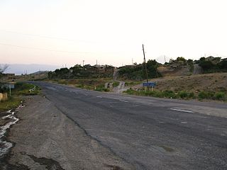
Cicimli is a village in the Lachin District of Azerbaijan.
Bəxtiyarlı, known in Armenian as Barkushat is a ghost village in the Qubadli Rayon of Azerbaijan. Video footage released in March 2021 show that almost every building if the village has been left in ruins for what appears to be a very substantial period of time, as is common amongst those Azeri settlements that were occupied by Armenia between 1993 and 2020.
Baharly is a village in the Zangilan District of Azerbaijan.

Şəfibəyli is a village in the Zangilan District of Azerbaijan.
Aladin is a village in the Zangilan District of Azerbaijan.

The Upper Carniola Statistical Region is a statistical region in northwest Slovenia. It is a region with high mountains, including Mount Triglav, and is almost entirely Alpine. A large part of this statistical region is protected as a national park. The relief and climate are good bases for tourism. In 2013, the region recorded almost 19% of tourist nights in Slovenia, of which 78% were by foreign tourists. The region ranked second in Slovenia in number of tourist beds per 1,000 population, even though it had just over half as many beds as the Coastal–Karst Statistical Region. In 2013, the registered unemployment rate here was the lowest in Slovenia, 3 percentage points lower than the national average and more than 8 percentage points lower than in the Mura Statistical Region, where the registered unemployment rate was the highest. Although agriculture in this region is not among the most important activities, the farms are among the largest in the country both in terms of average utilised agricultural area per farm and in terms of the number of livestock per farm.
Oued Melliz is a town and commune in the Jendouba Governorate in Tunisia. In 2004, it had a population of 2,188.
Goris Airport, also known as Shinuyar Airport or Shinuhayr Airport is located to the south of Goris, near the village of Shinuhayr, Syunik Province, Armenia. It has been closed since the collapse of the USSR in 1991. However, the government of Armenia planned on reconstructing the airport and opening it to public and private service. As of September 2023, reconstruction of the airport remains ongoing.
The 1931 Zangezur earthquake occurred on April 27 at with a moment magnitude of 6.5. The earthquake was located in the Zangezur Mountains near the boundary between southwestern Armenia and Azerbaijan's exclave, the Nakhichivan Autonomous Republic. Both territories were part of the Soviet Union at that time.
Regal is an unincorporated community in northeast Ray County, in the U.S. state of Missouri.
Əyrik is a village in the Lachin District of Azerbaijan.
Köhnə Çorman is a village in the Lachin District of Azerbaijan.
Qarasaqqal is a village in the Lachin District of Azerbaijan.


