She'eb | |
|---|---|
| Country | |
| Region | Northern Red Sea |
| Capital | She'eb |
| Time zone | UTC+3 (GMT +3) |
She'eb subregion is a subregion in the Northern Red Sea region (Zoba Semienawi Keyih Bahri) of Eritrea. Its capital lies at She'eb.
She'eb | |
|---|---|
| Country | |
| Region | Northern Red Sea |
| Capital | She'eb |
| Time zone | UTC+3 (GMT +3) |
She'eb subregion is a subregion in the Northern Red Sea region (Zoba Semienawi Keyih Bahri) of Eritrea. Its capital lies at She'eb.

The Tōkai region is a subregion of the Chūbu region and Kansai region in Japan that runs along the Pacific Ocean. The name comes from the Tōkaidō, one of the Edo Five Routes. Because Tōkai is a sub-region and is not officially classified, there is some disagreement about where exactly the region begins and ends, however Japanese maps widely conclude that the region includes Shizuoka, Aichi, Gifu and Mie prefectures.

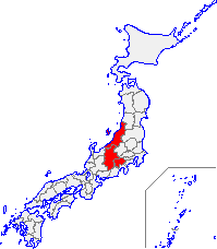
Kōshin'etsu (甲信越) is a subregion of the Chūbu region in Japan consisting of Yamanashi, Nagano, and Niigata prefectures.

A subregion is a part of a larger geographical region or continent. Cardinal directions are commonly used to define subregions. There are many criteria for creating systems of subregions; this article is focusing on the United Nations geoscheme, which is a changing, constantly updated, UN tool based on specific political geography and demography considerations relevant in UN statistics.

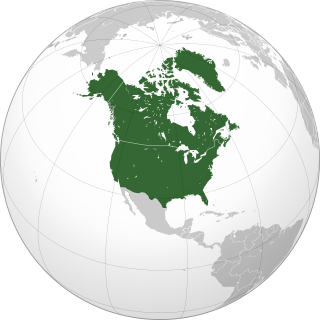
Northern America is the northernmost subregion of North America as well as the northernmost region in the Americas. The boundaries may be drawn significantly differently depending on the source of the definition. In one definition, it lies directly north of Middle America. Northern America's land frontier with the rest of North America then coincides with the Mexico–United States border. Geopolitically, according to the United Nations' scheme of geographical regions and subregions, Northern America consists of Bermuda, Canada, Greenland, Saint Pierre and Miquelon and the United States.

The Interim Biogeographic Regionalisation for Australia (IBRA) is a biogeographic regionalisation of Australia developed by the Australian government's Department of Sustainability, Environment, Water, Population, and Communities. It was developed for use as a planning tool, for example for the establishment of a national reserve system. The first version of IBRA was developed in 1993–94 and published in 1995.

The San'yō Region is an area in the south of Honshū, the main island of Japan. It consists of the southern part of the Chūgoku region, facing the Seto Inland Sea. The name San'yō means "southern, sunny (yō) side of the mountains" and contrasts with the San'in or "northern, shady (in) side of the mountains".

The six regions of Eritrea are divided into administrative subregions.

The Avon Wheatbelt is a bioregion in Western Australia. It has an area of 9,517,104 hectares. It is considered part of the larger Southwest Australia savanna ecoregion.

Yalgoo is an interim Australian bioregion located in Western Australia. It has an area of 5,087,577 hectares. The bioregion, together with the Avon Wheatbelt and Geraldton Sandplains bioregions, is part of the larger Southwest Australia savanna ecoregion as classified by the World Wildlife Fund.

Subregions of Hungary were subdivisions of Hungary, dividing the twenty counties of Hungary into 175 administrative subregions. The subregions were abolished and replaced by 198 districts in 2013.

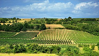
There are nearly 70,000 hectares of vineyards in Serbia, producing about 425,000 tons of grapes annually. The majority of Serbian wines are produced in local wineries.
The Western Region of Uganda is one of four regions in the country of Uganda. As of Uganda's 2014 census, the Western region's population was 8,874,862.
A subregion or sub-region is a designation for an administrative division in some countries.

Districts of Hungary are the second-level divisions of Hungary after counties. They replaced the 175 subregions of Hungary in 2013.

The West Marmara Region (TR2) is a statistical region in Turkey.

The Aegean Region (TR3) is a statistical region in Turkey.

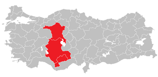
The West Anatolia Region (TR5) is a statistical region in Turkey. Its largest city is Ankara, which serves as the national capital.

The Mediterranean Region (TR6) is a statistical region in Turkey.

The West Black Sea Region (TR8) is a statistical region in Turkey.

The Southeast Anatolia Region (TRC) is a statistical region in Turkey.