Related Research Articles

Tulpehocken Creek is a 39.5-mile-long (63.6 km) tributary of the Schuylkill River in southeastern Pennsylvania in the United States, and during the American Canal Age, once provided nearly half the length of the Union Canal linking the port of Philadelphia, the largest American city and the other communities of Delaware Valley with the Susquehanna basin and the Pennsylvania Canal System connecting the Eastern seaboard to Lake Erie and the new settlements of the Northwest Territory via the Allegheny}, Monongahela. and Ohio Rivers at Pittsburgh.

Brandywine Creek is a tributary of the Christina River in southeastern Pennsylvania and northern Delaware in the United States. The Lower Brandywine is 20.4 miles (32.8 km) long and is a designated Pennsylvania Scenic River with several tributary streams. The East Branch and West Branch of the creek originate within 2 miles (3 km) of each other on the slopes of Welsh Mountain in Honey Brook Township, Pennsylvania, about 20 miles (32 km) northwest of their confluence.

Red Clay Creek is a 12.7-mile-long (20.4 km) tributary of White Clay Creek, running through southeastern Pennsylvania and northern Delaware in the United States. As of 2000, portions of the creek are under wildlife habitat protection.

The West Branch Delaware River is one of two branches that form the Delaware River. It is approximately 90 mi (144 km) long, and flows through the U.S. states of New York and Pennsylvania. It winds through a mountainous area of New York in the western Catskill Mountains for most of its course, before joining the East Branch along the northeast border of Pennsylvania with New York. Midway or so it is empounded by the Cannonsville Dam to form the Cannonsville Reservoir, both part of the New York City water supply system for delivering drinking water to the City.

Lycoming Creek is a 37.5-mile-long (60.4 km) tributary of the West Branch Susquehanna River located in Tioga and Lycoming counties in Pennsylvania in the United States.

The Line of Property is the name commonly given to the line dividing Indian lands from those of the Thirteen Colonies, which were established in the 1768 Treaty of Fort Stanwix between British officials and the Iroquois tribes. In western Pennsylvania, it is referred to as the Purchase line.
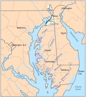
The Elk River is a tidal tributary of the Chesapeake Bay on the Eastern Shore of Maryland and on the northern edge of the Delmarva Peninsula. It is about 15 miles (24 km) long. As the most northeastern extension of the Chesapeake Bay estuary, it has served as one entrance to the Chesapeake & Delaware Canal since the 19th century. The canal and river now serve as one boundary of the Elk Neck Peninsula. The river flows through Cecil County, Maryland, with its watershed extending into New Castle County, Delaware and Chester County, Pennsylvania. Elkton, the county seat of Cecil County, is located at its head. Its total watershed area is 143 square miles (370 km2), with 21 square miles (54 km2) of open water, so its watershed is 15% open water. It is south and east of the North East River, and north of the Sassafras River.
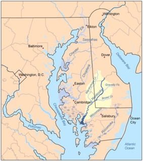
Marshyhope Creek is a 37.0-mile-long (59.5 km) tributary of the Nanticoke River on the Delmarva Peninsula. It rises in Kent County, Delaware, and runs through Caroline County, Maryland, and Dorchester County, Maryland.

Brodhead Creek is a 21.9-mile-long (35.2 km) tributary of the Delaware River in the Poconos of eastern Pennsylvania in the United States.

Chester Creek is a 9.4-mile-long (15.1 km) tributary of the Delaware River in Delaware County, Pennsylvania in the United States.
Fishing Creek is a 29.98-mile (48.25 km) long tributary of the Susquehanna River in Columbia County, Pennsylvania, in the United States. It joins the Susquehanna River near the census-designated place of Rupert and the town of Bloomsburg. The watershed has an area of 385 square miles (1,000 km2).
The Great Valley is a west-to-east valley through the center of Chester County, Pennsylvania, United States. It is also sometimes referred to as Chester Valley, and both names are in use throughout the region. The valley stretches from the Schuylkill River in Montgomery County in the east, southwesterly through Chester and Lancaster counties. The valley is most distinct in central Chester County, although traces of it can be followed almost the entire distance between the Delaware and Susquehanna rivers.

Starlight is a village in Buckingham Township, Wayne County, Pennsylvania. Crosstown Highway, which is entirely concurrent with Pennsylvania Route 370 (PA-370), is generally thought to be the southern edge of the village. It was once a depot of the Scranton Division of the New York, Ontario & Western (O&W) Railway, but today, when it is known outside its immediate vicinity, it is largely for being home to the Inn at Starlight Lake & Restaurant, which has been open since 1909.
Sugar Run Creek is a tributary of the Susquehanna River in Bradford County, Pennsylvania, in the United States. It is approximately 7.9 miles (12.7 km) and flows through North Branch Township, Windham Township, and Wilmot Township.
West Branch Dyberry Creek is a tributary of Dyberry Creek in Wayne County, Pennsylvania in the United States. The most famous or recognizable feature of the creek is Tanners Falls, a large and swift moving waterfall.

Naamans Creek is a tributary of the Delaware River in northeast New Castle County, Delaware and southeast Delaware County, Pennsylvania. The stream rises near the intersection of Foulk Road and Naamans Creek Road at 39°50′34″N75°29′32″W in Bethel Township, Pennsylvania, flows through Arden, Delaware, and discharges into the Delaware River at 39°48′19″N75°26′11″W in Claymont, Delaware. The creek is believed to be named after a Minqua chief who befriended the Swedish settlers of the area. A large tract of land along the creek was deeded to Governor Johan Risingh by chief Peminacka in 1655.
Mahantango Creek is a 2.1-mile-long (3.4 km) tributary of the Susquehanna River in Snyder and Juniata counties, Pennsylvania, in the United States. Its name comes from a Delaware Indian word meaning "where we had plenty to eat". The creek flows along the border between Snyder County and Juniata County.

Pisgah Mountain or Pisgah Ridge is a ridgeline running 12.5 miles (20.1 km) from Tamaqua to Jim Thorpe, Pennsylvania. It is oriented north-northeast to south-southwest, and its north-side valley is followed by U.S. Route 209 from river gap to river gap. The ridge is a succession of peaks exceeding 1,440 feet (438.9 m) rising 300 to 540 feet above the boroughs of Lansford, Coaldale, and Tamaqua in the Panther Creek valley. The highest point on Pisgah Mountain is at 1,611 feet (491 m) in the borough of Summit Hill, which sits atop the ridge. Near Summit Hill was the "Sharpe Mountain" (peak) where in 1791 Phillip Ginter is documented as having discovered anthracite, leading to the formation of the Lehigh Coal Mine Company. In 1818 the Lehigh Coal Company took over the mines, and the mining camp gradually became a settlement and grew into Summit Hill.
Muddy Run is a tributary of the West Branch Susquehanna River in Northumberland County, Pennsylvania, in the United States. It is 5.4 miles (8.7 km) in length. The creek is several miles northeast of the community of Milton. Main land uses include agricultural land and forest. The area of the creek's watershed is 11.4 square miles (30 km2), most of which is agricultural land. Muddy Run is entirely within Turbot Township. Most of the rock in the watershed is shale. The most common soil series is the Berks-Weikert-Bedington series.
References
- ↑ "Shehawken Creek". Geographic Names Information System . United States Geological Survey . Retrieved February 12, 2021.
- ↑ "USGS Site Map for USGS 01427100 Shehawken Creek near Starlight, PA". waterdata.usgs.gov.
- ↑ "Fishing in Shehawken Creek". Fishbrain.
- ↑ "Shehawken Creek Fishing near Susquehanna, Pennsylvania | HookandBullet.com". www.hookandbullet.com. Retrieved 2021-09-10.