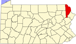
Starlight, Pennsylvania

Last updated

Starlight, Pennsylvania
Village of Starlight
O&W Depot, Starlight PA.JPG
The former Starlight Station in Starlight, which is now the Buckingham Township Municipal Building. It is also a U.S. National Historic Place.
USA Pennsylvania location map.svg
Red pog.svg
Starlight, Pennsylvania
Starlight's Location within Pennsylvania.
Coordinates: 41°54′18″N75°19′52″W / 41.90500°N 75.33111°W / 41.90500; -75.33111
CountryUnited States
State Pennsylvania
U.S. Congressional District PA-10
School District Wayne Highlands
Region I
County Wayne
Magisterial District 22-3-04 [1]
Township Buckingham
Named for Starlight Lake
Elevation
1,352 ft (412 m)
Time zone UTC-5 (Eastern (EST))
  Summer (DST) UTC-4 (Eastern Daylight (EDT))
ZIP code
18461
Area code 570
GNIS feature ID1188417 [2]
FIPS code 42-127-09824 [3] -73744 [2]
Major Roads PA-370.svg
Waterways Shehawken Creek, Starlight Lake

Starlight is a village that is located in Buckingham Township, Wayne County, Pennsylvania, United States. Crosstown Highway, which is entirely concurrent with Pennsylvania Route 370 (PA-370), is generally thought to be the southern edge of the village.

Contents

History

This village was once a depot of the Scranton Division of the New York, Ontario & Western (O&W) Railway, but is largely known today for being home to the Inn at Starlight Lake & Restaurant, [4] which has been open since 1909. [5]

Municipal status and boundaries

An image of Starlight's PennDOT sign, looking northeast along Crosstown Highway. The sign for Buckingham Township is also visible. Starlight PennDOT Sign.JPG
An image of Starlight's PennDOT sign, looking northeast along Crosstown Highway. The sign for Buckingham Township is also visible.

A Pennsylvania Department of Transportation (PennDOT) sign on Crosstown Highway identifies the community as the "Village of Starlight."

In Pennsylvania, a village is an unincorporated community within a township, but PennDOT identifies most villages with roadside signs, a fact that might reasonably lead those unfamiliar with this practice to believe that these communities are incorporated municipalities administered separately from the townships in which they are located. Since Pennsylvania's villages, including Starlight, are, in fact, not municipalities in their own right, they do not have official boundaries, and the United States Census Bureau does not collect statistics for them (unless, unlike Starlight, they are census-designated places). In spite of this, because of strong local consensus, as well as the fact that many features are named for the villages they are associated with, it is almost always impossible to consistently determine whether a particular feature is in one village or another.

Natural features

Shehawken Creek [6] (once called Chehocton Creek [7] ) and Starlight Lake [8] are located in Starlight. The latter is the source of the former.

Related Research Articles

<span class="mw-page-title-main">Wayne County, Pennsylvania</span> County in Pennsylvania

Wayne is a county in the Commonwealth of Pennsylvania. The county's population was 51,155 at the 2020 census. The county seat is the Borough of Honesdale. The county was formed from part of Northampton County on March 21, 1798, and was named for the Revolutionary War General Anthony Wayne. The county is part of the Northeast Pennsylvania region of the state.

<span class="mw-page-title-main">Herrick Township, Susquehanna County, Pennsylvania</span> Township in Pennsylvania, United States

Herrick Township is a township in Susquehanna County, Pennsylvania. The population was 711 at the 2020 census.

<span class="mw-page-title-main">Berlin Township, Wayne County, Pennsylvania</span> Second-class township in Pennsylvania, United States

Berlin Township is a second-class township in Wayne County, Pennsylvania, United States. The township's population was 2,452 at the time of the 2020 United States Census.

<span class="mw-page-title-main">Buckingham Township, Wayne County, Pennsylvania</span> Second-class township in Pennsylvania, United States

Buckingham is a second-class township in Wayne County, Pennsylvania, United States. The township's population was 520 at the time of the 2010 United States Census.

<span class="mw-page-title-main">Lake Township, Wayne County, Pennsylvania</span> Second-class township in Pennsylvania, United States

Lake is a second-class township in Wayne County, Pennsylvania, United States. The township's population was 5,269 at the time of the 2010 United States Census.

<span class="mw-page-title-main">Mount Pleasant Township, Wayne County, Pennsylvania</span> Second-class township in Pennsylvania, United States

Mount Pleasant is a second-class township in Wayne County, Pennsylvania, United States. The township's population was 1,357 at the time of the 2010 United States Census.

<span class="mw-page-title-main">Preston Township, Pennsylvania</span> Second-class township in Pennsylvania, United States

Preston is a second-class township in Wayne County, Pennsylvania, United States. The township's population was 1,014 at the time of the 2010 United States Census.

<span class="mw-page-title-main">Lake Ariel, Pennsylvania</span> Village in Pennsylvania, United States

Lake Ariel is a village in Lake and Salem Townships of Wayne County, Pennsylvania, United States.

<span class="mw-page-title-main">Orson, Pennsylvania</span> Village in Pennsylvania, United States

Orson is a village in Preston Township, Pennsylvania, United States, situated in the Lake Region of the Poconos. It was once an important depot of the Scranton Division of the New York, Ontario & Western (O&W) Railway, but today, when it is known outside of its immediate vicinity, it is largely for being the site of the intersection of two state roads, Belmont Turnpike and Crosstown Highway, or as the location of Independent Lake Camp (ILC), since ILC's reputation and commercial reach, like those of most rural American summer camps, extend beyond the community in which the camp is physically located.

Equinunk is a village in Buckingham and Manchester Townships in Wayne County, Pennsylvania, United States. The community's name is pronounced EE-kwi-nunk.

<span class="mw-page-title-main">Gouldsboro, Pennsylvania</span> Village in Pennsylvania, United States

Gouldsboro is a village and census-designated place (CDP) in Lehigh Township in Wayne County, and Coolbaugh Township, in Monroe County, Pennsylvania, United States. The CDP's population was 750 at time of the 2020 United States Census.

<span class="mw-page-title-main">Pennsylvania Route 370</span> State highway in Pennsylvania, US

Pennsylvania Route 370 is a 16.73-mile-long (26.92 km) state highway located in Susquehanna and Wayne counties in Pennsylvania. The western terminus is at PA 171 in East Ararat. The eastern terminus is at PA 191 in Buckingham Township near Hancock, New York. PA 370 was first designated by the Pennsylvania Department of Highways in 1928 from the intersection with then PA 70 in East Ararat to an intersection with PA 570 in the hamlet of Preston Park. The route was extended to an intersection with PA 90 in 1946, when the 23-mile-long (37 km) PA 570 was decommissioned.

Lake Como is a village in Buckingham and Preston Townships in Wayne County, Pennsylvania.

<span class="mw-page-title-main">Poyntelle, Pennsylvania</span> Village in Pennsylvania, United States

Poyntelle is a village that is located in Preston Township, Wayne County, Pennsylvania, United States, in the Lake Region of the Poconos.

<span class="mw-page-title-main">Milanville, Pennsylvania</span> Village in Pennsylvania, United States

Milanville is a village in Damascus Township, Wayne County, Pennsylvania, United States.

<span class="mw-page-title-main">Lakewood, Pennsylvania</span> Village in Pennsylvania, United States

Lakewood is a village that is located in Preston Township, Wayne County, Pennsylvania, United States. It is situated on Pennsylvania Route 370 (PA-370), approximately 7 miles (11 km) east of Thompson, Pennsylvania and about 10 miles (16 km) southwest of Hancock, New York.

<span class="mw-page-title-main">Damascus, Pennsylvania</span> Village in Pennsylvania, United States

Damascus is a village in Damascus Township, Wayne County, Pennsylvania, United States. The Damascus-Cochecton Bridge connects the town with Cochecton, New York across the Delaware River. The bridge is often used by smugglers of fireworks, legal in Pennsylvania but illegal in New York State, in the run-up to the Independence Day holiday, in which observance fireworks are used extensively.

Jericho is a village in Sterling Township, Wayne County, Pennsylvania, United States.

<span class="mw-page-title-main">Pleasant Mount, Pennsylvania</span> Unincorporated community in Pennsylvania, United States

Pleasant Mount is an unincorporated community in Mount Pleasant Township, Wayne County, Pennsylvania, United States.

Shehawken Creek is a stream located in Wayne County, Pennsylvania, near the town of Starlight. It is also known as Chehocton Creek. It is a tributary of the West Branch Delaware River, into which it flows shortly before the West Branch unites with the East Branch to form the Delaware River.

References

  1. "District Magistrate". Wayne County, PA. Wayne County Courthouse. 2014. Archived from the original on November 27, 2014. Retrieved November 22, 2014.
  2. 1 2 "Starlight". Geographic Names Information System . United States Geological Survey, United States Department of the Interior. August 2, 1979. Retrieved November 22, 2014.
  3. U.S. Census Bureau. Census 2000. "Census Demographic Profiles, Buckingham Township" (PDF). CenStats Databases. Retrieved January 31, 2009.{{cite web}}: CS1 maint: numeric names: authors list (link)[ dead link ]
  4. "The Inn at Starlight Lake & Restaurant". The Inn at Starlight Lake & Restaurant. Retrieved November 22, 2014.
  5. "History of the Inn". The Inn at Starlight Lake & Restaurant. Retrieved November 22, 2014.
  6. "Shehawken Creek". Geographic Names Information System . United States Geological Survey, United States Department of the Interior. August 2, 1897. Retrieved November 22, 2014.
  7. White, Israel Charles; Dolph, John M. (1881). The Geology of Susquehanna County and Wayne County (Report). Vol. 23. Board of Commissioners for the Second Geological Survey of Pennsylvania. p. 162. Retrieved November 22, 2014.
  8. "Starlight Lake". Geographic Names Information System . United States Geological Survey, United States Department of the Interior. August 2, 1979. Retrieved November 22, 2014.