Cherry Ridge Township, Wayne County, Pennsylvania

Last updated

Cherry Ridge, Pennsylvania
Township of Cherry Ridge
Tuffets.jpg
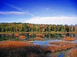
A wetland in Hoadleys.
Wayne County Pennsylvania incorporated and unincorporated areas Cherry Ridge township highlighted.svg
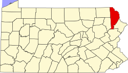
Location in Wayne County and the state of Pennsylvania.
Country United States
State Pennsylvania
U.S. congressional district PA-8
State senatorial district 20
State House of Representatives district 139
County Wayne
School district Wayne Highlands
Region III
SettledBefore 1798 [1]
Incorporated April 30, 1844 [1]
Founded byEnos Woodward, Col. John H. Schenck [1]
Named for Cherry tree [1]
Government
  Type Board of Supervisors
  Board of Supervisors [2]
Supervisors
   US Representative Matt Cartwright (D)
  State Senator Rosemary Brown (R)
  State Representative Jeffrey Olsommer (R)
Area
[3]
  Total22.26 sq mi (57.65 km2)
  Land21.42 sq mi (55.49 km2)
  Water0.83 sq mi (2.16 km2)
Elevation
1,401 ft (427 m)
Population
 (2010)
  Total1,895
  Estimate 
(2016) [4]
1,834
  Density85.61/sq mi (33.05/km2)
Time zone UTC-5 (Eastern (EST))
  Summer (DST) UTC-4 (Eastern Daylight (EDT))
Area code(s) 570
GNIS feature ID1217215 [5]
FIPS code 42-127-13096 [6]
Website Cherry Ridge Township

Cherry Ridge is a second-class township in Wayne County, Pennsylvania, United States. The township's population was 1,895 at the time of the 2010 United States Census. [7]

Contents

Geography

According to the United States Census Bureau, the township has a total area of 22.2 square miles (57 km2), of which 21.4 square miles (55 km2) is land and 0.8 square miles (2.1 km2) (3.6%) is water.

Communities

The following villages are located in Cherry Ridge Township:

Demographics

Historical population
CensusPop.Note
2010 1,895
2016 (est.)1,834 [4] −3.2%
U.S. Decennial Census [12]

As of the census of 2010, there were 1,895 people, 773 households, and 538 families residing in the township. The population density was 88.5 inhabitants per square mile (34.2/km2). There were 903 housing units at an average density of 42.2 per square mile (16.3/km2). The racial makeup of the township was 98.6% White, 0.1% African American, 0.05% Native American, 0.1% Asian, 0.1% from other races, and 1.05% from two or more races. Hispanic or Latino of any race were 2% of the population.

There were 773 households, out of which 25.9% had children under the age of 18 living with them, 58.7% were married couples living together, 7.8% had a female householder with no husband present, and 30.4% were non-families. 23.5% of all households were made up of individuals, and 11.2% had someone living alone who was 65 years of age or older. The average household size was 2.45 and the average family size was 2.94.

In the township the population was spread out, with 21.4% under the age of 18, 60.2% from 18 to 64, and 18.4% who were 65 years of age or older. The median age was 44.7 years.

The median income for a household in the township was $49,375, and the median income for a family was $52,500. Males had a median income of $34,348 versus $31,875 for females. The per capita income for the township was $24,824. About 4% of families and 6% of the population were below the poverty line, including 9.5% of those under age 18 and 7.5% of those age 65 or over.

Related Research Articles

<span class="mw-page-title-main">Frankenmuth Township, Michigan</span> Civil township in Michigan, United States

Frankenmuth Township is a civil township of Saginaw County in the U.S. state of Michigan. The population was 1,895 at the 2020 Census. The city of Frankenmuth is located within the survey township area, but the township and city are administrated autonomously.

<span class="mw-page-title-main">Cherry Grove Township, Michigan</span> Civil township in Michigan, United States

Cherry Grove Township is a civil township of Wexford County in the U.S. state of Michigan. The population was 2,421 at the 2020 census.

Liberty Township is a township in Beltrami County, Minnesota, United States. The population was 623 as of the 2000 census.

Maple Ridge Township is a township in Beltrami County, Minnesota, United States. The population was 108 as of the 2000 census.

Cherry Grove Township is a township in Goodhue County, Minnesota, United States. The population was 430 at the 2000 census.

<span class="mw-page-title-main">Maple Ridge Township, Isanti County, Minnesota</span> Township in Minnesota, United States

Maple Ridge Township is a township in Isanti County, Minnesota, United States. The population was 737 at the 2000 census.

Cherry Township is a township in Saint Louis County, Minnesota, United States. The population was 860 at the 2010 census.

<span class="mw-page-title-main">Cherry Hill Mall, New Jersey</span> Populated place in Camden County, New Jersey, US

Cherry Hill Mall is an unincorporated community and census-designated place (CDP) located in Cherry Hill, in Camden County, in the U.S. state of New Jersey. As of the 2020 United States census, the CDP's population was 14,805, its highest decennial count ever and an increase of 634 (+4.5%) from the 14,171 residents recorded at the 2010 census count, which in turn reflected an increase of 933 (+7.0%) from the 13,238 counted in the 2000 census. The CDP is home to the namesake Cherry Hill Mall shopping complex.

<span class="mw-page-title-main">Pine Ridge at Crestwood, New Jersey</span> Populated place in Ocean County, New Jersey, US

Pine Ridge at Crestwood is an unincorporated community and census-designated place (CDP) located within Manchester Township, in Ocean County, in the U.S. state of New Jersey. As of the 2010 United States Census, the CDP's population was 2,369.

<span class="mw-page-title-main">Indiana Township, Allegheny County, Pennsylvania</span> Township and census-designated place in Pennsylvania, United States

Indiana Township is a township in Allegheny County, Pennsylvania, and a Pittsburgh suburb located in the United States. It contains the communities of Rural Ridge, Dorseyville, and Indianola. The population was 7,255 at the 2020 census.

<span class="mw-page-title-main">Bedford Township, Pennsylvania</span> Township in Pennsylvania, United States

Bedford Township is a township in Bedford County, Pennsylvania, United States. The population was 5,107 at the 2020 census.

<span class="mw-page-title-main">Colerain Township, Bedford County, Pennsylvania</span> Township in Pennsylvania, United States

Colerain Township is a township in Bedford County, Pennsylvania, United States. The population was 1,129 at the 2020 census.

<span class="mw-page-title-main">Snake Spring Township, Pennsylvania</span> Township in Pennsylvania, United States

Snake Spring Township is a township in Bedford County, Pennsylvania, United States. The population was 1,771 at the 2020 census.

<span class="mw-page-title-main">Cherry Township, Butler County, Pennsylvania</span> Township in Pennsylvania, United States

Cherry Township is a township in Butler County, Pennsylvania, United States. The population was 1,106 at the 2010 census.

<span class="mw-page-title-main">South Coventry Township, Pennsylvania</span> Township in Pennsylvania, United States

South Coventry Township is a township in Chester County, Pennsylvania, United States. The population was 2,604 at the 2010 census.

<span class="mw-page-title-main">Greene Township, Pike County, Pennsylvania</span> Township in Pennsylvania, United States

Greene Township is a township in Pike County, Pennsylvania, United States. The population was 3,453 at the 2020 census.

<span class="mw-page-title-main">Berlin Township, Wayne County, Pennsylvania</span> Second-class township in Pennsylvania, United States

Berlin Township is a second-class township in Wayne County, Pennsylvania, United States. The township's population was 2,452 at the time of the 2020 United States Census.

<span class="mw-page-title-main">Clinton Township, Wayne County, Pennsylvania</span> Second-class township in Pennsylvania, United States

Clinton Township is a second-class township in Wayne County, Pennsylvania, United States. The township's population was 2,053 at the time of the 2010 United States Census.

<span class="mw-page-title-main">Dyberry Township, Wayne County, Pennsylvania</span> Second-class township in Pennsylvania, United States

Dyberry is a second-class township in Wayne County, Pennsylvania, United States. The township's population was 1,401 at the time of the 2010 United States Census.

<span class="mw-page-title-main">Lake Township, Wayne County, Pennsylvania</span> Second-class township in Pennsylvania, United States

Lake is a second-class township in Wayne County, Pennsylvania, United States. The township's population was 5,269 at the time of the 2010 United States Census.

References

  1. 1 2 3 4 "Cherry Ridge Township". Wayne County Historical Society. 2014. Archived from the original on February 2, 2015. Retrieved December 15, 2014.
  2. "Municipal Index" (PDF). Wayne County Planning Commission/GIS. WordPress. 2011. Archived from the original (PDF) on December 3, 2014. Retrieved December 1, 2014.
  3. "2016 U.S. Gazetteer Files". United States Census Bureau. Retrieved August 14, 2017.
  4. 1 2 "Population and Housing Unit Estimates" . Retrieved June 9, 2017.
  5. "Township of Cherry Ridge". Geographic Names Information System . United States Geological Survey, United States Department of the Interior. December 1, 1989. Retrieved December 1, 2014.
  6. U.S. Census Bureau. Census 2000. "Census Demographic Profiles, Cherry Ridge Township" (PDF). CenStats Databases. Retrieved January 31, 2009.{{cite web}}: CS1 maint: numeric names: authors list (link)[ dead link ]
  7. "U.S. Census website". United States Census Bureau . Retrieved May 14, 2011.
  8. 1 2 3 "CHERRY RIDGE: SECOND CLASS TOWNSHIP MAP" (PDF). Pennsylvania Department of Transportation. Commonwealth of Pennsylvania. January 29, 2010. Retrieved December 1, 2014.[ permanent dead link ]
  9. "Cherry Ridge". Geographic Names Information System. United States Geological Survey. August 2, 1979. Retrieved December 1, 2014.
  10. "Clemo". Geographic Names Information System. United States Geological Survey. August 2, 1979. Retrieved December 1, 2014.
  11. "Hoadleys". Geographic Names Information System. United States Geological Survey. August 2, 1979. Retrieved December 1, 2014.
  12. "Census of Population and Housing". Census.gov. Retrieved June 4, 2016.