The Hideout, Pennsylvania

Last updated

The Hideout
Wayne County Pennsylvania incorporated and unincorporated areas The Hideout highlighted.svg
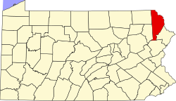
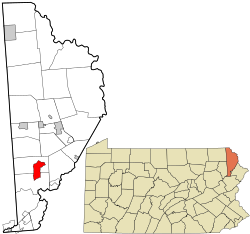
Location in Wayne County and the state of Pennsylvania.
Coordinates: 41°26′07″N75°20′59″W / 41.43528°N 75.34972°W / 41.43528; -75.34972 Coordinates: 41°26′07″N75°20′59″W / 41.43528°N 75.34972°W / 41.43528; -75.34972
CountryUnited States
StatePennsylvania
County Wayne
Township Lake
Salem
Area
  Total6.7 sq mi (17 km2)
  Land6.1 sq mi (16 km2)
  Water0.6 sq mi (2 km2)
Elevation
1,450 ft (440 m)
Population
 (2010)
  Total3,013
  Density450/sq mi (170/km2)
Time zone UTC-5 (EST)
  Summer (DST) UTC-4 (EDT)
ZIP Code
18436
Area code 570

The Hideout is a private community and census-designated place (CDP) in Lake and Salem Townships in Wayne County, Pennsylvania, United States. The community's population was 3,013 at the time of the 2010 United States Census. [1]

Contents

Demographics

As of the census of 2010, there were 3,013 people, 1,325 households, and 969 families residing in the CDP. The population density was 493.9 people per square mile. There were 3,306 housing units at an average density of 541.9/sq mi. The racial makeup of the CDP was 94.5% White, 2.8% African American, 0.2% American Indian, 0.3% Asian, 0.8% from other races, and 1.4% from two or more races. Hispanic or Latino of any race were 5.2% of the population.

There were 1,325 households, out of which 19.8% had children under the age of 18 living with them, 62.8% were married couples living together, 7.2% had a female householder with no husband present, and 26.9% were non-families. 22.6% of all households were made up of individuals, and 11% had someone living alone who was 65 years of age or older. The average household size was 2.27 and the average family size was 2.64.

In the CDP, the population was spread out, with 16% under the age of 18, 54.8% from 18 to 64, and 29.2% who were 65 years of age or older. The median age was 54.7 years.

Related Research Articles

<span class="mw-page-title-main">Cantua Creek, California</span> Census-designated place in California, United States

Cantua Creek is a census-designated place (CDP) in Fresno County, California, United States. As of the 2010 census, the population was 466, down from the 655 reported at the 2000 census. Cantua Creek is located 11 miles (18 km) south-southwest of Tranquillity, at an elevation of 295 feet.

<span class="mw-page-title-main">Humboldt Hill, California</span> Census-designated place in Humboldt County, California, U.S.

Humboldt Hill is a census-designated place (CDP) in Humboldt County, California, United States. Humboldt Hill rises to an elevation of 636 feet (194 m). The population was 3,414 at the 2010 census, up from 3,246 at the 2000 census. The area is in the 95503 zip code and part of unincorporated Eureka.

<span class="mw-page-title-main">Lucerne, Lake County, California</span> Census-designated place in California, United States

Lucerne is a census-designated place (CDP) in Lake County, California, United States. Lucerne is located 7.25 miles (12 km) east-northeast of Lakeport, at an elevation of 1329 feet. The population was 235 in 1871, 2,870 at the 2000 census and 3,067 at the 2010 census.

<span class="mw-page-title-main">Sunnyslope, California</span> Former census-designated place in California, United States

Sunnyslope was a census-designated place (CDP) in Riverside County, California, United States. The population was 5,153 at the 2010 census, up from 4,437 at the 2000 census. On July 1, 2011, the CDP became part of the City of Jurupa Valley.

<span class="mw-page-title-main">Fruitdale, San Jose</span> Place in California, United States

Fruitdale is a district of San Jose, California, located in West San Jose, though some portions are still unincorporated as a census-designated place. The population of the CDP was 935 at the 2010 census.

<span class="mw-page-title-main">Eldridge, California</span> Census-designated place in California, United States

Eldridge is a census-designated place (CDP) in Sonoma County, California, United States. The population was 1,233 at the 2010 census. It is notably the home to the Sonoma Developmental Center, the largest facility serving the needs of persons with developmental disabilities in the state.

Bret Harte is a census-designated place (CDP) in Stanislaus County, California, United States. The population was 5,152 at the 2010 census, down from 5,161 at the 2000 census. It is part of the Modesto Metropolitan Statistical Area. It is named for the American poet and short story writer, Bret Harte, best known for his writings about the California Gold Rush.

<span class="mw-page-title-main">Glencoe, Florida</span> CDP in Florida, United States

Glencoe is a census-designated place (CDP) in Volusia County, Florida, United States. The population was 2,582 at the 2010 census.

<span class="mw-page-title-main">East Porterville, California</span> Place in California, United States

East Porterville is an unincorporated community in Tulare County, California, United States. Adjacent to the city of Porterville, the community lies by the Sierra Nevada foothills. The population was 7,331 at the 2010 census, up from 6,730 at the 2000 census. For statistical purposes, the United States Census Bureau has defined East Porterville as a census-designated place (CDP). The census definition of the area may not precisely correspond to local understanding of the area with the same name.

<span class="mw-page-title-main">Putnam (CDP), Connecticut</span> Census-designated place in Connecticut, United States

Putnam District is a village and census-designated place (CDP) in Windham County, Connecticut, United States. The CDP was formed when the former city of Putnam disincorporated, and it consists of the main town center of the town of Putnam along the Quinebaug River. The population was 7,214 at the 2010 census.

<span class="mw-page-title-main">West Belmar, New Jersey</span> Census-designated place in New Jersey, United States

West Belmar is an unincorporated community and census-designated place (CDP) within Wall Township, in Monmouth County, New Jersey, United States. At the 2010 census, the CDP's population was 2,493.

<span class="mw-page-title-main">Yorketown, New Jersey</span> Census-designated place in New Jersey, United States

Yorketown is an unincorporated community and census-designated place (CDP) within Manalapan Township, in Monmouth County, New Jersey, United States. At the 2020 census, the CDP's population was 6,739.

<span class="mw-page-title-main">Leisure Village East, New Jersey</span> Census-designated place in New Jersey, United States

Leisure Village East is an unincorporated community and census-designated place (CDP) located within Lakewood Township, in Ocean County, New Jersey, United States. As of the 2010 United States Census, the CDP's population was 4,217. Leisure Village East is one of several active adult communities bearing similar names. Leisure Village and Leisure Village West are the other two communities nearby.

<span class="mw-page-title-main">Aquebogue, New York</span> Hamlet and census-designated place in New York, United States

Aquebogue is a census-designated place (CDP) roughly corresponding to the hamlet by the same name in the Town of Riverhead in Suffolk County, on Long Island, in New York, United States. The CDP's population was 2,438 at the 2010 census.

<span class="mw-page-title-main">North Zanesville, Ohio</span> CDP in Ohio, United States

North Zanesville is a census-designated place (CDP) in Muskingum County, Ohio, United States, just north of the city of Zanesville, along the Muskingum River. The population was 3,013 at the 2000 census.

<span class="mw-page-title-main">Roseburg North, Oregon</span> CDP in Oregon, United States

Roseburg North is a census-designated place (CDP) in Douglas County, Oregon, United States. The population was 5,912 at the 2010 census. Winchester, Oregon is included as part of Roseburg North.

<span class="mw-page-title-main">Donaldson, Pennsylvania</span> CDP in Pennsylvania, United States

Donaldson is a census-designated place (CDP) in Frailey Township, Schuylkill County, Pennsylvania, United States. The population was 325 at the 2000 census.

<span class="mw-page-title-main">Shiloh, York County, Pennsylvania</span> CDP in Pennsylvania, United States

Shiloh is a census-designated place (CDP) in West Manchester Township, York County, Pennsylvania, United States. The population was 11,218 at the 2010 census.

<span class="mw-page-title-main">Lago, Texas</span> Census-designated place in Texas, United States

Lago is a census-designated place (CDP) in Cameron County, Texas, United States. The population was 204 at the 2010 census. It is part of the Brownsville–Harlingen Metropolitan Statistical Area.

<span class="mw-page-title-main">Oak Hill, Maine</span> Census-designated place in Maine, United States

Oak Hill is a census-designated place (CDP) in the town of Scarborough in Cumberland County, Maine, United States. Prior to the 2020 census, the CDP was known as Scarborough. The population was 4,403 at the 2010 census. It is part of the Portland–South Portland–Biddeford, Maine Metropolitan Statistical Area.

References

  1. "U.S. Census website". United States Census Bureau . Retrieved May 14, 2011.