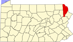
Big Bass Lake | |
---|---|
Coordinates: 41°15′20″N75°29′4″W / 41.25556°N 75.48444°W | |
Country | United States |
State | Pennsylvania |
County | Lackawanna Wayne |
Township | Clifton Covington Lehigh |
Area | |
• Total | 4.37 sq mi (11.32 km2) |
• Land | 4.13 sq mi (10.70 km2) |
• Water | 0.24 sq mi (0.62 km2) |
Elevation | 1,830 ft (560 m) |
Population | |
• Total | 1,337 |
• Density | 323.49/sq mi (124.92/km2) |
Time zone | UTC-5 (EST) |
• Summer (DST) | UTC-4 (EDT) |
ZIP code | 18424 [3] |
Area codes | 570/272 |
FIPS code | 42-06236 |
Website | Big Bass Lake Community Association |
Big Bass Lake is a private community and census-designated place (CDP) in Clifton and Covington Townships in Lackawanna County and Lehigh Township, Wayne County, Pennsylvania, United States. The community's population was 1,270 at time of the 2010 United States Census. [4]
Big Bass Lake is located at 41°15′20″N75°29′4″W / 41.25556°N 75.48444°W (41.2533624, -75.4840284). [5]
According to the United States Census Bureau, the CDP has a total area of 4.37 square miles, of which 4.13 square miles is land and 0.24 square mile (5.49%) is water.
Climate data for Big Bass Lake, Clifton Twp, Lackawanna County, Pennsylvania (1981 – 2010 averages). | |||||||||||||
---|---|---|---|---|---|---|---|---|---|---|---|---|---|
Month | Jan | Feb | Mar | Apr | May | Jun | Jul | Aug | Sep | Oct | Nov | Dec | Year |
Mean daily maximum °F (°C) | 30.9 (−0.6) | 34.5 (1.4) | 42.8 (6.0) | 55.3 (12.9) | 66.3 (19.1) | 74.4 (23.6) | 78.5 (25.8) | 77.1 (25.1) | 69.7 (20.9) | 58.1 (14.5) | 47.2 (8.4) | 35.3 (1.8) | 55.9 (13.3) |
Mean daily minimum °F (°C) | 13.9 (−10.1) | 16.1 (−8.8) | 22.6 (−5.2) | 33.4 (0.8) | 43.2 (6.2) | 51.9 (11.1) | 56.8 (13.8) | 55.6 (13.1) | 48.5 (9.2) | 37.2 (2.9) | 29.4 (−1.4) | 19.6 (−6.9) | 35.8 (2.1) |
Average precipitation inches (mm) | 3.52 (89) | 3.00 (76) | 3.73 (95) | 4.33 (110) | 4.33 (110) | 4.73 (120) | 4.58 (116) | 3.91 (99) | 4.90 (124) | 4.67 (119) | 4.17 (106) | 3.77 (96) | 49.64 (1,260) |
Average snowfall inches (cm) | 19.3 (49) | 13.9 (35) | 14.4 (37) | 3.4 (8.6) | 0.0 (0.0) | 0.0 (0.0) | 0.0 (0.0) | 0.0 (0.0) | 0.0 (0.0) | 0.1 (0.25) | 3.7 (9.4) | 11.6 (29) | 66.4 (169) |
Source: PRISM [6] |
Census | Pop. | Note | %± |
---|---|---|---|
2020 | 1,337 | — | |
U.S. Decennial Census [7] [2] |
At the 2010 census, there were 1,270 people, 550 households, and 393 families in the CDP. The population density was 317.5 people per square mile. There were 1,211 housing units at an average density of 293.2/sq mi. The racial makeup of the CDP was 94.6% White, 2.3% African American, 0.9% Asian, 1.1% from other races, and 1.1% from two or more races. Hispanic or Latino of any race were 5% of the population.
There were 550 households, 14.4% had children under the age of 18 living with them, 59.8% were married couples living together, 7.3% had a female householder with no husband present, and 28.5% were non-families. 22.7% of households were made up of individuals, and 9.5% were one person aged 65 or older. The average household size was 2.31 and the average family size was 2.68.
The age distribution was 16.5% under the age of 18, 58.9% from 18 to 64, and 24.6% 65 or older. The median age was 51.7 years.
The school district is North Pocono School District. [8] [9]
Wyoming County is a county in the Commonwealth of Pennsylvania. As of the 2020 census, the population was 26,069. Its county seat is Tunkhannock. It was created in 1842 from part of Luzerne County. The county is part of the Northeast Pennsylvania region of the state.
Wayne is a county in the Commonwealth of Pennsylvania. The county's population was 51,155 at the 2020 census. The county seat is the Borough of Honesdale. The county was formed from part of Northampton County on March 21, 1798, and was named for the Revolutionary War General Anthony Wayne. The county is part of the Northeast Pennsylvania region of the state.
Susquehanna County is a county in the Commonwealth of Pennsylvania. As of the 2020 census, the population was 38,434 Its county seat is Montrose. The county was created on February 21, 1810, from part of Luzerne County and later organized in 1812. It is named for the Susquehanna River. The county is part of the Northeast Pennsylvania region of the state.
Lackawanna County is a county in the Commonwealth of Pennsylvania. It is located in Northeastern Pennsylvania and had a population of 215,615 (2022). Its county seat and most populous city is Scranton.
Bucks Lake is a census-designated place (CDP) in Plumas County, California, United States. Bucks Lake is located on the south shore of the lake of the same name, 13 miles (20.9 km) west-southwest of Quincy. The population was 22 at the 2020 census, up from 10 at the 2010 census.
Georgetown is a census-designated place in Fairfield County, Connecticut, United States. It is located in the area where the towns of Wilton, Redding, Weston meet.
Lakes of the Four Seasons is a census-designated place (CDP) in Lake and Porter counties in the U.S. state of Indiana. The population was 7,033 at the 2010 census.
Conneaut Lakeshore is a census-designated place (CDP) in Crawford County, Pennsylvania, United States. The population was 2,395 at the 2010 census.
Hartstown is a census-designated place (CDP) in Crawford County, Pennsylvania, United States. The population was 201 at the 2010 census, down from 246 in 2000.
Glenburn is a census-designated place (CDP) in Glenburn Township, Lackawanna County, Pennsylvania, United States. The population was 953 at the 2010 census. It is approximately 10 miles (16 km) north of downtown Scranton, in the growing suburban area known as the "Abingtons". Glenburn is located north of Clarks Summit and south of Dalton.
Moscow is a borough in Lackawanna County, Pennsylvania, United States. The population was 2,039 at the 2020 census. It is located 11 miles (18 km) southeast of Scranton and 24 miles (39 km) southwest of Honesdale.
Mount Cobb is an unincorporated community and census-designated place (CDP) in Lackawanna County, Pennsylvania, United States. The population was 1,799 at the 2010 census.
The Back Mountain is a region and former census-designated place (CDP) in Luzerne County, Pennsylvania, United States. It is near the cities of Scranton and Wilkes-Barre. The population was 33,551 as of 2016. The region has a total area of 117.59 square miles (304.6 km2). The area was not delineated as a CDP for the 2010 census. The name "Back Mountain" refers to the area's location behind the mountain ridge forming the northwest side of the Wyoming Valley. The area includes the townships of Dallas, Franklin, Jackson, Kingston, Lake, and Lehman. The region also includes the boroughs of Dallas and Harveys Lake. Each township and borough is independently governed.
Mountain Top is an unincorporated area and census-designated place (CDP) in Luzerne County, Pennsylvania, United States. As of the 2010 census, its population was 10,982.
Arlington Heights is a census-designated place (CDP) in Monroe County, Pennsylvania, United States. The population was 6,331 at the 2020 census. One notable location in Arlington Heights is the Stroud Mall.
Mountainhome is a census-designated place (CDP) in Barrett Township, Monroe County, Pennsylvania, United States. The population was 1,182 at the 2010 census.
Pocono Pines is a census-designated place (CDP) in Monroe County, Pennsylvania. The population in the 2020 United States Census was 2,007, an increase over the 1,409 population at the 2010 census.
Kulpsville is a census-designated place (CDP) in Montgomery County, Pennsylvania. The population was 8,194 at the 2010 census. It is located in Towamencin Township, which is part of the North Penn Valley region that is centered around the borough of Lansdale. The name is derived from the Kulp family.
Spring Mount is a census-designated place (CDP) in Lower Frederick Township, Montgomery County, Pennsylvania, United States. The population was 2,259 at the 2010 census.
Covington Township is a township in Lackawanna County, Pennsylvania, United States. The population was 2,206 as of the 2020 Census.