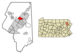
Blakely, Pennsylvania | |
---|---|
Coordinates: 41°29′N75°36′W / 41.483°N 75.600°W | |
Country | United States |
State | Pennsylvania |
County | Lackawanna |
Established | 27 August 1867 |
Government | |
• Mayor | Jeanette Acciare-Mariani |
Area | |
• Total | 3.81 sq mi (9.88 km2) |
• Land | 3.81 sq mi (9.88 km2) |
• Water | 0.00 sq mi (0.00 km2) |
Elevation | 856 ft (261 m) |
Population | |
• Total | 6,657 |
• Density | 1,745.87/sq mi (674.12/km2) |
Time zone | UTC-5 (EST) |
• Summer (DST) | UTC-4 (EDT) |
ZIP Code | 18452 |
Area code | 570 |
FIPS code | 42-06928 |
Website | blakelyborough |
Blakely is a borough in Lackawanna County, Pennsylvania, United States. It is part of Northeastern Pennsylvania. The population was 6,657 at the 2020 census. [3]
The Lackawanna River flows through Blakely, and within the borough is the village of Peckville.
Blakely Township was formed in 1818 from portions of old Providence Township and recently formed Greenfield Township, and named after War of 1812 naval hero Johnston Blakely, who captained the sloop Wasp in battle against the British Cruizer-class brig-sloop Avon in 1814. [4] As the first borough established from a portion of old Blakely Township, the Borough of Blakely as created on 27 August 1867 is also named after Capt. Johnston Blakely, [4] one of the most successful naval officers of his era. The "Johnston Blakeley Memorial" in Blakely is a large anchor from the aircraft carrier USS Wasp, decommissioned in the 1960s.
In the 1970s, Blakely was home to Masterpiece Inc., the seventh largest manufacturer of artificial Christmas trees. [5]
According to the U.S. Census Bureau, the borough has a total area of 3.8 square miles (9.8 km2), all land.
Census | Pop. | Note | %± |
---|---|---|---|
1870 | 659 | — | |
1880 | 871 | 32.2% | |
1890 | 2,452 | 181.5% | |
1900 | 3,915 | 59.7% | |
1910 | 5,345 | 36.5% | |
1920 | 6,564 | 22.8% | |
1930 | 8,260 | 25.8% | |
1940 | 8,106 | −1.9% | |
1950 | 6,828 | −15.8% | |
1960 | 6,374 | −6.6% | |
1970 | 6,391 | 0.3% | |
1980 | 7,438 | 16.4% | |
1990 | 7,222 | −2.9% | |
2000 | 7,027 | −2.7% | |
2010 | 6,564 | −6.6% | |
2020 | 6,657 | 1.4% | |
2021 (est.) | 6,660 | [3] | 0.0% |
Sources: [6] [7] [8] [9] [2] |
As of the census [10] of 2010, there were 6,564 people, 2,816 households, and 1,742 families in the borough. The population density was 1,727.4 inhabitants per square mile (667.0/km2). There were 3,024 housing units at an average density of 795.8 units per square mile (307.3 units/km2). The racial makeup of the borough was 96.6% White, 1% African American, 0.1% Native American, 0.1% Pacific Islander, 0.7% Asian, 0.6% from other races, and 0.9% from two or more races. Hispanic or Latino of any race were 1.8% of the population.
There were 2,816 households, out of which 23% had children under the age of 18 living with them, 45.1% were married couples living together, 12.2% had a female householder with no husband present, and 38.1% were non-families. 33.2% of all households were made up of individuals, and 17.9% had someone living alone who was 65 years of age or older. The average household size was 2.23 and the average family size was 2.85.
In the borough the population was spread out, with 18.3% under the age of 18, 56.6% from 18 to 64, and 25.1% who were 65 years of age or older. The median age was 47.2 years.
The median income for a household in the borough was $38,153, and the median income for a family was $60,341. Males had a median income of $48,170 versus $32,158 for females. The per capita income for the borough was $23,063. About 6.6% of families and 12.4% of the population were below the poverty line, including 14.2% of those under age 18 and 5.3% of those age 65 or over.
The "Blakely Borough Recreation Complex" is public sports complex located on the bank of the Lackawanna River. [11]
New Brighton is a borough in north-central Beaver County, Pennsylvania, United States, located along the Beaver River 28 miles (45 km) northwest of Pittsburgh. The population was 5,729 at the 2020 census. It is part of the Pittsburgh metropolitan area.
Towanda is a borough in, and the county seat of, Bradford County in the U.S. state of Pennsylvania. It is part of Northeastern Pennsylvania and is located 66 miles (106 km) northwest of Wilkes-Barre, on the Susquehanna River. The name means "burial ground" in the Algonquian language. As of the 2020 census, the population of Towanda was 2,833.
Waverly Township is a township in Lackawanna County, Pennsylvania, United States. It is bordered by Dalton and Glenburn townships to the west, North Abington Township to the north, the boroughs of Clarks Summit and Clarks Green to the south, and South Abington Township to the south and southeast. Waverly Township is part of a suburban area known as "the Abingtons". The population was 1,861 at the 2020 census.
Archbald is a borough in Lackawanna County, Pennsylvania, United States. It is part of Northeastern Pennsylvania and is named for James Archbald, the first mayor of Carbondale, Pennsylvania. Before being renamed in Archbald's honor, the name of the settlement was White Oak Run. Most of the original settlers were Irish Catholics, fleeing the Great Famine. The population was 7,348 at the 2021 census.
Benton Township is a township in Lackawanna County, Pennsylvania, United States. The population was 1,728 at the 2020 census. The village of Fleetville is in Benton Township.
Carbondale Township is a township in Lackawanna County, Pennsylvania and is respectively named for the adjoining city of Carbondale. The township is located near Scranton. The population was 1,126 at the 2020 census. The village of Childs is located in Carbondale township.
Clarks Summit is a borough in Lackawanna County, northwest of Scranton in Northeastern Pennsylvania. The population was 5,108 at the 2020 census. It is also the northern control city of the Pennsylvania Turnpike Northeast Extension, I-476, though the official terminus is in adjacent South Abington Township.
Dunmore is a borough in Lackawanna County, Pennsylvania, United States, adjoining Scranton. It is part of Northeastern Pennsylvania and was settled in 1835 and incorporated in 1862. Extensive anthracite coal, brick, stone, and silk interests had led to a rapid increase in the population from 8,315 in 1890 to 23,086 in 1940. The population was 14,042 in the 2020 census.
Jessup is a borough in Lackawanna County, Pennsylvania, United States. The population was 4,532 at the 2020 census.
La Plume Township is a township in Lackawanna County, Pennsylvania, United States. The population was 486 at the 2020 census. It is home to Keystone College. La Plume is located 11 miles northwest of Scranton, one of Pennsylvania's most populated cities.
Madison Township is a township in Lackawanna County, Pennsylvania, United States. The population was 2,476 at the 2020 census. Madisonville and Quicktown are part of Madison Township.
Moosic is a borough in Lackawanna County, Pennsylvania, United States, 3 miles (5 km) south of downtown Scranton and 10 miles (16 km) northeast of downtown Wilkes-Barre, on the Lackawanna River.
Moscow is a borough in Lackawanna County, Pennsylvania, United States. The population was 2,039 at the 2020 census. It is located 11 miles (18 km) southeast of Scranton and 24 miles (39 km) southwest of Honesdale.
North Abington Township is a township in Lackawanna County, Pennsylvania, United States. It is located approximately 10 miles (16 km) north of Scranton, Pennsylvania, and is located in the suburban area known as “the Abingtons". North Abington is also approximately 6 miles (10 km) north of Clarks Summit and borders Waverly Township and Dalton Borough to the south, as well as Benton Township to the north. The population was 709 at the 2020 census.
Ransom Township is a township in Lackawanna County, Pennsylvania, United States. The population was 1,401 at the 2020 census. The township includes the village of Milwaukee.
Scott Township is a township in the north central area of Lackawanna County, Pennsylvania, United States. As of the 2020 census, it had a population of 4,641.
Spring Brook Township is a township in Lackawanna County, Pennsylvania, United States. The population was 2,753 at the 2020 census.
Throop is a borough in Lackawanna County, Pennsylvania, United States, adjoining Scranton. Formerly, coal mining and silk manufacturing provided employment for the people of Throop, who numbered 2,204 in 1900 and 5,133 in 1910. In 1940, 7,382 people lived in Throop. The population was 4,078 at the 2020 census.
Duryea is a borough in the Greater Pittston area of Luzerne County, Pennsylvania, United States, 9 miles (14 km) south of Scranton. The Susquehanna River marks Duryea's western boundary and the Lackawanna River flows through Duryea. It was incorporated as a borough in 1901, and had a notable switching rail yard, the Duryea yard, connecting the central Wyoming Valley to destinations in lower New York and down-state Pennsylvania. Coal mining and silk manufacturing were the chief industries in Duryea's early years. The population was 5,032 at the 2020 census.
Factoryville is a borough in Wyoming County, Pennsylvania, United States. The population was 1,146 at the 2020 census.