Bethany, Pennsylvania

Last updated
Bethany, Pennsylvania
Bethany, Pennsylvania.jpg
Bethany, Pennsylvania
Wayne County Pennsylvania incorporated and unincorporated areas Bethany highlighted.svg
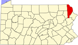
Location in Wayne County and the U.S. state of Pennsylvania.
USA Pennsylvania location map.svg
Red pog.svg
Bethany
Location of Bethany in Pennsylvania
Usa edcp location map.svg
Red pog.svg
Bethany
Bethany (the United States)
Coordinates: 41°36′52″N75°17′19″W / 41.61444°N 75.28861°W / 41.61444; -75.28861 Coordinates: 41°36′52″N75°17′19″W / 41.61444°N 75.28861°W / 41.61444; -75.28861
CountryUnited States
StatePennsylvania
County Wayne
Area
[1]
  Total0.50 sq mi (1.30 km2)
  Land0.50 sq mi (1.29 km2)
  Water0.00 sq mi (0.01 km2)
Elevation
1,486 ft (453 m)
Population
 (2020) [2]
  Total241
  Density483.94/sq mi (186.99/km2)
Time zone UTC-5 (EST)
  Summer (DST) UTC-4 (EDT)
Area code 570
FIPS code 42-05976
Website Bethany Borough

Bethany is a borough in Wayne County, Pennsylvania, United States. The borough's population was 246 at the time of the 2010 United States Census. [3]

Contents

History

The borough was named after Bethany, a place mentioned in the Bible. [4]

The Wilmot House and Wilmot Mansion are listed on the National Register of Historic Places. [5]

Geography

Bethany is located at 41°36′52″N75°17′19″W / 41.61444°N 75.28861°W / 41.61444; -75.28861 (41.614321, -75.288537). [6]

According to the United States Census Bureau, the borough has a total area of 0.5 square miles (1.3 km2), all land.

Demographics

Historical population
CensusPop.Note
1830 327
1840 299−8.6%
1850 295−1.3%
1860 225−23.7%
1870 202−10.2%
1880 181−10.4%
1890 134−26.0%
1900 130−3.0%
1910 1300.0%
1920 106−18.5%
1930 14637.7%
1940 1481.4%
1950 1480.0%
1960 18122.3%
1970 26747.5%
1980 2825.6%
1990 238−15.6%
2000 29222.7%
2010 246−15.8%
2020 241−2.0%
Sources: [7] [8] [9] [10] [2]

As of the census of 2010, there were 246 people, 108 households, and 73 families residing in the borough. The racial makeup of the borough was 98% White, 1.6% African American, and 0.4% American Indian or Alaska Native. Hispanic or Latino of any race were 1.6% of the population.

There were 108 households, out of which 25.9% had children under the age of 18 living with them, 56.5% were married couples living together, 8.3% had a female householder with no husband present, and 32.4% were non-families. 26.9% of all households were made up of individuals, and 13% had someone living alone who was 65 years of age or older. The average household size was 2.28 and the average family size was 2.75.

In the borough the population was spread out, with 19.1% under the age of 18, 59.8% from 18 to 64, and 21.1% who were 65 years of age or older. The median age was 48 years.

The median income for a household in the borough was $39,167, and the median income for a family was $41,161. Males had a median income of $29,167 versus $26,042 for females. The per capita income for the borough was $21,683. About 3.2% of families and 6.8% of the population were below the poverty line, including 4.3% of those under the age of eighteen and 3.6% of those 65 or over.

Notable people

Related Research Articles

<span class="mw-page-title-main">Green Spring, Kentucky</span> City in Kentucky, United States

Green Spring is a home rule-class city in Jefferson County, Kentucky, United States. The population was 715 at the 2010 census.

<span class="mw-page-title-main">New Albany, Pennsylvania</span> Borough in Pennsylvania, United States

New Albany is a borough in Bradford County, Pennsylvania, United States. It is part of Northeastern Pennsylvania. The population was 254 at the 2020 census.

<span class="mw-page-title-main">Petrolia, Pennsylvania</span> Borough in Pennsylvania, United States

Petrolia is a borough in Butler County, Pennsylvania, United States. The population was 212 at the 2010 census.

<span class="mw-page-title-main">South Coatesville, Pennsylvania</span> Borough in Pennsylvania, United States

South Coatesville is a borough in Chester County, Pennsylvania, United States. The population was 1,604 at the 2020 census.

<span class="mw-page-title-main">Clarks Green, Pennsylvania</span> Borough in Pennsylvania, United States

Clarks Green is a borough in Lackawanna County, Pennsylvania. It is part of Northeastern Pennsylvania. The population was 1,529 at the 2020 census.

<span class="mw-page-title-main">Taylor, Pennsylvania</span> Borough in Pennsylvania, United States

Taylor is a borough in Lackawanna County, Pennsylvania, United States, 3 miles (5 km) southwest of Scranton on the Lackawanna River. It was founded in 1790 by Cornelius Atherton. Silk manufacturing and coal mining were once practiced in the borough. Most of Taylor is built over abandoned mines. The Pennsylvania Turnpike Northeast Extension (I-476), accessible via the Keyser Avenue Interchange, passes through Taylor, going north to Clarks Summit and south to Philadelphia.

<span class="mw-page-title-main">Throop, Pennsylvania</span> Borough in Pennsylvania, United States

Throop is a borough in Lackawanna County, Pennsylvania, United States, adjoining Scranton. Formerly, coal mining and silk manufacturing provided employment for the people of Throop, who numbered 2,204 in 1900 and 5,133 in 1910. In 1940, 7,382 people lived in Throop. The population was 4,078 at the 2020 census.

<span class="mw-page-title-main">Vandling, Pennsylvania</span> Borough in Pennsylvania, United States

Vandling is a borough in the northeastern corner of Lackawanna County, Pennsylvania, United States. The population was 730 at the 2020 census. It is located immediately south of Forest City, which is in Susquehanna County.

<span class="mw-page-title-main">Bear Creek Village, Pennsylvania</span> Borough in Pennsylvania, United States

Bear Creek Village is a borough in Luzerne County, Pennsylvania, United States. The population was 290 at the 2020 census.

<span class="mw-page-title-main">Dupont, Pennsylvania</span> Borough in Pennsylvania, United States

Dupont is a borough in the Greater Pittston area of Luzerne County, Pennsylvania, United States. The population was 2,536 as of the 2020 census.

<span class="mw-page-title-main">Edwardsville, Pennsylvania</span> Borough in Pennsylvania, United States

Edwardsville is a borough in Luzerne County, Pennsylvania, United States. The population was 4,918 at the 2020 census.

<span class="mw-page-title-main">Yatesville, Pennsylvania</span> Borough in Pennsylvania, United States

Yatesville is a borough in the Greater Pittston area of Luzerne County, Pennsylvania. The population was 638 as of the 2020 census.

<span class="mw-page-title-main">Lanesboro, Pennsylvania</span> Borough in Pennsylvania, United States

Lanesboro is a borough in Susquehanna County, Pennsylvania, United States. The population was 485 at the 2020 census.

<span class="mw-page-title-main">New Milford, Pennsylvania</span> Borough in Pennsylvania, United States

New Milford is a borough in Susquehanna County, Pennsylvania, United States. The population was 817 at the 2020 census. Children living in New Milford are served by the schools in the Blue Ridge School District, including Blue Ridge High School.

<span class="mw-page-title-main">Oakland, Susquehanna County, Pennsylvania</span> Borough in Pennsylvania, United States

Oakland is a borough in Susquehanna County, Pennsylvania, United States. The population of Oakland borough was 564 at the 2020 census.

<span class="mw-page-title-main">Thompson, Pennsylvania</span> Borough in Pennsylvania, United States

Thompson is a borough in Susquehanna County, Pennsylvania, United States. The population was 255 at the 2020 census.

<span class="mw-page-title-main">Union Dale, Pennsylvania</span> Borough in Pennsylvania, United States

Union Dale is a borough in Susquehanna County, Pennsylvania, United States. The borough was incorporated in 1885. Union Dale's population was 267 at the 2010 census.

<span class="mw-page-title-main">Prompton, Pennsylvania</span> Borough in Pennsylvania, United States

Prompton is a borough in Wayne County, Pennsylvania, United States. The population was 250 at the 2010 census.

<span class="mw-page-title-main">Waymart, Pennsylvania</span> Borough in Pennsylvania, United States

Waymart is a borough in Wayne County, Pennsylvania, United States. The borough's population was 1,341 at the time of the 2010 United States Census.

<span class="mw-page-title-main">Nicholson, Pennsylvania</span> Borough in Pennsylvania, United States

Nicholson is a borough in Wyoming County, Pennsylvania. The population was 698 at the 2020 census.

References

  1. "ArcGIS REST Services Directory". United States Census Bureau. Retrieved October 12, 2022.
  2. 1 2 "Census Population API". United States Census Bureau. Retrieved Oct 12, 2022.
  3. "U.S. Census website". United States Census Bureau . Retrieved 2011-05-14.
  4. Herschell, Don (September 22, 1995). "Why name your town Ninevah?". Observer-Reporter. pp. B5. Retrieved 28 April 2015.
  5. "National Register Information System". National Register of Historic Places . National Park Service. July 9, 2010.
  6. "US Gazetteer files: 2010, 2000, and 1990". United States Census Bureau. 2011-02-12. Retrieved 2011-04-23.
  7. Mitchell, Samuel Augustus (1843). Accurate Synopsis of the Population of the Union, According to the Census of 1840. Alphabetically Arranged. S. A. Mitchell. p. 2.
  8. "Census of Population and Housing". U.S. Census Bureau. Retrieved 11 December 2013.
  9. "U.S. Census website". United States Census Bureau . Retrieved 2008-01-31.
  10. "Incorporated Places and Minor Civil Divisions Datasets: Subcounty Resident Population Estimates: April 1, 2010 to July 1, 2012". Population Estimates. U.S. Census Bureau. Archived from the original on 11 June 2013. Retrieved 11 December 2013.

Commons-logo.svg Media related to Bethany, Pennsylvania at Wikimedia Commons