Western Wayne School District

Last updated
Western Wayne School District
Map of Wayne County Pennsylvania School Districts.png
Address
1970c Easton Turnpike
Lake Ariel
, Pennsylvania , 18436-0158
United States
District information
TypePublic
Other information
Website https://ww3.westernwayne.org/

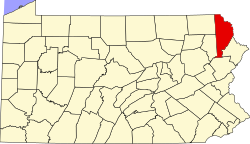
Western Wayne School District is a third-class school district in Wayne County, Pennsylvania. The district's population was 19,292 at the time of the 2010 United States Census.

Contents

Western Wayne was formed in 1969. It serves the townships of Canaan, Lake, Salem, South Canaan, Sterling, and a portion of Clinton. The borough of Waymart is also part of the Western Wayne School District. The District encompasses 174 square miles (450 km2). The school district is 25 miles north and east of the city of Scranton in the Northeastern region of Pennsylvania. In 2009, the District residents’ per capita income was $16,259, while the median family income was $39,971. [1] In the Commonwealth of Pennsylvania, the median family income was $49,501 [2] and the United States median family income was $49,445, in 2010. [3]

Western Wayne School District operates four schools:

Regions and constituent municipalities

The district is divided into three regions, which include the following municipalities:

Region I

Region II

Region III

Extracurriculars

The Western Wayne School District offers a wide variety of clubs, activities and an extensive sports program.

Sports

The District funds:

Middle School Sports

According to PIAA directory June 2013 [4]

Related Research Articles

<span class="mw-page-title-main">Wayne County, Pennsylvania</span> County in Pennsylvania

Wayne is a county in the Commonwealth of Pennsylvania. It is part of Northeastern Pennsylvania. The county's population was 51,155 at the 2020 census. The county seat is the Borough of Honesdale. The county was formed from part of Northampton County on March 21, 1798, and was named for the Revolutionary War General Anthony Wayne.

<span class="mw-page-title-main">Waymart, Pennsylvania</span> Borough in Pennsylvania, United States

Waymart is a borough in Wayne County, Pennsylvania, United States. The borough's population was 1,341 at the time of the 2010 United States Census.

<span class="mw-page-title-main">Shaler Area School District</span> School district in Pennsylvania, United States

Shaler Area School District is a large, urban and suburban public school district located in Allegheny County, Pennsylvania. Shaler Area School District encompasses approximately 14 square miles (36 km2) in Pittsburgh's northern suburbs, including Shaler Township, Etna Borough, Millvale Borough, and Reserve Township. According to 2000 federal census data, it served a resident population of 41,565. By 2010, the district's population declined to 39,293 people. In 2009, Shaler Area School District residents’ per capita income was $21,333, while the median family income was $52,135. In the Commonwealth, the median family income was $49,501 and the United States median family income was $49,445, in 2010. By 2013, the median household income in the United States rose to $52,100.

<span class="mw-page-title-main">Forest City Regional School District</span> School district in Pennsylvania

Forest City Regional School District is a Pennsylvania third-class school district in Lackawanna, Susquehanna, and Wayne Counties. The district's population was 5,095 at the time of the 2010 United States Census.

<span class="mw-page-title-main">Brownsville Area School District</span> School district in Fayette County, Penn.

The Brownsville Area School District spans portions of two counties. In Fayette County, Pennsylvania it covers the Borough of Brownsville and Brownsville Township, Luzerne Township and Redstone Township in Fayette County. In Washington County, Pennsylvania it covers a portion of the Borough of West Brownsville. Brownsville Area School District encompasses approximately 57 square miles. According to 2000 federal census data, it served a resident population of 15,097. By 2010, the district's population declined to 14,959 people per the US Census Bureau. The educational attainment levels for the Brownsville Area School District population were 80% high school graduates and 9.9% college graduates. The district is one of the 500 public school districts of Pennsylvania.

<span class="mw-page-title-main">Exeter Township School District</span> School district in Pennsylvania

The Exeter Township School District is a small suburban public school district located in Berks County, Pennsylvania. The district serves two municipalities southeast of Reading, the Borough of St. Lawrence, and Exeter Township. In 2009, the District residents’ per capita income was $24,836, while the median family income was $63,670. In the Commonwealth, the median family income was $49,501 and the United States median family income was $49,445, in 2010.

<span class="mw-page-title-main">Allegheny-Clarion Valley School District</span> Public school district in Pennsylvania, United States

Allegheny-Clarion Valley School District (ACVSD) is a small, rural, public school district in western Pennsylvania. It spans portions of four counties and is the only Pennsylvania public school district to do so. The district is one of the 500 public school districts of Pennsylvania. The Allegheny-Clarion Valley School District encompasses approximately 121 square miles (310 km2). In Armstrong County it covers the City of Parker and Hovey Township. In Butler County it serves Allegheny Township. In Clarion County it serves the Boroughs of Emlenton, Foxburg and St. Petersburg and Perry Township and Richland Township. In Venango County it serves the Borough of Emlenton and Richland Township and Scrubgrass Township. According to 2000 federal census data, Allegheny-Clarion Valley School District serves a resident population of 5,944. By 2010, the district's population declined to 5,749 people. In 2009, the district residents' per capita income was $15,525, while the median family income was $36,867. In the Commonwealth of Pennsylvania, the median family income was $49,501 and the United States median family income was $49,445, in 2010. By 2013, the median household income in the United States rose to $52,100.

<span class="mw-page-title-main">Elk Lake School District</span> School district in Pennsylvania

Elk Lake School District is a small, rural, K-12 public school district with its only building located on State Route 3019 in Dimock, Susquehanna County, Pennsylvania. It covers Auburn Township, Middletown Township, Rush Township, Dimock Township, and Springville Township in Susquehanna County, along with Meshoppen Borough and Meshoppen Township in Wyoming County. The Elk Lake School District encompasses approximately 197 square miles (510 km2). According to 2000 federal census data, Elk Lake School District serves a resident population of 7,735 people. In 2009, the district residents’ per capita income was $15,355, while the median family income was $38,385. In the Commonwealth, the median family income was $49,501 and the United States median family income was $49,445, in 2010. In 2006, the district students are 97% white, less than 1% Asian, less than 1% black and 2% Hispanic.

<span class="mw-page-title-main">Wayne Highlands School District</span> School district in Pennsylvania

Wayne Highlands is a third-class school district in Wayne County, Pennsylvania. The district's population was 20,870 at the time of the 2010 United States Census.

<span class="mw-page-title-main">Berwick Area School District</span> School district in Pennsylvania, United States

The Berwick Area School District is a midsized, rural, public school district. Berwick Area School District encompasses approximately 101 square miles (260 km2), spanning portions of two central Pennsylvania counties. In Columbia County it covers the Boroughs of Berwick and Briar Creek and Briar Creek Township. In Luzerne County it covers the Borough of Nescopeck and Hollenback Township, Nescopeck Township and Salem Township. According to 2000 federal census data, it served a resident population of 22,622. By 2010, the district's population had declined to 22,332 people. The educational attainment levels for the school district population were 82.1% high school graduates and 13.7% college graduates. The district is one of the 500 public school districts of Pennsylvania.

<span class="mw-page-title-main">Crawford Central School District</span> School district in Pennsylvania

The Crawford Central School District is a midsized, public school district in Crawford County, Pennsylvania. It serves the City of Meadville, Borough of Cochranton and East Fairfield Township, Fairfield Township, Union Township, Vernon Township, Wayne Township and West Mead Township as well as a small portion of Greenwood Township in Crawford County, Pennsylvania, as well as French Creek Township in neighboring Mercer County, Pennsylvania. Crawford Central School District encompasses approximately 156 square miles. According to 2000 federal census data, it serves a resident population of 30,882 people. By 2010, the district's population declined to 30,635 people. In 2009, the Crawford Central School District residents' per capita income was $18,463, while the median family income was $43,771. In the Commonwealth, the median family income was $49,501 and the United States median family income was $49,445, in 2010. By 2013, the median household income in the United States rose to $52,100.

<span class="mw-page-title-main">Crestwood School District (Pennsylvania)</span> School district in Pennsylvania

The Crestwood School District is a midsized, suburban public school district which serves the Boroughs of Nuangola, Penn Lake Park and White Haven and Dennison Township, Dorrance Township, Fairview Township, Rice Township, Slocum Township and Wright Township in Luzerne County, Pennsylvania. Crestwood School District encompasses approximately 109.5 square miles (284 km2). According to 2000 federal census data, it serves a resident population of 18,299.

<span class="mw-page-title-main">Purchase Line School District</span> School district in Pennsylvania

Purchase Line School District is a small, public school district located in central Pennsylvania which covers small areas in two counties. It serves a rural region, including the townships of Montgomery and Green, and the Borough of Glen Campbell in Indiana County. It also serves the Boroughs of New Washington, Burnside, Mahaffey, Newburg, and Bell Township in Clearfield County. Purchase Line School District encompasses approximately 144 square miles (370 km2). According to 2000 federal census data, Purchase Line Area School District serves a resident population of 7,687. In 2009, the District residents’ per capita income was $12,174, while the median family income was $31,893. In the Commonwealth, the median family income was $49,501 and the United States median family income was $49,445, in 2010.

<span class="mw-page-title-main">Reynolds School District (Pennsylvania)</span> School district in Pennsylvania

The Reynolds School District is a rural, public school district serving parts of Mercer County, Pennsylvania. Reynolds School District encompasses approximately 88 square miles (230 km2) encompassing the communities of Fredonia, West Salem Township, Delaware Township, and Pymatuning Township. The western border of the district is part of the Pennsylvania - Ohio border. According to 2000 federal census data, it served a resident population of 10,158. By 2010, the district's population declined to 9,611 people. It is built on what was once a military camp during World War II, Camp Reynolds. In 2009, the district residents' per capita income was $16,380 while the median family income was $42,200. In the Commonwealth, the median family income was $49,501 and the United States median family income was $49,445, in 2010.

<span class="mw-page-title-main">Keystone School District</span> School district in Pennsylvania

The Keystone School District is a small, rural public school district in Clarion County, Pennsylvania. It serves the boroughs of Shippenville, Knox, and Callensburg, as well as the townships of Beaver Township, Elk Township, Licking Township, Ashland Township, and Salem Township. The Keystone School District encompasses approximately 126 square miles. According to 2000 federal census data, it serves a resident population of 7,589. In 2009, the district residents' per capita income was $16,347, while the median family income was $39,271.

<span class="mw-page-title-main">Jersey Shore Area School District</span> Public school district in Pennsylvania

The Jersey Shore Area School District is a large rural, American, public school district that is located in Lycoming County, Pennsylvania and Clinton County, Pennsylvania. The district, which encompasses approximately 385 square miles (1,000 km2), is centered on the borough of Jersey Shore and serves the surrounding Lycoming County municipalities of Limestone Township, Bastress Township, Nippenose Township, Porter Township, Piatt Township, Anthony Township, Mifflin Township, Watson Township, Cummings Township, McHenry Township, Brown Township, and Salladasburg.

<span class="mw-page-title-main">Upper Dauphin School District</span> School district in Pennsylvania

The Upper Dauphin Area School District is a small, rural, public school district located in Dauphin County, Pennsylvania. It is fragmented in four discontinuous pieces, including: the boroughs of Lykens, Elizabethville, Gratz, Berrysburg, and Pillow, as well as Jefferson Township, Washington Township, Mifflin Township, and Lykens Township. Upper Dauphin Area School District encompasses approximately 91 square miles (240 km2). According to 2007 local census data, it serves a resident population of 9,723 people. By 2010, the district's population was 9,759 people. The educational attainment levels for the district's population aged 25 years and over were 81.4% high school graduates and 10.6% college graduates.

<span class="mw-page-title-main">Tuscarora School District</span> School district in Pennsylvania

The Tuscarora School District is a midsized, rural, public school district located in Franklin County, Pennsylvania. It serves: the borough of Mercersburg, as well as St. Thomas Township, Peters Township, Montgomery Township, and Warren Township. The district is one of the 500 public school districts of Pennsylvania. Tuscarora School District covers an area of 201 square miles (520 km2), stretching north–south from just south of 40 degrees north latitude to the Maryland border and from east of the 78 degree west longitude line to just west of Chambersburg, Pennsylvania. The district is primarily a rural agricultural area with a total population of approximately 17,000 people. Tuscarora, the name of the mountain on the western boundary, is derived from the Tuscarora Tribe of the Iroquois Confederation. The Tribe came north from the Carolinas about 1713 and settled for a time along the mountains. The name Tuscarora comes from the Indian name Skaruron or hemp gatherers. Conococheague, the name of the creek that flows through the district on its way from the Path Valley south to the Potomac River, is an Indian name from the Delaware Tribe meaning clear water.

<span class="mw-page-title-main">South Western School District</span> School district in Pennsylvania

South Western School District is a midsized, suburban public school district in York County, Pennsylvania. It serves the townships of Penn Township, Manheim Township and West Manheim Township. It encompasses approximately 56 square miles (150 km2). According to 2000 federal census data, South Western School District serves a resident population of 22,576 people. By 2010, the district's population increased to 26,768 people. In 2009, South Western School District residents’ per capita income was $20,618, while the median family income was $56,296. In the Commonwealth, the median family income was $49,501 and the United States median family income was $49,445, in 2010.

<span class="mw-page-title-main">South Eastern School District</span> School district in Pennsylvania

The South Eastern School District is a midsized, rural, public school district in southern York County, Pennsylvania. It serves the boroughs of Cross Roads, Stewartstown, Delta, and Fawn Grove, plus the townships of Hopewell Township, East Hopewell Township, Fawn Township, and Peach Bottom Township. It also includes the villages of Bryansville and Woodbine. The district encompasses approximately 105 square miles (270 km2). According to data from the 2000 federal census, it serves a resident population of 17,884 people. By 2010, South Eastern School District's population increased to 19,567 people. In 2009, the district residents’ per capita income was $20,060, while the median family income was $55,846. In the Commonwealth, the median family income was $49,501 and the United States median family income was $49,445, in 2010.

References

  1. US Census Bureau, American Fact Finder, 2009
  2. US Census Bureau (2010). "American Fact Finder, State and County quick facts".
  3. US Census Bureau (September 2011). "Income, Poverty, and Health Insurance Coverage in the United States: 2010" (PDF).
  4. Pennsylvania Interscholastic Athletics Association, PIAA School Directory, 2013