
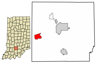
Shoals is a town in Center and Halbert townships, Martin County, in the U.S. state of Indiana. The population was 756 at the 2010 census.

Jug Rock is a natural geological formation located outside of Shoals, Indiana, in the valley of the East Fork of the White River. It is composed of sandstone, and is the largest free-standing table rock formation in the United States east of the Mississippi River. It is part of the Mansfield formation, laid down in the Pennsylvanian geological epoch, roughly 325 to 286 million years ago. Erosion along fracture lines separated it from a nearby cliff. A companion feature, House Rock, stands opposite Jug Rock.
Lake is a place located in St. Louis County in the State of Missouri in the United States of America. It is located at latitude 38°40'46" North, longitude 90°31'12" West.

Halbert Township is one of six townships in Martin County, Indiana, United States. As of the 2010 census, its population was 1,631 and it contained 789 housing units.

Lost River Township is one of six townships in Martin County, Indiana, United States. As of the 2010 census, its population was 572 and it contained 265 housing units.

Mitcheltree Township is one of six townships in Martin County, Indiana, United States. As of the 2010 census, its population was 624 and it contained 357 housing units.

Dubois is an unincorporated community and census-designated place (CDP) in Dubois County, Indiana, United States. Its population at the 2010 census was 488.
Williams is an unincorporated census-designated place in Spice Valley Township, Lawrence County, Indiana. Williams is situated on the White River. Williams is home to Williams Dam, a hydroelectric dam that once powered the electricity for stone industries across Southern Indiana, especially in nearby Bedford and Bloomington.

Yenne is an unincorporated community in Lost River Township, Martin County, in the U.S. state of Indiana.
Trinity Springs is an unincorporated community in Mitcheltree Township, Martin County, in the U.S. state of Indiana.

Lewisville is an unincorporated community in the northeast corner of Harrison Township, Owen County, in the U.S. state of Indiana. It lies near the intersection of County Road 700 East and West Lewisville Road, which is a community about twenty miles northeast of the city of Spencer, the county seat. Its elevation is 771 feet, and it is located at 39°28′16″N86°37′55″W. This community lies on the border of Owen County and Morgan County.
Clay City is an unincorporated community in Clay Township, Spencer County, in the U.S. state of Indiana.

Fairview is an unincorporated community in Brown Township, Washington County, in the U.S. state of Indiana.
Brimstone Corners is an unincorporated community in Brown Township, Washington County, in the U.S. state of Indiana.
Shorts Corner is an unincorporated community in Pierce Township, Washington County, in the U.S. state of Indiana.
Fayetteville is an unincorporated community in Posey Township, Washington County, in the U.S. state of Indiana.
Highland is an unincorporated community in Washington Township, Washington County, in the U.S. state of Indiana.
Pearsontown is an unincorporated community in Southeast Township, Orange County, in the U.S. state of Indiana.
Hindostan is an unincorporated community in Northwest Township, Orange County, in the U.S. state of Indiana.


