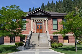
Shoshone Countyshuh-SHONE is a county in the U.S. state of Idaho. As of the 2020 census, the population was 13,169. The county seat is Wallace and the largest city is Kellogg. The county was established in 1864, named for the Native American Shoshone tribe.
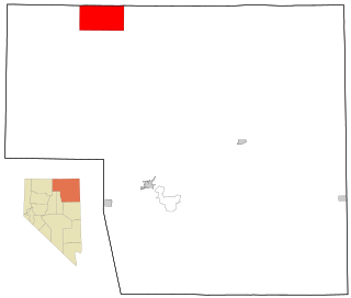
Owyhee is a census-designated place (CDP) in Elko County, Nevada, United States, along the banks of the Owyhee River. The population was 953 at the 2010 census. It is part of the Elko Micropolitan Statistical Area. It is the primary town of the federally recognized Shoshone-Paiute tribe's Duck Valley Indian Reservation, which covers portions of northern Nevada and southern Idaho, and the majority of its population are Native American.

The Wind River Range is a mountain range of the Rocky Mountains in western Wyoming in the United States. The range runs roughly NW–SE for approximately 100 mi (160 km). The Continental Divide follows the crest of the range and includes Gannett Peak, which at 13,802 ft (4,207 m), is the highest peak in Wyoming; and also Fremont Peak at 13,750 ft (4,191 m), the third highest peak in Wyoming. There are more than 40 other named peaks in excess of 12,999 ft (3,962 m). With the exception of the Grand Teton in the Teton Range, the next 19 highest peaks in Wyoming after Gannett are also in the Winds.
The Shoshone or Shoshoni are a Native American tribe with four large cultural/linguistic divisions:

Cache Valley(Shoshoni: Seuhubeogoi, “Willow Valley”) is a valley of northern Utah and southeast Idaho, United States, that includes the Logan metropolitan area. The valley was used by 19th century mountain men and was the site of the 1863 Bear River Massacre. The name, Cache Valley is often used synonymously to describe the Logan Metropolitan Area, one of the fastest growing metro areas in the US per capita — both in terms of economic GDP and population.

Western Shoshone comprise several Shoshone tribes that are indigenous to the Great Basin and have lands identified in the Treaty of Ruby Valley 1863. They resided in Idaho, Nevada, California, and Utah. The tribes are very closely related culturally to the Paiute, Goshute, Bannock, Ute, and Timbisha tribes.

The Wind River Indian Reservation, in the west-central portion of the U.S. state of Wyoming, is shared by two Native American tribes, the Eastern Shoshone and the Northern Arapaho. Roughly 60 mi (97 km) east to west by 50 mi (80 km) north to south, the Indian reservation is located in the Wind River Basin, and includes portions of the Wind River Range, Owl Creek Mountains, and Absaroka Range.
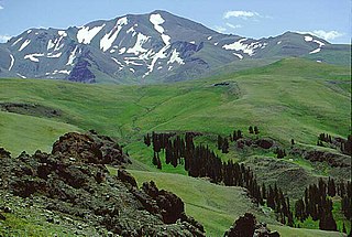
Shoshone National Forest is the first federally protected National Forest in the United States and covers nearly 2,500,000 acres (1,000,000 ha) in the state of Wyoming. Originally a part of the Yellowstone Timberland Reserve, the forest is managed by the United States Forest Service and was created by an act of Congress and signed into law by U.S. President Benjamin Harrison in 1891. Shoshone National Forest is one of the first nationally protected land areas anywhere. Native Americans have lived in the region for at least 10,000 years, and when the region was first explored by European adventurers, forestlands were occupied by several different tribes. Never heavily settled or exploited, the forest has retained most of its wildness. Shoshone National Forest is a part of the Greater Yellowstone Ecosystem, a nearly unbroken expanse of federally protected lands encompassing an estimated 20,000,000 acres (8,100,000 ha).

Francs Peak, elevation 13,158 feet (4,011 m), is the highest point in the Absaroka Range which extends from north-central Wyoming into south-central Montana, in the United States. It is in the Washakie Wilderness of Shoshone National Forest, and the peak is also the highest point in Park County, Wyoming, which includes much of Yellowstone National Park. It was named after Otto Franc, a cattle baron and homesteader in the Big Horn Basin.
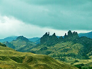
Buffalo Bill State Park is a public recreation area surrounding the reservoir formed by the Buffalo Bill Dam, an impoundment of the Shoshone River, in Park County, Wyoming. The state park, reservoir and dam were named after William "Buffalo Bill" Cody, who founded the nearby town of Cody and who owned much of the land now occupied by the reservoir and park. The park offers camping, hiking, boating, fishing, and picnicking and is managed by Wyoming Division of State Parks and Historic Sites.

Deep Springs is a set of artesian springs in Inyo County, California that were used for irrigation. It lies within the treaty territory of the Western Bands of the Shoshone Nation of Indians. It is located in the northeastern section of Deep Springs Valley, 22 miles (35 km) east of Bishop, 2.6 km (1.6 mi) north of Soldier Pass, and 6.4 km (4 mi) southwest of Chocolate Mountain, at an elevation of 5194 feet.

The Duck Valley Indian Reservation was established in the 19th century for the federally recognized Shoshone-Paiute Tribe. It is isolated in the high desert of the western United States, and lies on the state line, the 42nd parallel, between Idaho and Nevada.
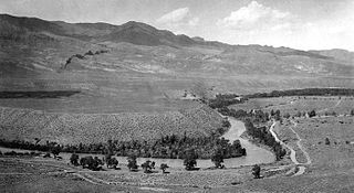
The Shoshone River is a 100-mile (160 km) long river in northern Wyoming in the United States. Its headwaters are in the Absaroka Range in Shoshone National Forest. It ends when it runs into the Big Horn River near Lovell, Wyoming. Cities it runs near or through are Cody, Powell, Byron, and Lovell. Near Cody, it runs through a volcanically active region of fumaroles known as Colter's Hell. This contributed to the river being named on old maps of Wyoming as the Stinking Water River.

Yucca Mountain is a mountain in Nevada, near its border with California, approximately 100 miles (160 km) northwest of Las Vegas. Located in the Great Basin, Yucca Mountain is east of the Amargosa Desert, south of the Nevada Test and Training Range and in the Nevada National Security Site. It is the site of the Yucca Mountain nuclear waste repository, which is currently identified by Congressional law as the nation's spent nuclear waste storage facility. However, while licensure of the site through the Nuclear Regulatory Commission is ongoing, political maneuvering led to the site being de-funded in 2010.
The Shoshone Range is a mountain range in Lander County, Nevada. The northeast end of the range extends into Eureka County at Shoshone Point on the Humboldt River.

Eastern Shoshone are Shoshone who primarily live in Wyoming and in the northeast corner of the Great Basin where Utah, Idaho and Wyoming meet and are in the Great Basin classification of Indigenous People. They lived in the Rocky Mountains during the 1805 Lewis and Clark Expedition and adopted Plains horse culture in contrast to Western Shoshone that maintained a Great Basin culture.

The Te-Moak Tribe of Western Shoshone Indians of Nevada is a federally recognized tribe of Western Shoshone people in northeastern Nevada.
Three Waters Mountain is located in the northern Wind River Range in the U.S. state of Wyoming. Three Waters Mountain straddles the Continental Divide and is in both Bridger-Teton and Shoshone National Forests. The mountain receives its name from being the triple point between the watersheds of the Colorado, Columbia, and Mississippi Rivers.
Washakie Needles is the highest peak in the Washakie Range in the U.S. state of Wyoming. Washakie Needles is in the Washakie Wilderness of Shoshone National Forest. The Washakie Range is one of the southern group of mountains within the Absaroka Range, the other being the Owl Creek Mountains. Washakie Needles is only .8 mi (1.3 km) south of the slightly lower Dome Mountain, the second tallest peak in the Washakie Range. Part of the Absaroka volcanic field, the dacites that comprise the summit needles or pillars on Washakie Needles have been dated at 38.8 million years old, and are the youngest volcanic rocks associated with the Absarokas.
Dome Mountain is the highest peak in the Washakie Range in the U.S. state of Wyoming. Dome Mountain is in the Washakie Wilderness of Shoshone National Forest.


