
The Kariba Dam is a double curvature concrete arch dam in the Kariba Gorge of the Zambezi river basin between Zambia and Zimbabwe. The dam stands 128 metres (420 ft) tall and 579 metres (1,900 ft) long. The dam forms Lake Kariba, which extends for 280 kilometres (170 mi) and holds 185 cubic kilometres (150,000,000 acre⋅ft) of water.

Zambia, officially the Republic of Zambia, is a landlocked country at the crossroads of Central, Southern and East Africa. It is typically referred to being in South-Central Africa or Southern Africa. It is bordered to the north by the Democratic Republic of the Congo, Tanzania to the north-east, Malawi to the east, Mozambique to the southeast, Zimbabwe and Botswana to the south, Namibia to the southwest, and Angola to the west. The capital city of Zambia is Lusaka, located in the south-central part of Zambia. The population is concentrated mainly around Lusaka in the south and the Copperbelt Province to the north, the core economic hubs of the country.
The history of Zambia experienced many stages from colonisation to independence from Britain on 24 October 1964. Northern Rhodesia became a British sphere of influence in the present-day region of Zambia in 1888, and was officially proclaimed a British protectorate in 1924. After many years of suggested mergers, Southern Rhodesia, Northern Rhodesia, and Nyasaland were merged into the British Federation of Rhodesia and Nyasaland.
This article is about the Transport in Zambia.

The Zambezi is the fourth-longest river in Africa, the longest east-flowing river in Africa and the largest flowing into the Indian Ocean from Africa. Its drainage basin covers 1,390,000 km2 (540,000 sq mi), slightly less than half of the Nile's. The 2,574 km (1,599 mi) river rises in Zambia and flows through eastern Angola, along the north-eastern border of Namibia and the northern border of Botswana, then along the border between Zambia and Zimbabwe to Mozambique, where it crosses the country to empty into the Indian Ocean.
Kariba is a resort town in Mashonaland West province, Zimbabwe, located close to the Kariba Dam at the north-eastern end of Lake Kariba, near the Zambian border. According to the 2022 Population Census, the town had a population of 27,600.

Lake Kariba is the world's largest artificial lake and reservoir by volume. It lies 1,300 kilometres (810 mi) upstream from the mouth of the Zambezi river on Indian Ocean, along the border between Zambia and Zimbabwe. Lake Kariba was filled between 1958 and 1963 following the completion of the Kariba Dam at its northeastern end, flooding the Kariba Gorge on the Zambezi River.

Livingstone is a city in Zambia. Until 1935, it served as the capital of Northern Rhodesia. Lying 10 km (6 mi) to the north of the Zambezi River, it is a tourism attraction center for the Victoria Falls and a border town with road and rail connections to Zimbabwe on the other side of the Victoria Falls. A historic British colonial city, its present population was enumerated at 177,393 inhabitants at the 2022 census. It is named after David Livingstone, the Scottish explorer and missionary who was the first European to explore the area. Until 2011, Livingstone was the provincial capital of Zambia's Southern Province.
Kariba is a district and constituency on the shores of Lake Kariba in the Mashonaland West Province of northern Zimbabwe, along the border with Zambia. The constituency comprises 12 rural wards or municipalities in Kariba Rural, also known as Nyaminyami Rural District, and 9 urban wards in Kariba Town, the district capital. The district's total population was just under 60,000 in 2011. Kariba town was built to house the workers who built Kariba Dam, which was completed in 1960 to supply Zimbabwe and Zambia with hydroelectric power, and which gave rise to one of the largest artificial lakes in the world. The creation of the Kariba Lake led to a thriving fishing industry, but following Zimbabwe's economic collapse, Kariba became the least developed district in the country. Kariba is also the most isolated district in Zimbabwe, with no tarred roads as of 2002. The main economic activities are subsistence agriculture, fishing and subsistence hunting. The district, which includes Matusadona National Park, suffers from high levels of wildlife poaching and high levels of human-wildlife conflict.

Southern Province is one of Zambia's ten provinces, and home to Zambia's premier tourist attraction, Mosi-oa-Tunya, shared with Zimbabwe. The centre of the province, the Southern Plateau, has the largest area of commercial farmland of any Zambian province, and produces most of the maize crop.

Binga District is a district of Zimbabwe in southern Africa. It is located in Matabeleland North just south of Kariba Lake, across the lake from Zambia It lies along the southern Zambezi Escarpment.
The Tonga are an ethnic group living in northern Malawi on the shores of Lake Malawi in Nkhata Bay and northern part of Nkhotakota. Their language and Tonga people of Zambia and Zimbabwe belong to different branches of the Bantu family.
Zambezi Escarpment is a name used for the escarpments forming both sides of the rift valley or graben in which lie the middle Zambezi river and Lake Kariba. They are fault scarps, rising 500 to 600 m higher than the lake or river, running from the Batoka Gorge roughly 800 km to the lower Zambezi, and facing each other about 50 to 100 km apart, closer in the west and opening up in the east.

The Nyami Nyami, otherwise known as the Zambezi River God or Zambezi Snake Spirit, is one of the most important gods of the Tonga people living along the Zambezi River. Nyami Nyami is believed to protect the Tonga people and give them sustenance in difficult times. The River God is usually portrayed as male.
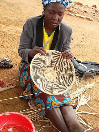
The Tonga people of Zambia and Zimbabwe are a Bantu ethnic group of southern Zambia and neighbouring northern Zimbabwe, and to a lesser extent, in Mozambique. They are related to the Batoka who are part of the Tokaleya people in the same area, but not to the Tonga people of Malawi. In southern Zambia they are patrons of the Kafue Twa. They differ culturally and linguistically from the Tsonga people of South Africa and southern Mozambique.
Kariba Gorge is a large, natural gorge through which flowed the Zambezi River on the border of Zambia and Zimbabwe, Africa. In 1959 the large double arch concrete Kariba Dam was completed, completely filling the gorge and creating the largest man-made lake in the world. Lake Kariba was filled between 1958 and 1963 following the completion of the Kariba Dam at its northeastern end, flooding the Kariba Gorge on the Zambezi River and displacing large numbers of wildlife and the local Tonga people.
Operation Noah was a wildlife rescue operation on the Zambezi River lasting from 1958 to 1964. In the late 1950s, Northern and Southern Rhodesia constructed the Kariba Dam hydroelectric power station across the Zambezi River, at the Kariba Gorge, about 400 km from Victoria Falls. The Kariba Dam mostly provided electric power to both countries, created Lake Kariba, the world's largest man-made lake, and flooded the Kariba Gorge - home to thousands of native animals and the local Tonga people. In a wildlife rescue operation lasting 5 years, over 6000 animals were rescued and relocated to the mainland.
Zambia, officially known as the Republic of Zambia, is a landlocked country in Southern Africa. The neighbouring countries are the Democratic Republic of the Congo to the north, Tanzania to the north-east, Malawi to the east, Mozambique, Zimbabwe, Botswana, and Namibia to the south, and Angola to the west. The capital city is Lusaka, located in the southeast of the country. The population is concentrated mainly around the capital and the Copperbelt to the northwest.

Siavonga District is a district of Zambia, located in Southern Province. The capital lies at Siavonga. As of the 2000 Zambian Census, the district had a population of 58,864 people. It is separated from Zimbabwe by Lake Kariba.

The T2 is a trunk road in Zambia. The road runs from the Tunduma border with Tanzania via Mpika, Kabwe and Lusaka to the Chirundu border with Zimbabwe. The road is the longest route of the country, as it is approximately 1,155 kilometres (718 mi). The route from Mpika to Kafue is a toll road. The route from Tanzania to Lusaka is Zambia's Great North Road and is part of the Tanzam Highway.
