Signal du Petit Mont-Cenis

Last updated
Signal du Petit Mont-Cenis
(in Italian) Punta Clairy
Fort de Variselle and Signal du Petit Mont Cenis.png
Highest point
Elevation 3,162 m (10,374 ft)
Prominence 979 m (3,212 ft) [1]
Listing Alpine mountains above 3000 m
Coordinates 45°14′39″N6°52′22″E / 45.2442786°N 6.8727681°E / 45.2442786; 6.8727681 Coordinates: 45°14′39″N6°52′22″E / 45.2442786°N 6.8727681°E / 45.2442786; 6.8727681
Geography
Alps location map.png
Red triangle with thick white border.svg
Signal du Petit Mont-Cenis
Location in the Alps
Location Savoie (France)
Parent range Cottian Alps

The Signal du Petit Mont-Cenis (in Italian Punta Clairy [2] ) is a 3,162 m high mountain of the Cottian Alps.

Contents

Geography

The mountain in wintertime Punta Clairy 001.JPG
The mountain in wintertime

The mountain is located in the French departement of Savoie (Auvergne-Rhône-Alpes), near the Italian border. It visually dominates the west side of the Mont Cenis lake and belongs to the main chain of the Alps, standing on the water divide between the watersheds of the Dora Riparia (Po Valley) and of the Arc (Rhone Valley). It lies between the pass of Mont Cenis and the Col du Petit Mont-Cenis (2,183 m). [3]

History

The mountain, although lying on the Alpine watershed between the Val di Susa and the Maurienne, is entirely in French territory following the boundary adjustments decided in the 1947 Treaty of Paris. The area was interested by the Vallo Alpino and ligne Maginot fortifications and then saw heavy fights during the II World War, facing in 1945 the chasseurs alpins (French Army) and German mountain troops. [4]

Access to the summit

Summit cairn 09 09 01 Signal du Petit Mont Cenis summit cairn.png
Summit cairn

The summit can be reached on foot starting from the refuge du Petit Mont Cenis with some scrambling, in about 3 hours' walk. [5]

Maps

Related Research Articles

Graian Alps Mountain range in the Western part of the Alps

The Graian Alps are a mountain range in the western part of the Alps.

Rocciamelone

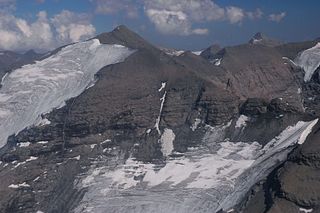
Rocciamelone is a 3,538 m high mountain in Piedmont, Italy, near the border between Italy and France.

Mont Cenis Mountain in France

Mont Cenis is a massif and a pass in Savoie (France), which forms the limit between the Cottian and Graian Alps.

Geography of the Alps

The Alps cover a large area. This article describes the delimitation of the Alps as a whole and of subdivisions of the range, follows the course of the main chain of the Alps and discusses the lakes and glaciers found in the region.

Pointe de Ronce

Pointe de Ronce is a mountain of Savoie, France. It lies in the Mont Cenis range. It has an elevation of 3,612 metres (11,850 ft) above sea level.

Aiguille de Scolette

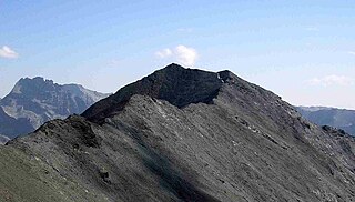
Aiguille de Scolette or Pierre Menue is a mountain of Savoie (F) and of the province of Turin (I). It lies in the Cottian Alps and has an elevation of 3,506 metres above sea level.

Pointe de Paumont

Pointe de Paumont or Cima del Vallone is a mountain of Savoie, France and of the Province of Turin, Italy. It lies in the Cottian Alps range. It has an elevation of 3,171 metres above sea level.

Punta Bagnà

Punta Bagnà or Cime du Grand Vallon is a mountain of Savoie, France and of the Province of Turin, Italy. It lies in the Cottian Alps range. It has an elevation of 3,129 metres above sea level.

Punta Sommeiller

Punta Sommeiller or Pointe Sommeiller is a mountain of the Province of Turin, Italy and of Savoie, France. It lies in the Cottian Alps range. It has an elevation of 3,333 metres (10,935 ft) above sea level.

Rognosa dEtiache

Rognosa d'Etiache or Rognosa d'Étache is a mountain in the Cottian Alps on the border of Turin, Italy, and Savoie, France. It has an elevation of 3,382 metres above sea level.

Ambin group Sub-range of the Cottian Alps on the French-Italian border

The Ambin group is a sub-range of the Cottian Alps located on the French-Italian border.

Mont Giusalet

Mont Giusalet is a mountain in the Ambin group of the Cottian Alps in Savoie, France, near the Italian border.

Mongioia

The Cima Mongioia or simply Mongioia or Bric de Rubren is a 3,340 metres high mountain of the Cottian Alps.

Punta Nera

The Punta Nera is a mountain of Savoie (France) and of the Province of Turin (Italy). It lies in the Cottian Alps range. It has an elevation of 3,047 metres above sea level.

Le Grand Argentier Mountain in France

Le Grand Argentier is a mountain of Savoie (France). It lies in the Cottian Alps range at an elevation of 3,042 metres (9,980 ft) above sea level.

Pointe Rochers Charniers Mountain in France

The Pointe Rochers Charniers is a mountain of the Cottian Alps at an elevation of 3,063 metres above sea level, located in France.

Mount Chenaillet Mountain in France

The Mont Chenaillet is a 2,650 metres high mountain of the Cottian Alps, located on the Main chain of the Alps South of the Col de Montgenèvre.

Grand Aréa Mountain in France

The Grand Aréa is a 2.869 metres high mountain of the Cottian Alps located in the French department of Hautes-Alpes.

Pointe de Bellecombe Mountain in France

The Pointe de Bellecombe is a 2,775 m high mountain of the northern Cottian Alps.

LAiguille Rouge Mountain in France

L'Aguille Rouge is a 2,545 metres high mountain of the Cottian Alps, located on the Main chain of the Alps NW of the Col de l'Échelle.

References

  1. "Signal du Petit Mont Cenis, France". Peakbagger.com. Retrieved 8 October 2019.
  2. Aruga, Roberto; Losana, Pietro; Re, Alberto (1985). Alpi Cozie settentrionali. Guida dei Monti d'Italia (in Italian). 6. CAI - TCI. pp. 371–373.
  3. "Géoportail" (in French). IGN . Retrieved 2019-10-09.
  4. (in French), Jean-Louis Portehaut, La Bataille du Mont-Froid : 5-12 avril 1945, 1983, 96 pages.
  5. "Signal du Petit Mont Cenis (3162m), voie normale de l'arête sud-ouest" (in French). Altituderando. Retrieved 2019-10-09.

Commons-logo.svg Media related to Signal du Petit Mont-Cenis at Wikimedia Commons