The Wank is a mountain in southern Germany, situated in the Loisach valley close to the Austrian border in the southwestern Ester Mountains range near Garmisch-Partenkirchen. It rises from about 700 metres (2,300 ft) above mean sea level up to 1,780 metres (5,840 ft) at the summit. The mountain is crowned by a grassy summit which has views over Garmisch-Partenkirchen and the surrounding region. The summit can be reached via the eponymous Wankbahn, a cable car system that runs during the summer months, or by a network of footpaths that criss-cross the area. A mountain hut on the summit, the Wank-Haus, provides food and accommodation, and a nearby scientific observatory plays a role in monitoring atmospheric and climatic conditions. The Wank is a destination for hikers, day-trippers from Garmisch-Partenkirchen and paragliders.

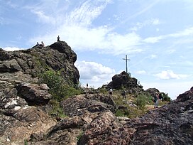
Mam Tor is a 517 m (1,696 ft) hill near Castleton in the High Peak of Derbyshire, England. Its name means "mother hill", so called because frequent landslips on its eastern face have resulted in a multitude of "mini-hills" beneath it. These landslips, which are caused by unstable lower layers of shale, also give the hill its alternative name of Shivering Mountain.

The Zugspitze, at 2,962 m (9,718 ft) above sea level, is the highest peak of the Wetterstein Mountains as well as the highest mountain in Germany. It lies south of the town of Garmisch-Partenkirchen, and the Austria–Germany border runs over its western summit. South of the mountain is the Zugspitzplatt, a high karst plateau with numerous caves. On the flanks of the Zugspitze are three glaciers, including the two largest in Germany: the Northern Schneeferner with an area of 30.7 hectares and the Höllentalferner with an area of 24.7 hectares. The third is the Southern Schneeferner which covers 8.4 hectares.

The Schilthorn is a summit in Europe, in the Bernese Alps of Switzerland. It overlooks the valley of Lauterbrunnen in the Bernese Oberland, and is the highest mountain in the range lying north of the Sefinenfurgge Pass. The Schilthorn lies above the village of Mürren, from where a cable car leads to its summit.

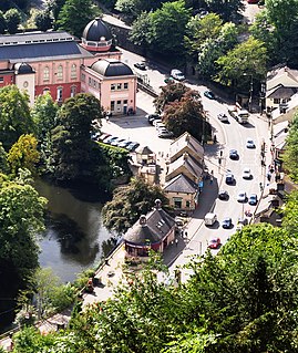
The Heights of Abraham is a tourist attraction in Matlock Bath, Derbyshire, England. It consists of a hilltop park on top of Masson Hill, accessed from the village by either the Heights of Abraham cable car or a steep zig-zag path. The heights are named after a supposed resemblance to the Plains of Abraham, also known as the Heights of Abraham, in Quebec, Canada, where James Wolfe died in battle.

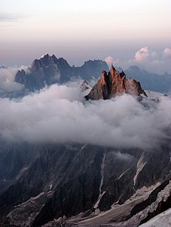
The Aiguille du Midi is a 3,842-metre-tall (12,605 ft) mountain in the Mont Blanc massif within the French Alps. It is a popular tourist destination and can be directly accessed by cable car from Chamonix that takes visitors close to Mont Blanc.

The Never Summer Mountains are a mountain range in the Rocky Mountains in north central Colorado in the United States consisting of seventeen named peaks. The range is located along the northwest border of Rocky Mountain National Park, forming the continental divide between the headwaters of the Colorado River in Rocky Mountain National Park to the local-east and the upper basin of the North Platte River to the local-west; the continental divide makes a loop in these mountains. The range is small and tall, covering only 25 sq mi (65 km2) with a north-south length of 10 mi (16 km) while rising to over 12,000 ft (3,700 m) at over ten distinct peaks. The range straddles the Jackson-Grand county line for most of its length, and stretches into Jackson and Larimer county at its northern end. A panoramic view of the range is available from sections of Trail Ridge Road in Rocky Mountain National Park. One of the northernmost peaks, Nokhu Crags, is prominently visible from the west side of Cameron Pass.

The Uetliberg is a mountain in the Swiss plateau, part of the Albis chain, rising to 870 m (2,850 ft). The mountain offers a panoramic view of the entire city of Zürich and the Lake of Zurich, and lies on the boundary between the city of Zürich and the municipalities of Stallikon and Uitikon. The summit, known as Uto Kulm, is in Stallikon.
The Ester Mountains are a small mountain range in Bavaria. They are classified either as part of Bavarian Prealps or the larger chain of Northern Limestone Alps. The range stretches for about 15 kilometres. From the west it is bordered by the valley of the river Loisach and from the east by Walchensee lake and the valley of the river Isar. With its highest peak being Krottenkopf, the highest part of the range just exceeds 2,000 m. The range is of composed of limestone. The treeline is around 1,700 m.

Eldon Hill is a hill in the Peak District National Park in the county of Derbyshire, England, 4 kilometres (2.5 mi) southwest of the village of Castleton. It is a 470-metre (1,540 ft) limestone hill whose pastureland is used for rough grazing, although a large proportion has been lost to limestone quarrying. It lies within the Castleton Site of Special Scientific Interest. Eldon Hill was formed when a bed of pure limestone was squeezed and upfolded by geological forces to form a dome; it is the highest limestone hill north of the River Wye.

The Gornergrat is a rocky ridge of the Pennine Alps, overlooking the Gorner Glacier south-east of Zermatt in Switzerland. It can be reached from Zermatt by the Gornergrat rack railway (GGB), the highest open-air railway in Europe. Between the Gornergrat railway station and the summit is the Kulm Hotel. In the late 1960s two astronomical observatories were installed in the two towers of the Kulmhotel Gornergrat. The project “Stellarium Gornergrat” is hosted in the Gornergrat South Observatory.

Hohsaas is a cable car station and a ski area in the Pennine Alps above Saas Grund in Valais.

The Kitzbüheler Horn is a mountain in the Kitzbühel Alps in Tyrol, Austria, whose western flank lies near the smart ski resort of Kitzbühel. With a height of 1,996 m (AA) it only just misses being a 'two-thousander'.

The Jenner is a mountain in Bavaria, Germany. It is part of the Göll massif within the Berchtesgaden Alps. Its summit, accessible from Schönau by cable car (Jennerbahn) since 1953, offers panoramic views to the Watzmann range and the Königssee below.

The Kofel is a 1,342 metres (4,403 ft) mountain in the Bavarian Alps of Germany. With its distinctive white head it is the signature mountain of the town of Oberammergau, from which the summit is only about one km away. Due to its prominent location and unique shape it can be identified from a considerable distance both from the direction of Ettal and that of Unterammergau.

Oberfrauenwald is a 947.7 m (3,109 ft) high wooded mountain in the southern Bavarian Forest in Bavaria, Germany. It is positioned between the cities of Waldkirchen and Hauzenberg. The district borders between Passau and Freyung-Grafenau run over the mountain's peaks.

Wendelstein is a 1,838-metre-high (6,030 ft) mountain in the Bavarian Alps in South Germany. It is part of the Mangfall Mountains, the eastern part of the Bavarian Pre-Alps, and is the highest peak in the Wendelstein massif. It lies between the valleys of the Leitzach and Inn and is accessible via the Wendelstein Cable Car and the Wendelstein Rack Railway. On its northern foothills rises the Jenbach, which becomes the Kalten on its way to the River Mangfall. Local valley settlements include Bayrischzell, Brannenburg and Osterhofen.

Rigi Kaltbad is a resort in the Swiss Alps, located in the canton of Lucerne. The resort sits on a sunny terrace at an elevation of 1,433 metres (4,701 ft), overlooking Lake Lucerne above Weggis in Central Switzerland. The locality is part of the municipality of Weggis.

Begunjščica is a ridge mountain in the Karawanks. It rises from the western Smokuč mountain pasture to St. Anne on its eastern side. The mountain has three main peaks, the highest being Big Peak. The western Middle Peak lies a little lower, and the lowest is Begunje Mount Vrtača. Its southern slopes rise over the Draga Valley. The ascent of the mountain is relatively easy and possible throughout the year. In the winter and early spring conditions are favourable for ski touring.

The Scheidegg is a mountain summit of the Rigi massif, overlooking Goldau in the canton of Schwyz on its north mountainside, and Gersau and the Gersauerbecken on its south side. The cable car station 160 metres east of it is called Rigi Scheidegg.


