
Newton is a city in Middlesex County, Massachusetts, United States. It is roughly 8 miles (13 km) west of downtown Boston, and comprises a patchwork of thirteen villages. The city borders Boston to the northeast and southeast, Brookline to the east, Watertown and Waltham to the north, and Weston, Wellesley, and Needham to the west. At the 2020 U.S. census, the population of Newton was 88,923.
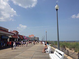
Rehoboth Beach is a city on the Atlantic Ocean along the Delaware Beaches in eastern Sussex County, Delaware, United States. As of 2020, its population was 1,108. Along with the neighboring coastal town of Lewes, Rehoboth Beach is one of the principal cities of Delaware's rapidly growing Cape Region. Rehoboth Beach lies within the Salisbury metropolitan area.
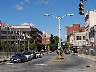
Fall River is a city in Bristol County, Massachusetts, United States. Fall River's population was 94,000 at the 2020 United States census, making it the tenth-largest city in the state. It abuts the Rhode Island state line with Tiverton, RI to its south.
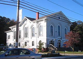
Holliston is a New England town in Middlesex County, Massachusetts, United States in the Greater Boston area. The population was 14,996 at the 2020 census. It is located in MetroWest, a Massachusetts region that is west of Boston. Holliston is the only town in Middlesex County that borders both Norfolk and Worcester counties.

Chelsea is a city in Suffolk County, Massachusetts, United States, directly across the Mystic River from Boston. The 2020 census reported Chelsea as having a population of 40,787, thereby making it the second most densely populated city in Massachusetts, behind Somerville. With a total area of 2.46 square miles (6.4 km2), Chelsea is the smallest city in Massachusetts in terms of total area. It is the city with the second-highest percentage of Latino residents in Massachusetts, behind Lawrence.

Burlington is a town in Middlesex County, Massachusetts, United States. The population was 26,377 at the 2020 census.

Framingham is a city in the Commonwealth of Massachusetts, United States. Incorporated in 1700, it is located in Middlesex County and the MetroWest subregion of the Greater Boston metropolitan area. The city proper covers 25 square miles (65 km2) with a population of 72,362 in 2020, making it the 14th most populous municipality in Massachusetts. Residents voted in favor of adopting a charter to transition from a representative town meeting system to a mayor–council government in April 2017, and the municipality transitioned to city status on January 1, 2018. Before it transitioned, it had been the largest town by population in Massachusetts.

Wilmington is a town in Middlesex County, Massachusetts, United States. Its population was 23,349 at the 2020 United States census.

In the United States, trolley parks, which started in the 19th century, were picnic and recreation areas along or at the ends of streetcar lines in most of the larger cities. These were precursors to amusement parks. Trolley parks were often created by the streetcar companies to give people a reason to use their services on weekends.

The National Catholic Forensic League (NCFL) is a speech and debate league that was formed in 1951. It is organized into regions that correspond to Roman Catholic dioceses. Member schools include both public and parochial high schools. The NCFL recruits member schools in both the United States and Canada. As of January, 2011, there were 65 active dioceses with NCFL leagues. The IRS recognizes the NCFL as an organization eligible to receive tax-deductible charitable donations.

Dorchester is a neighborhood comprising more than 6 square miles (16 km2) in the City of Boston, Massachusetts, United States. Originally, Dorchester was a separate town, founded by Puritans who emigrated in 1630 from Dorchester, Dorset, England, to the Massachusetts Bay Colony. This dissolved municipality, Boston's largest neighborhood by far, is often divided by city planners in order to create two planning areas roughly equivalent in size and population to other Boston neighborhoods.
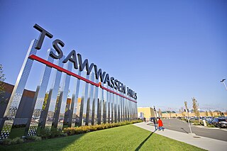
Tsawwassen is a suburban, mostly residential community on a peninsula in the southwestern corner of the City of Delta in British Columbia, Canada. It provides the only road access to the American territory on the southern tip of the peninsula, the community of Point Roberts, Washington, via 56th Street. It is also the location of Tsawwassen Ferry Terminal, part of the BC Ferries, built in 1959 to provide foot-passenger and motor vehicle access from the Lower Mainland to the southern part of Vancouver Island and the southern Gulf Islands. Because Tsawwassen touches a shallow bank, the ferry terminal is built at the southwestern end of a 3 km (1.9 mi) causeway that juts into the Strait of Georgia. Boundary Bay Airport, a major training hub for local and international pilots which also provides local airplane and helicopter service, is ten minutes away. The Roberts Bank Superport is also nearby.

Forest Park in Springfield, Massachusetts, is one of the largest urban, municipal parks in the United States, covering 735 acres (297 ha) of land overlooking the Connecticut River. Forest Park features a zoo, aquatic gardens, and outdoor amphitheater, in addition to design elements like winding wooded trails, and surprising, expansive views. The site of America's first public, municipal swimming pool, currently, during the holiday months Forest Park hosts a popular high-tech lighting display, known as Bright Nights. Contrary to popular belief, the park was not designed by Frederick Law Olmsted, although it was designed by his firm.
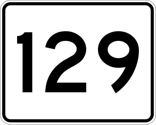
Route 129 is a 34.08-mile-long (54.85 km) east–west Massachusetts state route that runs from Route 4 and Route 110 in Chelmsford to Route 114 in Marblehead. Along the way it intersects several major highways including U.S. Route 3 in Chelmsford, Interstate 93 (I-93) in Wilmington, I-95 and Route 128 in Wakefield, and US 1 in Saugus and Lynnfield.
Municipal annexation is a process by which a municipality acquires new territory, most commonly by expanding its boundaries into an adjacent unincorporated area. This has been a common response of cities to urbanization in neighboring areas. It may be done because the neighboring urban areas seek municipal services or because a city seeks control over its suburbs or neighboring unincorporated areas.
Cape Fear is a coastal plain and Tidewater region of North Carolina centered about the city of Wilmington. The region takes its name from the adjacent Cape Fear headland, as does the Cape Fear River which flows through the region and empties into the Atlantic Ocean near the cape. Much of the region's populated areas are found along the Atlantic beaches and the Atlantic Intracoastal Waterway, while the rural areas are dominated by farms and swampland like that of the Green Swamp. The general area can be also identified by the titles "Lower Cape Fear", "Wilmington, NC Metropolitan Statistical Area", "Southeastern North Carolina", and "Azalea Coast". The latter name is derived from the North Carolina Azalea Festival held annually in Wilmington. Municipalities in the area belong to the Cape Fear Council of Governments.
The Chelsea High School is located in Chelsea, Massachusetts, United States and is the only public high school in Chelsea. It is a part of Chelsea Public Schools. Established in 1845, Chelsea High moved into its current school building in 1996. Chelsea High School is located at 299 Everett Avenue, Chelsea, Massachusetts 02150.

Magnolia is a small village in Gloucester, located in Essex County, Massachusetts, United States, on the Manchester-by-the-Sea town line in the southwestern part of the city. Straddling the town line between the two communities is Surf Park, a two-acre swath of land that has scenic views of Kettle Cove.
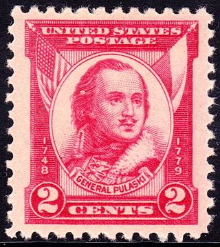
Casimir Pulaski was a Polish nobleman, soldier and military commander who has been called "the father of the American cavalry". He has had hundreds of monuments, memorial plaques, streets, parks and similar objects named after him.

Silver Lake is an unincorporated village in Middlesex County, Massachusetts, in the towns of Wilmington and Tewksbury. It is centered around its namesake lake in Wilmington, Silver Lake.


