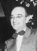
Sir Ambrose Shea was a political and business figure in colonial Newfoundland who later served as Governor of the Bahamas. He was one of two Newfoundland delegates to the Quebec Conference that led to Canadian confederation.

Joseph Roberts Smallwood was a Newfoundlander and Canadian politician. He was the main force who brought the Dominion of Newfoundland into Canadian Confederation in 1949, becoming the first premier of Newfoundland, serving until 1972. As premier, he vigorously promoted economic development, championed the welfare state, and emphasized modernization of education and transportation. The results of his efforts to promote industrialization were mixed, with the most favourable results in hydroelectricity, iron mining and paper mills.
Whitbourne is a town on the Avalon Peninsula in Newfoundland and Labrador, Canada in Division 1.

Marine Atlantic Inc. is an independent Canadian federal Crown corporation which is mandated to operate ferry services between the provinces of Newfoundland and Labrador and Nova Scotia.

Channel-Port aux Basques is a town at the extreme southwestern tip of Newfoundland fronting on the western end of the Cabot Strait. A Marine Atlantic ferry terminal is located in the town which is the primary entry point onto the island of Newfoundland and the western terminus of the Newfoundland and Labrador Route 1 in the province. The town was incorporated in 1945 and its population in the 2021 census was 3,547.

The Newfoundland Railway was a narrow-gauge railway that operated on the island of Newfoundland from 1898 to 1988. With a total track length of 906 miles (1,458 km), it was the longest 3 ft 6 in narrow-gauge system in North America.

Bellevue is a former provincial electoral district for the House of Assembly of Newfoundland and Labrador, Canada. As of 2003 it had 7310 eligible voters. The district was abolished in 2015 and replaced by Placentia West-Bellevue.

Placentia—St. Mary's is a provincial electoral district for the House of Assembly of Newfoundland and Labrador, Canada. As of 2011, there were 7,361 eligible voters living within the district.

MV Joseph and Clara Smallwood was a Marine Atlantic passenger/vehicle ferry which operated between Newfoundland and Cape Breton Island in eastern Canada. She is named after former Newfoundland premier Joseph R. Smallwood and his wife Clara.
The Burin Peninsula is a peninsula located on the south coast of the island of Newfoundland in the province of Newfoundland and Labrador. Marystown is the largest population centre on the peninsula.

Gaultois is a small settlement in the Coast of Bays area in Newfoundland and Labrador, Canada. Gaultois had a population of 100 people in the 2021 census. The town has a K-12 school called Victoria Academy, as well as a fire department, public library, Lion's Club, and town hall. The town is only accessible by ferry or helicopter. The provincial government ferry runs from the nearby town of Hermitage several times daily and the crossing takes approximately 20 minutes. This ferry also services the more remote community of McCallum once to twice daily with a crossing time of around one hour and fifteen minutes. In 2015, Gaultois voted against resettlement. Gaultois considered resettlement again in 2023 but it failed.

Argentia is a Canadian commercial seaport and industrial park located in the Town of Placentia, Newfoundland and Labrador. It is situated on the southwest coast of the Avalon Peninsula and defined by a triangular shaped headland which reaches northward out into Placentia Bay creating a natural harbour 3 km (1.9 mi) in length.
St. Mary's Bay is one of many bays in Newfoundland, Canada, where bay is taken as a regional subdivision, somewhat along the lines of county divisions. It is the most southern and eastern of Newfoundland's major bays.

The 1859 Newfoundland general election was held in 1859 to elect members of the 7th General Assembly of Newfoundland in Newfoundland Colony. 18 Liberals and 12 Conservatives were elected. The Liberal Party led by John Kent formed the government.
The 1855 Newfoundland general election was held in 1855 to elect members of the 6th General Assembly of Newfoundland. This was the first election after responsible government was introduced to Newfoundland Colony. The Liberal Party led by Philip Francis Little formed the government.
The 1882 Newfoundland general election was held in 1882 to elect members of the 14th General Assembly of Newfoundland in the Newfoundland Colony. The Conservative Party led by William Vallance Whiteway formed the government.
The 1878 Newfoundland general election was held in 1878 to elect members of the 13th General Assembly of Newfoundland in Newfoundland Colony. The Conservative Party led by William Vallance Whiteway formed the government.

The 1873 Newfoundland general election was held in November 1873 to elect members of the 11th General Assembly of Newfoundland in the Colony of Newfoundland. The Anti-Confederates led by Charles Fox Bennett formed the government; a "new" Conservative party led by Frederick Carter formed the opposition.
The 1885 Newfoundland general election was held on 31 October 1885 to elect members of the 15th General Assembly of Newfoundland in the Newfoundland Colony. The Reform Party had been created by Robert Thorburn on a platform of "Protestant Rights" after supporters of the Orange Order abandoned the Whiteway government after sectarian riots in 1885 against the government's 'denominational compromise'. Whiteway's Conservative Party was destroyed as a result and Whiteway founded a new Liberal Party. Thorburn's new party swept to power but soon turned away from its sectarian agenda by inviting Catholic Liberals into the Cabinet.

Route 100 is a major highway in Newfoundland and Labrador. The highway begins at its northern terminus at the Trans-Canada Highway in the town of Whitbourne, runs for 108 kilometres (67 mi) until it ends at its southern terminus, the town of Branch, where it transitions into Route 92. Motorists can drive along the coast of Placentia Bay once traveling south of Point Verde.


