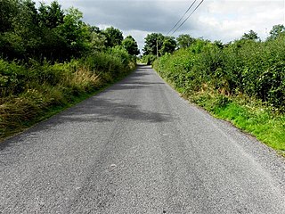
Shercock is a small town situated in the east of County Cavan, Ireland. As of the 2016 census, the population of the town was 588.

The N12 road is one of the shortest national primary roads in the Republic of Ireland, running 6.87 km (4.27 mi) from outside Monaghan to the border with County Armagh, Northern Ireland, at Ardgonnell Bridge. The N12 is part of an overall route running from Cavan Town to Belfast.

Emyvale, known before the Plantation of Ulster as Scarnageeragh, is a village and townland in the north of County Monaghan, Ireland. It is on the main Dublin to Derry and Letterkenny road, the (N2), about 10 km (6 miles) north of Monaghan and 8 km (5 miles) south of Aughnacloy. Its population is about 700.

Scotshouse (Achadh is the Scottish Gealic for field and the Ulster dialect of Gaelic is close to the Scottish. NahAlban is Gaelic for Scottish. The more logical name for Scotshouse in Gaelic would be Achadh nahAlban, field of the Scots. is a small agricultural village about 7 kilometres away from the border town of Clones, in County Monaghan, Ireland. It is close to the border with both County Cavan and County Fermanagh. Cavan town is 18 km away and Monaghan town is 27 km away from Scotshouse.
Séamus Turlough McElwaine was active in the South Fermanagh Brigade of the Provisional Irish Republican Army (IRA) during "The Troubles" who was shot dead by the British Army.

Cullaville or Culloville is a small village and townland near Crossmaglen in County Armagh, Northern Ireland. It is the southernmost settlement in the county and one of the southernmost in Northern Ireland, straddling the Irish border. In the 2001 Census it had a population of 400 people. The village is on a busy crossroads on the main Dundalk to Castleblaney road ; three of the roads lead across the border and the fourth leads to Crossmaglen.

Sheskin, traditionally divided into Sheskinmor and Sheskinbeg, is a townland in the north of County Monaghan in Ireland. It is in the foothills of Sliabh Beagh. Sheskin is part of the civil parish of Tydavnet, situated about 3 miles from the village of Scotstown and about 8 miles from Monaghan town. Sheskin is straddled in the east by the River Blackwater and in the south by one of its tributaries, which converge at the south eastern corner of the townland.
Corblonog is a townland in the north of County Monaghan in Ireland, to the east of the townland of Sheskin in the parish of Tydavnet.
Killycarnan is a townland in the north of County Monaghan in Ireland, to the south east of the townland of Sheskin in the parish of Tydavnet.
Mullaghmore may refer to the following places in Ireland:

Tirnaneill is a townland situated in north County Monaghan in Ireland, about halfway between Emyvale and Monaghan Town at a crossroads on the N2 road known as Tirnaneill Cross.

The Black Pig's Dyke or Worm's Ditch is a series of discontinuous linear earthworks in southwest Ulster and northeast Connacht, Ireland. Remnants can be found in north County Leitrim, north County Longford, County Cavan, County Monaghan and County Fermanagh. Sometimes, the Dorsey enclosure in County Armagh and the Dane's Cast in County Down are considered to be part of the dyke.

Glaslough is a village and townland in the north of County Monaghan, Ireland, on the R185 regional road 3 km (2 mi) south of the border with Northern Ireland and 10 km (6 mi) northeast of Monaghan town. Glaslough won the Irish Tidy Towns Competition in 1978. Castle Leslie, the large Victorian country house and luxury hotel, is located on the edge of the village.

Drumcalpin is the name of three townlands in County Cavan, Ireland, with one situated in the civil parishes of Annagh, Castleterra, and Larah.

Gowlagh South is a townland in the civil parish of Templeport, County Cavan, Ireland. It lies in the Roman Catholic parish of Templeport and barony of Tullyhaw.
Derrynacreeve is a townland in the civil parish of Templeport, County Cavan, Ireland. It lies in the Roman Catholic parish of Corlough and barony of Tullyhaw.

Tonlegee is a townland in the civil parish of Templeport, County Cavan, Ireland. It lies in the Roman Catholic parish of Corlough and barony of Tullyhaw.
Muineal is a townland in the civil parish of Templeport, County Cavan, Ireland. It lies in the Roman Catholic parish of Corlough and barony of Tullyhaw.


