Knockatallon or Knockatallan (Irish: Cnoc an tSalainn, meaning 'hill of salt') is a hamlet and townland in the north of County Monaghan in Ireland, being located in the parish of Tydavnet. The Roman Catholic parish church is located in the village of Tydavnet itself. Knockatallan is located to the west of Sheskin. The Knockatallan name is also used by locals to refer to a larger area including several other townlands such as Knockacullion and Corlat.
Not quite a village, Knockatallon's diminishing business/social community is centred on what is known as the Cross Roads. This includes Knockatallon's national school, St. Joseph's National School, a small grocery store and until recently a post office (closed in August, 2007).
In recent times Knockatallon has been largely eclipsed by a neighbouring townland of Corlat as a community centre. St Joseph's Catholic church is located in the townland of Corlat.
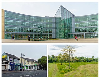
Blanchardstown is a large outer suburb of Dublin in the modern county of Fingal, Ireland. Located ten kilometres (6 mi) northwest of Dublin city centre, it has developed since the 1960s from a small village to a point where Greater Blanchardstown is the largest urban area in Fingal.
Castleknock is an affluent suburb located 8 km (5 mi) west of the centre of Dublin city, Ireland. It is centered on the village of the same name in Fingal.
Kilglass or Kilglas is a rural townland in County Sligo, Ireland, in the hinterland of Enniscrone.
Carrickmore is a small town in County Tyrone, Northern Ireland. It is situated in the historic barony of Omagh East, the civil parish of Termonmaguirk and the Roman Catholic Parish of Termonmaguirc between Cookstown, Dungannon and Omagh. It had a population of 612 in the 2001 Census. In the 2011 Census 2,330 people lived in the Termon Ward, which covers the Carrickmore and Creggan areas.
Ballymoyer or Ballymyre is a civil parish in the historic barony of Fews Upper, County Armagh, Northern Ireland, 3 miles north-east of Newtownhamilton.
Tydavnet, officially Tedavnet , is a village in northern County Monaghan, Ireland, and also the name of the townland and civil parish in which the village sits. Both the Church of Ireland and Catholic church have Tydavnet named as a parish and in both cases, the geographical area is almost identical. The village is located on the R186 regional road.
Derrynoose is a village and civil parish in south County Armagh, Northern Ireland, 4.5 km south-west of Keady.
Kilcloon or Kilclone is a parish situated in the south-east of County Meath in Ireland. Kilcloon parish is largely rural and contains the village of Kilcloon itself and the neighbouring villages of Batterstown and Mulhussey. The parish church is located at Ballynare Cross Roads in the village of Kilcloon with chapels in Kilcock and Batterstown.
Sheskin, traditionally divided into Sheskinmor and Sheskinbeg, is a townland in the north of County Monaghan in Ireland. It is in the foothills of Sliabh Beagh. Sheskin is part of the civil parish of Tydavnet, situated about 3 miles from the village of Scotstown and about 8 miles from Monaghan town. Sheskin is straddled in the east by the River Blackwater and in the south by one of its tributaries, which converge at the south eastern corner of the townland.
Killoe is a rural community and parish in County Longford, Ireland, located approximately 6 miles north of Longford Town. It is home to Cairn Hill or Carn Clonhugh - the highest peak in County Longford.
Corlat or Corlatt is a townland in the north of County Monaghan in Ireland, being located in the parish of Tydavnet. The Church of Ireland parish church is located in the village of Tydavnet itself. Corlat is often referred to as part of Knockatallon, which is an adjacent townland. Corlat is situated entirely on foothills of the Sliabh Beagh mountains.
Ballinderreen is a village located on the N67 route between Kilcolgan and Kinvara in south County Galway, in Ireland.
Raheen is a townland and village in County Wexford, Ireland. It lies 27 km from Wexford, 11 km from New Ross, and 23 km from Enniscorthy.
Kilmurry McMahon, also called Kilmurry-Clonderalaw, is a civil parish in County Clare in Ireland. It is also a Catholic parish in the Diocese of Killaloe.
Milltown is a small village in County Cavan, Ireland. The population as at 2021 was around 100. During a nineteenth century O'Donavan townlands survey of Co. Cavan it was noted that the Milltown area was traditionally referred to as Bellanaleck, there are no other records with this name. The Archaeological Inventory of County Cavan notes (507) Derrygeeraghan, a raised circular Rath area with two substantial earthen banks and a wide deep fosse dating from earlier medieval times. The present Milltown Electoral Division and catchment area comprises several neighboring townlands within an ancient Barony of Loughtee Lower, Co. Cavan and Drumlane Civil Parish in County Cavan.
Huntstown and Littlepace is a set of modern housing developments that forms a remote suburb of Dublin city in the county of Fingal in Ireland. It was built in the townlands of Littlepace (westerly) and Huntstown (easterly) which are the southernmost townlands of the civil parish of Mulhuddart. The district is also a parish in the Blanchardstown deanery of the Roman Catholic Archdiocese of Dublin. The nearest villages in the county are Ongar, Mulhuddart and Clonsilla along with Clonee in County Meath.
Scotstown GAA is a Gaelic football and ladies' football club in Scotstown, County Monaghan, Ireland which represents the parish of Tydavnet.
St Thomas, the Apostle parish is an ecclesiastical parish in the Blanchardstown deanery of the Roman Catholic Archdiocese of Dublin. It is served by the church of "St Thomas, the Apostle". The parish is centered on "Laurel Lodge" district and the townland of Carpenterstown in the civil parish of Castleknock, Fingal in Ireland. On 6 June 2018, the Archbishop of Dublin, Diarmuid Martin, concelebrated mass in the parish church on the occasion of the 25th anniversary of the laying of the building's foundation stone.
Midfield is a village, in the barony of Gallen, in County Mayo, in Ireland. It is located close to the towns of Kilkelly, Kiltimagh, and Swinford, and to Ireland West (Knock) Airport.
Clonsilla or "Clonsillagh" is a civil parish and a townland located in the south-western corner of the modern county of Fingal, Ireland. The civil parish is part of the ancient barony of Castleknock. It is centred on the suburban village of Clonsilla. In geology, the parish rests on a substratum of limestone and comprises 2943 statute acres, the whole of which is arable land. It is roughly bounded to the north by the old "Navan Road" – the modern N3; to the east by the civil parish of Castleknock; to the south by the River Liffey; to the south-east by the civil parish of Leixlip, chiefly in County Kildare, and to the north-west by the civil parish of Dunboyne in County Meath.
This page is based on this Wikipedia article Text is available under the CC BY-SA 4.0 license; additional terms may apply. Images, videos and audio are available under their respective licenses.