Lillooet is a district municipality in the Squamish-Lillooet region of southwestern British Columbia. The town is on the west shore of the Fraser River immediately north of the Seton River mouth. On BC Highway 99, the locality is by road about 100 kilometres (62 mi) northeast of Pemberton, 64 kilometres (40 mi) northwest of Lytton, and 172 kilometres (107 mi) west of Kamloops.

The Stʼatʼimc, also known as the Lillooet, St̓át̓imc, Stl'atl'imx, etc., are an Interior Salish people located in the southern Coast Mountains and Fraser Canyon region of the Interior of the Canadian province of British Columbia.
The Chehalis River is located in the southwest corner of British Columbia, Canada near the city of Chilliwack. It flows south-eastward out of the Douglas Ranges of the Coast Mountains, draining into the Harrison River.

Harrison Hot Springs is a village located at the southern end of Harrison Lake in the Fraser Valley of British Columbia. It is a member of the Fraser Valley Regional District; its immediate neighbour is the District of Kent, which includes the town of Agassiz. It is a resort community known for its hot springs and has a population of just over 1500 people. It is named after Benjamin Harrison, a former deputy governor for the Hudson's Bay Company.
The Skatin First Nations, aka the Skatin Nations, are a band government of the In-SHUCK-ch Nation, a small group of the larger St'at'imc people who are also referred to as Lower Stl'atl'imx. The Town of Skatin - the St'at'imcets version of the Chinook Jargon Skookumchuck- is located 4 km south of T'sek Hot Spring- alt. spelling T'sek Hot Spring - commonly & formerly named both St. Agnes' Well & Skookumchuck Hot Springs The community is 28 km south of the outlet of Lillooet Lake on the east side of the Lillooet River. It is approximately 75 km south of the town of Pemberton and the large reserve of the Lil'wat branch of the St'at'imc at Mount Currie. Other bands nearby are Samahquam at Baptiste Smith IR on the west side of the Lillooet River at 30 km. and Xa'xtsa First Nations; the latter is located at Port Douglas, near the mouth of the Lillooet River where it enters the head of Harrison Lake. The N'Quatqua First Nation on Anderson Lake, between Mount Currie and Lillooet, was at one time involved in joint treaty negotiations with the In-SHUCK-ch but its members have voted to withdraw, though a tribal council including the In-SHUCK-ch bands and N'Quatqua remains, the Lower Stl'atl'imx Tribal Council.

The Lillooet River is a major river of the southern Coast Mountains of British Columbia. It begins at Silt Lake, on the southern edge of the Lillooet Crown Icecap about 80 kilometres northwest of Pemberton and about 85 kilometres northwest of Whistler. Its upper valley is about 95 kilometres in length, entering Lillooet Lake about 15 km downstream from Pemberton on the eastern outskirts of the Mount Currie reserve of the Lil'wat branch of the St'at'imc people. From Pemberton Meadows, about 40 km upstream from Pemberton, to Lillooet Lake, the flat bottomlands of the river form the Pemberton Valley farming region.

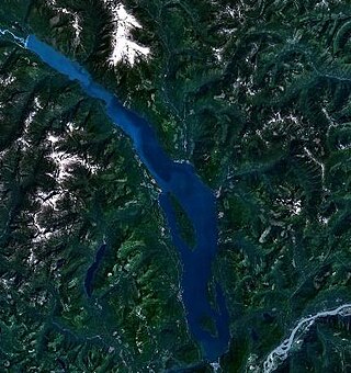
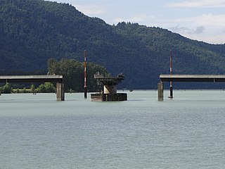
Harrison Lake is the largest lake in the southern Coast Mountains of Canada, being about 250 square kilometres (95 mi²) in area. It is about 60 km (37 mi) in length and at its widest almost 9 km (5.6 mi) across. Its southern end, at the resort community of Harrison Hot Springs, is c. 95 km east of downtown Vancouver. East of the lake are the Lillooet Ranges while to the west are the Douglas Ranges. The lake is the last of a series of large north-south glacial valleys tributary to the Fraser along its north bank east of Vancouver, British Columbia. The others to the west are the Chehalis, Stave, Alouette, Pitt, and Coquitlam Rivers. Harrison Lake is a natural lake, not man-made. The lake is supplied primarily from the Lillooet River, which flows into the lake at the northernmost point.

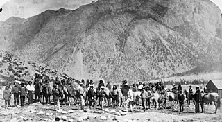
The Douglas Road, a.k.a. the Lillooet Trail, Harrison Trail or Lakes Route, was a goldrush-era transportation route from the British Columbia Coast to the Interior. Over 30,000 men are reckoned to have travelled the route in, although by the end of the 1860s it was virtually abandoned due to the construction of the Cariboo Wagon Road, which bypassed the region.

Port Douglas, sometimes referred to simply as Douglas, is a remote community in British Columbia, Canada at east of the mouth of the Lillooet River, and at the head of Harrison Lake, which is the head of river navigation from the Strait of Georgia. Port Douglas was the second major settlement of any size on the British Columbia mainland during the Fraser Canyon Gold Rush. It came into being in 1858 when Governor Douglas ordered that it be laid out.

The Harrison River is a short but large tributary of the Fraser River, entering it near the community of Chehalis, British Columbia, Canada. The Harrison drains Harrison Lake and is the de facto continuation of the Lillooet River, which feeds the lake.
The Birkenhead River, formerly known as the Portage River, the Pole River and the Mosquito River, is a major tributary of the Lillooet River, which via Harrison Lake and the Harrison River is one of the major tributaries of the lower Fraser River. It is just over 50 km long from its upper reaches in the unnamed ranges south of Bralorne, British Columbia ; their western area towards the named Bendor Range east of Bralorne is sometimes called the Cadwallader Ranges.
The Lillooet Tribal Council is the official English name of the largest tribal council of what is also known as the St'at'imc Nation, though not including all governments of St'at'imc peoples - the term St'at'imc Nation has another context of all St'at'imc peoples, not just those within this tribal council or the tribal council itself, as the term can be used for. The Lillooet Tribal Council a.k.a. the St'at'imc Nation is the largest tribal council of the St'at'imc people, though a pan-St'at'imc organization, the St'át'timc Chiefs Council includes all St'at'imc bands.
The In-SHUCK-ch Nation, also known as Lower Lillooet people, are a small First Nations Tribal Council on the lower Lillooet River south of Pemberton-Mount Currie in the Canadian province of British Columbia. The communities of the In-SHUCK-ch are of the St'at'imcets-speaking St'at'imc people, but in recent years seceded from the Lillooet Tribal Council to form their own organization. The name In-SHUCK-ch is taken from In-SHUCK-ch Mountain, a distinctive mountain near the south end of Lillooet Lake.

The Lakes Route is an alternate name for the Douglas Road, which was the first formally designated "road" into the Interior of British Columbia, Canada from its Lower Mainland area flanking the Lower Fraser River. Also known as the Douglas-Lillooet Trail or the Lillooet Trail, the route consisted of a series of wagon roads connected via lake travel in between. A variety of craft were used on the lakes, from steamboats to sail-driven rafts to, through the early 20th Century, diesel and other engines. Lake travel continued for commerce, passenger travel and heavy freight until after World War II.

The Church of the Holy Cross is a National Historic Site of Canada, located on one of the Indian reserves of the Skatin First Nation, in southwestern British Columbia. It is located on the east side of the Lillooet River on BC's first inland Gold Rush trail, the Douglas Road. Skatin Nations is the St'at'imcets language rendition of the reserve-town's usual name in English, Skookumchuck Hot Springs.
Skatin is a community of under 100 persons in Skatin First Nations, aka the Skatin Nations, a Band government of the larger Band of the In-SHUCK-ch Nation, part of the St'at'imc people who are also referred to as Lower Stl'atl'imx. Skatin, the official new name, reverts to the traditional pre-colonial/pre-Columbian name. The alternate past name still commonly used by outsiders, Skookumchuck, is the St'at'imcets version of the Chinook Jargon Skookumchuck, meaning Strong Waters, i.e. rapids. The town site is 4 km south of T'sek Hot Spring, formerly named both Saint Agnes Well and Skookumchuck Hot Springs. The community is 28 km south of the outlet of Lillooet Lake on the east side of the Lillooet River. It is approximately 75 km south of the town of Pemberton and the large reserve of the Lil'wat branch of the St'at'imc at Mount Currie, British Columbia. See Skatin First Nations for details about the complicated Band(s) structure.
The Douglas First Nation, aka the Douglas Indian Band, Douglas Band, or Xa'xtsa First Nation, are a band government of the In-SHUCK-ch Nation, a subgroup of the larger St'at'imc people, also referred to as Lower Stl'atl'imx. The Douglas, Skatin and Samahquam communities are related through familial ties as well as culturally and linguistically. The In-SHUCK-ch are the southernmost of the four divisions making up the Lillooet ethnographic group. The Douglas First Nation's main community is at Xa'xtsa, a village on their main reserve at the head of Harrison Lake, near the former gold rush port-town of Port Douglas.
The New Westminster Land District is one of 59 land districts of British Columbia, Canada, which are the underlying cadastral divisions of that province, created with rest of those on Mainland British Columbia via the Lands Act of the Colony of British Columbia in 1860. The British Columbia government's BC Names system, a subdivision of GeoBC, defines a land district as "a territorial division with legally defined boundaries for administrative purposes". All land titles and surveys use the Land District system as the primary point of reference, and entries in BC Names for placenames and geographical objects are so listed.
Little Lillooet Lake, historically also Tenas Lake is a lake in the Lower Lillooet Country located to the south of Pemberton, British Columbia, Canada, turning off highway 99 on the FSR to 33 km. along the course of the Lillooet River, which continues southwards beyond it to Harrison Lake. Still formally a separate lake, historically construction of a small dam to enable steamer service to Port Pemberton, which lay at the head of Lillooet Lake, its northern neighbour and parent waterflow, during the construction of the Lakes Route during the Fraser Canyon Gold Rush. "Tenas" or "tenass" in Chinook Jargon means "small" or "child" and was an alternate name for this lake, at the south end of which was Port Lillooet, which connected by the Douglas Road to Port Douglas which was at the head of river navigation from the Strait of Georgia and served as a port for the Interior of British Columbia. The Indian reserve community of Samahquam is located near its southern end at 33 km and further south is the Indian Reserve Skatin at 47 km near the Tsek hotsprings at 44 km.

The Stlʼatlʼimx Tribal Police Service (STPS) is the police force for St'at'imc aboriginal peoples of British Columbia. The STPS is the only aboriginal police service in British Columbia. Their officers are appointed as designated provincial constables, and have full police powers on and off-duty throughout the province. They are based in Lillooet and Mount Currie.


