
Putnam County is a county in the U.S. state of New York. As of the 2020 census, the population was 97,668. The county seat is Carmel, within one of the county's six towns. The county is part of the Hudson Valley region.

Carmel is a town in Putnam County, New York, United States. As of the 2020 United States census, the town had a population of 33,576.

Mahopac is a hamlet in the town of Carmel in Putnam County, New York, United States. Also known as Lake Mahopac, the exurb is located some 47 miles (76 km) north of New York City, on US Route 6 at the county's southern central border with Westchester County. As of the 2020 census, the population was 8,933.

Patterson is a town in Putnam County, New York, United States. The town is in the northeastern part of the county. Interstate 84 passes through the southwestern section of the town. The population was 11,541 at the 2020 census. The town is named after early farmer Matthew Paterson. The town was spelled with two "t"s because of the looseness with which Paterson spelled his own last name.

Putnam Valley is a town in Putnam County, New York, United States. The population was 11,762 at the 2020 census. Its location is northeast of New York City, in the southwestern part of Putnam County. Putnam Valley calls itself the "Town of Lakes".

Southeast is a town in Putnam County, New York, United States, so named for its location in the southeastern corner of the county. The population was 18,058 at the 2020 census. The town as a whole is informally referred to as Brewster, the town's principal settlement; the latter is also an incorporated village within the town's borders. Interstate 84, Interstate 684, U.S. Route 202, US Route 6, and NY 22 are the primary routes through the town.
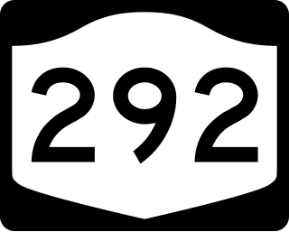
New York State Route 292 (NY 292) is a short 7.58-mile-long (12.20 km) state highway in the Hudson Valley of New York in the United States, bridging Putnam and Dutchess counties. The southern terminus of the route is at an intersection with NY 311 in the town of Patterson, and the northern terminus is at a junction with NY 55 in the town of Pawling. NY 292 traverses mostly rural areas as it heads northwestward through Patterson and Pawling. Along the way, NY 292 passes along the southern and western edges of Whaley Lake.
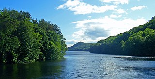
East Branch Reservoir, is a reservoir in the town of Southeast, New York, near the village of Brewster. Part of the New York City water supply system, it was formed by impounding the East Branch of the Croton River. Forming part of the Croton Watershed, it was placed into service in 1891, and lies some 35 miles (56 km) north of the city, in the southeast corner of Putnam County.
Nye is a tiny unincorporated rural hamlet in Putnam County, West Virginia, United States. There are only two homes at Nye, no businesses or services.

Cobleskill is a town in Schoharie County, New York, United States. The population was 6,086 at the 2020 census. The town contains a village, also named Cobleskill, as well as the State University of New York at Cobleskill.
Revere is an unincorporated community in Madison County, North Carolina, United States. It is also known as Sodom and Sodom Laurel.
Fowlerville is a small hamlet in the town of Concord, in southern Erie County, New York, United States.
Sodom is an unincorporated community in Logan County, West Virginia, United States.
Sodom is an unincorporated community in Trumbull County, Ohio, United States.
Ludingtonville is a hamlet in the town of Kent, Putnam County, New York, United States. It is named for early settler Henry Ludington from Connecticut.
Lake Peekskill is a hamlet in the town of Putnam Valley in Putnam County, New York, United States, centered on Lake Peekskill. The community is 3.7 miles (6.0 km) northeast of Peekskill. Lake Peekskill has a post office with ZIP code 10537.
Putnam Station is a hamlet in the town of Putnam in Washington County, New York, United States. The community is located along southern Lake Champlain 12.4 miles (20.0 km) north of Whitehall. Putnam Station has a post office with ZIP code 12861, which opened on July 30, 1879.

The West Branch Croton River is a tributary of the Croton River in Putnam and Westchester counties in the state of New York. It lies within the Croton River watershed and is part of the New York City water supply system's Croton Watershed.
The Middle Branch Croton River is a tributary of the Croton River in Putnam and Westchester counties in the state of New York. It lies within the Croton River watershed and is part of the New York City water supply system's Croton Watershed.
The Muscoot River is a short tributary of the Croton River in Putnam and Westchester counties in the state of New York. Approximately 6 mi (9.7 km) long and running north-to-south, it lies within the Croton River watershed and is part of the New York City water supply system's Croton Watershed.


