
The Strait of Juan de Fuca is a body of water about 96 miles long that is the Salish Sea's main outlet to the Pacific Ocean. The international boundary between Canada and the United States runs down the centre of the Strait.

Gulf Islands National Park Reserve is a national park located on and around the Gulf Islands in British Columbia, Canada. In the National Parks System Plan, this park provides representation of the Strait of Georgia Lowlands natural region, the only place in Canada with a Mediterranean climate of dry, sunny summers and mild, wet winters, the result of a rain shadow effect from surrounding mountains between the region and the ocean. It has similar dominant vegetation as the Pacific Northwest, such as coastal Douglas-fir, western red cedar, shore pine, Pacific dogwood, bigleaf maple, and red alder, but also contains the northern extent of some of the more drought tolerant trees such as Garry oak and Arbutus. The park was created in 2003 as the fortieth national park. It covers 36 square kilometres (14 sq mi) of area on 16 islands and more than 30 islets, reefs and surrounding waters, making it the sixth smallest national park in Canada.

The Strait of Georgia or the Georgia Strait is an arm of the Salish Sea between Vancouver Island and the extreme southwestern mainland coast of British Columbia, Canada, and the extreme northwestern mainland coast of Washington, United States. It is approximately 240 kilometres (150 mi) long and varies in width from 20 to 58 kilometres. Along with the Strait of Juan de Fuca and Puget Sound, it is a constituent part of the Salish Sea.
British Columbia Highway 14, named the West Coast (Sooke) Highway is the southernmost numbered route in the province of British Columbia. An east–west highway on the southwestern coast of Vancouver Island in the Capital Regional District, it is sometimes known as the Juan de Fuca Highway, as well as Sooke Road, Sooke being one of the largest communities that the highway passes through. Highway 14 first opened in 1953, extending west from Colwood, a suburb of Victoria, to the coastal community of Jordan River, and was extended all the way west to the remote community of Port Renfrew by 1975. The highway's eastern terminus was relocated to northern Langford in 2002.

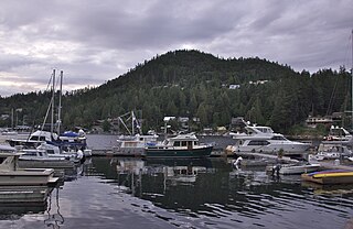
Sooke is a district municipality on the southern tip of Vancouver Island, Canada, 38 kilometres (24 mi) by road from Victoria, the capital of British Columbia. Sooke, the westernmost of Greater Victoria's Western Communities, is to the north and west of the Sooke Basin. It is a regional centre for residents in neighbouring communities, including Otter Point, Shirley and Jordan River.
The Sunshine Coast is a geographic subregion of the British Columbia Coast that generally comprises the regional districts of qathet and Sunshine Coast.

The West Coast Trail, originally called the Dominion Lifesaving Trail, is a 75 km (47 mi) backpacking trail following the southwestern edge of Vancouver Island in British Columbia, Canada. It was built in 1907 to facilitate the rescue of shipwrecked survivors along the coast, part of the treacherous Graveyard of the Pacific. It is now part of the Pacific Rim National Park and is often rated by hiking guides as one of the world's top hiking trails.

The Graveyard of the Pacific is a somewhat loosely defined stretch of the Pacific Northwest coast stretching from around Tillamook Bay on the Oregon Coast northward past the treacherous Columbia Bar and Juan de Fuca Strait, up the rocky western coast of Vancouver Island to Cape Scott.
French Beach Provincial Park is a provincial park in British Columbia, Canada.

Juan de Fuca Provincial Park is a provincial park located on the west coast of Vancouver Island in British Columbia, Canada. The park was established on April 4, 1996 by combining three former parks - China Beach, Loss Creek, and Botanical Beach - into one provincial park. It is the location of the majority of the Juan de Fuca Marine Trail, which is a southern compliment to the West Coast Trail within Pacific Rim National Park Reserve.

Jordan River, founded as, and still officially gazetted as, River Jordan, is a small settlement on the west coast of Vancouver Island, British Columbia, Canada, approximately 70 kilometres (43 mi) west of Victoria at the mouth of the Jordan River.

Port Renfrew is a small unincorporated community located on the south shore of Port San Juan, an inlet on the west coast of Vancouver Island in British Columbia, Canada. Port Renfrew has a population of 262 and has been touted as "the Tall Tree Capital of Canada".

The Juan de Fuca Marine Trail is a rugged 47 kilometres (29 mi) wilderness hiking trail located within Juan de Fuca Provincial Park along the southwestern coast of Vancouver Island, British Columbia, Canada. The trail stretches from China Beach, 35 kilometres (22 mi) west of Sooke, to Botanical Beach, just outside Port Renfrew.
The Salish Sea is a marginal sea of the Pacific Ocean located in the Canadian province of British Columbia and the U.S. state of Washington. It includes the Strait of Georgia, the Strait of Juan de Fuca, Puget Sound, and an intricate network of connecting channels and adjoining waterways.

Loss Creek is a stream in the Capital Regional District of British Columbia, Canada. Located on southern Vancouver Island, it flows through a long, steep-sided valley to the Strait of Juan de Fuca on the Pacific Ocean.

Port San Juan is an inlet along the Pacific coast of Vancouver Island in British Columbia, Canada. It was formed from the San Juan and Leech River faults which flank the northern and southern slopes of the San Juan Valley. The San Juan and Gordon rivers empty into the inlet from the northeast.
The Pacific Marine Circle Route is a 263-kilometre (163 mi) marked scenic loop road through southern Vancouver Island in British Columbia, Canada. The route is composed of Highway 14, Pacific Marine Road, Shore Road, Highway 18, and a segment of the Trans-Canada Highway.

The San Juan Valley is a small valley located in the Capital Regional District of Vancouver Island in British Columbia, Canada.
The Sombrio River is a river in the Capital Regional District of British Columbia, Canada. Located on southern Vancouver Island, it flows to the Strait of Juan de Fuca on the Pacific Ocean at Sombrio Beach.
Jack Elliott Creek is a stream in the Renfrew Land District of British Columbia, Canada. Located on southern Vancouver Island, it flows from its source to its mouth as a right tributary of Loss Creek.


