
Dakshina Kannada district is located in the state of Karnataka in India, with its headquarters in the coastal city of Mangalore. It is part of the larger Tulu Nadu region. The district covers an area nestled in between the Western Ghats to its east and the Arabian Sea to its west. Dakshina Kannada receives abundant rainfall during the Indian monsoon. It is bordered by Udupi district to the north, Chikmagalur district to the northeast, Hassan district to the east, Kodagu to the southeast and Kasaragod district of Kerala to the south. According to the 2011 census of India, Dakshina Kannada district had a population of 2,083,625. It is the only district in Karnataka state to have all modes of transport like road, rail, water and air due to the presence of a major hub, Mangalore. This financial district is also known as the Cradle of Indian banking.

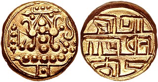
Krishnadevaraya was an emperor of the Vijayanagara Empire reigning from 1509 to 1529. He was the third monarch of the Tuluva dynasty, and is considered to be one of the greatest rulers in Indian history. He ruled the largest empire in India after the fall of the Islamic Delhi Sultanate. Presiding over the empire at its zenith, he is regarded as an icon by many Indians. Krishnadevaraya earned the titles Andhra Bhoja, Karnatakaratna Simhasanadeeshwara, Yavana Rajya Pratistapanacharya, Kannada Rajya Rama Ramana, Gaubrahmana Pratipalaka and Mooru Rayara Ganda. He became the dominant ruler of the peninsula by defeating the sultans of Bijapur, Golconda, the Bahmani Sultanate and the Gajapatis of Odisha, and was one of the most powerful Hindu rulers in India.

Dakṣiṇāmnāya Śrī Śāradā Pīṭham or Śri Śṛṅgagiri Maṭha is one amongst the four cardinal pīthams following the Daśanāmi Sampradaya - the peetham or matha is said to have been established by acharya Śrī Ādi Śaṅkara to preserve and propagate Sanātana Dharma and Advaita Vedānta, the doctrine of non-dualism. Located in Śringerī in Chikmagalur district in Karnataka, India, it is the Southern Āmnāya Pītham amongst the four Chaturāmnāya Pīthams, with the others being the Dvārakā Śāradā Pītham (Gujarat) in the West, Purī Govardhana Pīṭhaṃ (Odisha) in the East, Badri Jyotishpīṭhaṃ (Uttarakhand) in the North. The head of the matha is called Shankarayacharya, the title derives from Adi Shankara.
A matha, also written as math, muth, mutth, mutt, or mut, is a Sanskrit word that means 'institute or college', and it also refers to a monastery in Hinduism. An alternative term for such a monastery is adheenam. The earliest epigraphical evidence for mathas related to Hindu-temples comes from the 7th to 10th century CE.

Tigalari, also known as Tulu script, is a Southern Brahmic script which was used to write Tulu, Kannada, and Sanskrit languages. It was primarily used for writing Vedic texts in Sanskrit. It evolved from the Grantha script. It is called as Tigalari lipi in Kannada-speaking regions and Tulu speakers call it as Tulu lipi. It bears high similarity and relationship to its sister script Malayalam, which also evolved from the Grantha script.

Sirsi is a city and a taluk headquarter in Uttara Kannada district of Karnataka state in India. It was also known as Kalyana Pattana during the Sonda Dynasty. It is a tourist destination with evergreen forest and waterfalls and is also a commercial centre. The main businesses around the city are mostly subsistence and agriculture-based. Areca nut or betel nut, locally known as Adike, is the primary crop grown in the nearby villages, making it one of the major trading centres for areca nut. The region is also known for spices such as cardamom, pepper, betel leaves, and vanilla. The major food crop is paddy.

Sri Vadiraja Tirtha was a Dvaita philosopher, poet, traveller and mystic. He authored many works, often critical, on Madhva theology and metaphysics. Additionally, he composed numerous poems and as the pontiff of Sodhe Mutt, renovated the temple complex at Udupi and established the Paryaya system of worship. He also enriched the Kannada literature of the time by translating Madhvacharya's works to Kannada, giving impetus and contributing to the Haridasa movement. He has influenced both Carnatic and Hindustani music through his compositions. His compositions are mainly in Kannada and Sanskrit. His mudra is 'Hayavadana'. His works are characterised by their poetic flourishes, wit and humour.

Nayakas of Keladi (1499–1763), also known as Nayakas of Bednore and Ikkeri Nayakas, were an Indian dynasty based in Keladi in present-day Shimoga district of Karnataka, India. They were an important ruling dynasty in post-medieval Karnataka. They initially ruled as a vassal of the famous Vijayanagar Empire. After the fall of the empire in 1565, they gained independence and ruled significant parts of Malnad region of the Western Ghats in present-day Karnataka, most areas in the coastal regions of Karnataka and the central plains along the Tungabhadra river. In 1763 AD, with their defeat to Hyder Ali, they were absorbed into the Kingdom of Mysore. They played an important part in the history of Karnataka, during a time of confusion and fragmentation that generally prevailed in South India after the fall of the Vijayanagar Empire. The Keladi rulers were of the Vokkaliga and Banajiga castes and were Veerashaivas by faith. The Haleri Kingdom that ruled over Coorg between 1600 A.D and 1834 A.D. was founded by a member of the Keladi family.
Paryaya is a religious ritual which takes place every alternate year in Sri Krishna Matha of Udupi. The puja and administration of Krishna Matha is distributed among the Swamijis of Ashta Matha's established by Dvaita philosopher Sri Madhvacharya. Each swamiji of every matha gets chance to perform puja to Udupi Sri Krishna by rotation for a period of two years.

The Krishnapur Matha or Krishnapur Mutt in some records and literature is a Madhwa Vaishnava monastery. It is one of the Ashta Mathas of Udupi founded by Dvaita philosopher Madhvacharya of Udupi. Krishnapur Monastery is currently headed by Vidyasagara Thirta. The first swami of this monastery was Janardhana Thirta, who was one of the direct disciples of Madhvacharya. Its presiding deity is Kalingamardhana Krishna. The matha houses a Mukyaprana temple inside where puja is performed every day.The present swamiji of Krishnapura Matha Shri Vidyasagara Thirtha ascended paryaya for fourth time on 18 January 2022 and completed his two year term of performing pooje to Lord Krishna at Shri Krishna Matha ,Car street, Udupi on 17 January 2024.
The Alupa dynasty was an ancient ruling dynasty of India. The kingdom they ruled was known as Alvakheda Arusasira and its territory spanned the coastal districts of the modern Indian state known as Karnataka. The Alupas in their prime were an independent dynasty, centuries after reigning due to the dominance of Kadambas from Banavasi, they became feudatory to them. Later they became the vassals of the Chalukyas, Rashtrakutas, Hoysalas with the change in political scenario of Southern India. Their influence over coastal Karnataka lasted for about 1200 years. There is evidence that the Alupas followed the law of matrilineal inheritance (Appekatt/Aliyasantana) since the Alupa king Soyideva was succeeded by his nephew Kulasekhara Bankideva. The legendary king who is credited with introducing matrilineality in Alva Kheda|Tulu Vishaya Kheda is named Bhuta Alupa Pandya The descendants of this dynasty still survive to this date and have spread in the karavali region and they are widely referred to as the Bunt. The Bunts follow Matrilineality instead of the common Patrilineality, and are said to be Nagavanshi Kshatriyas by their maternal origin. They can be identified with their surnames such as Shetty, Rai, Hegde, Alva, Chowta etc. Even though most Bunt are Hindus by faith now, The sizeable section of the community still follows Jainism and they are called Jain Bunt The last Alupa king to have ruled is Kulasekharadeva Alupendradeva whose inscription dated 1444 CE have been found in Mudabidri Jain Basadi.

Karnataka, the sixth largest state in India, has been ranked as the third most popular state in the country for tourism in 2014. It is home to 507 of the 3600 centrally protected monuments in India, second only to Uttar Pradesh. The State Directorate of Archaeology and Museums protects an additional 752 monuments and another 25,000 monuments are yet to receive protection.

Udupi Shri Krishna Temple is a well-known historic Hindu temple dedicated to Krishna and Dvaita Matha located in the city of Udupi in Karnataka, India. The Matha area resembles a living Aashram, a holy place for daily devotion and living. Surrounding the Shri Krishna Temple are several temples namely the Udupi Anantheshwara Temple which is over a thousand years old.

The Tulu Ashta Mathas of Udupi are a group of eight mathas or Hindu monasteries established by Madhvacharya, the preceptor of the Dvaita school of Hindu thought with his direct disciples to be the first Swami, head of the matha.
Temples of the Indian State of Karnataka illustrate the variety of architecture prevalent in various periods. The architectural designs have found a distinguished place in forming a true atmosphere of devotion for spiritual attainment.

Tulu Nadu State movement is aimed at increasing Tulu Nadu's influence and political power through the formation of separate Tulu Nadu state from Karnataka and Kerala. Tulu Nadu is a region on the south-western coast of India. It consists of the Dakshina Kannada and Udupi districts of Karnataka and Kasargod district up to the Chandragiri river in Kerala. The Chandragiri River has traditionally been considered a boundary between Tulu Nadu and Kerala from the fourth century AD onwards. The first call for a separate Tulu Nadu state was made just after the Quit India Movement in 1942 by Srinivas Updhyaya Paniyadi, a banker and a press owner from Udupi. Mangalore is the largest and the chief city of Tulu Nadu. Tulu activists have been demanding a separate Tulu Nadu state since the late 2000s, considering language and culture as the basis for their demand.

The Uttaradi Math, is one of the main monasteries (matha) founded by Madhvacharya with Padmanabha Tirtha as its head to preserve and propagate Dvaita Vedanta (Tattvavada) outside Tulunadu region. Uttaradi Math is one of the three primary Dvaita monasteries or Mathatraya that descended from Madhvacharya in the lineage of Padmanabha Tirtha through Jayatirtha. After Jayatirtha and Vidyadhiraja Tirtha, Uttaradi Math continued in the lineage of Kavindra Tirtha and later in the lineage of Vidyanidhi Tirtha. The Moola Rama and Moola Sita idols worshipped in the Uttaradi Matha have a long history and are revered among adherents.

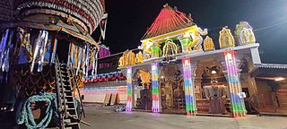
Dharmasthala Temple is an 800-year-old Hindu religious institution in the temple town of Dharmasthala in Dakshina Kannada, Karnataka, India. The deities of the temple are Hindu god Shiva, who is referred to as Mañjunatha, Hindu goddess Ammanavaru, the Tirthankara Chandraprabha and the protective gods of Jainism, Kalarahu, Kalarkayi, Kumarasvami and Kanyakumari. The temple was reconsecrated in 16th century by Hindu Dvaita saint Vadiraja Tirtha by the request of the then administrator of the temple, Devaraja Heggade. The temple is considered unique, since the priests in the temple are Madhwa Brahmins, who are Vaishnava, and the administration is run by a Jain Bunt family called the Pergades.
A. K. Shastry was an Indian historian in the state of Karnataka, India.
Koteshwara Brahmins are a Hindu Brahmin subcaste mainly from the Indian state of Karnataka. The community is mainly concentrated in the Koteshwara, Kundapur, and surrounding areas of Udupi district in Karnataka. The community takes its name from the village Koteshwara, which is their native place. Koteshwara Brahmins follows the Dvaita Vedanta propounded by Madhvacharya and are followers of Sodhe Vadiraja Swami Matha.
