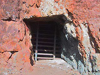
An adit or stulm is a horizontal or nearly horizontal passage to an underground mine. Miners can use adits for access, drainage, ventilation, and extracting minerals at the lowest convenient level. Adits are also used to explore for mineral veins. Although most strongly associated with mining, the term adit is sometimes also used in the context of underground excavation for non-mining purposes; for example, to refer to smaller underground passageways excavated for underground metro systems, to provide pedestrian access to stations, and for access required during construction.

Wirksworth is a market and former quarry town in the Derbyshire Dales district of Derbyshire, England. Its population of 4,904 in the 2021 Census was estimated at 5,220 in 2023. Wirksworth contains the source of the River Ecclesbourne. The town was granted a market charter by Edward I in 1306 and still holds a market on Tuesdays in the Memorial Gardens. The parish church of St Mary's is thought to date from 653. The town developed as a centre for lead mining and stone quarrying. Many lead mines were owned by the Gell family of nearby Hopton Hall.

This article details some of the history of lead mining in Derbyshire, England.

The Cromford Canal ran 14.5 miles from Cromford to the Erewash Canal in Derbyshire, England with a branch to Pinxton. Built by William Jessop with the assistance of Benjamin Outram, its alignment included four tunnels and 14 locks.
The History of coal mining goes back thousands of years, with early mines documented in ancient China, the Roman Empire and other early historical economies. It became important in the Industrial Revolution of the 19th and 20th centuries, when it was primarily used to power steam engines, heat buildings and generate electricity. Coal mining continues as an important economic activity today, but has begun to decline due to the strong contribution coal plays in global warming and environmental issues, which result in decreasing demand and in some geographies, peak coal.

Lathkill Dale is the valley of the River Lathkill near Bakewell, Derbyshire in the Peak District of England. The river emerges into the dale from springs below Lathkill Head Cave. Towards the head of the dale is the side valley Cales Dale.

The Worsley Navigable Levels are an extensive series of coal mines in Worsley in the City of Salford in Greater Manchester, England. They were worked largely by the use of underground canals and boats called starvationers.
The South Yorkshire Coalfield is so named from its position within Yorkshire. It covers most of South Yorkshire, West Yorkshire and a small part of North Yorkshire. The exposed coalfield outcrops in the Pennine foothills and dips under Permian rocks in the east. Its most famous coal seam is the Barnsley Bed. Coal has been mined from shallow seams and outcrops since medieval times and possibly earlier.

Cromford Mill is the world's first water-powered cotton spinning mill, developed by Richard Arkwright in 1771 in Cromford, Derbyshire, England. The mill structure is classified as a Grade I listed building. It is now the centrepiece of the Derwent Valley Mills UNESCO World Heritage Site, and is a multi-use visitor centre with shops, galleries, restaurants and cafes.
The Hoffman tunnel, or Hoffman drainage tunnel, was constructed to drain water from coal mines northwest of Clarysville in Allegany County, Maryland. The two-mile-long tunnel drains into the Braddock Run tributary of Wills Creek.

Coal mining in the United Kingdom dates back to Roman times and occurred in many different parts of the country. Britain's coalfields are associated with Northumberland and Durham, North and South Wales, Yorkshire, the Scottish Central Belt, Lancashire, Cumbria, the East and West Midlands and Kent. After 1972, coal mining quickly collapsed and had practically disappeared by the 21st century. The consumption of coal—mostly for electricity—fell from 157 million tonnes in 1970 to just 587,000 tonnes in 2023. Employment in coal mines fell from a peak of 1,191,000 in 1920 to 695,000 in 1956, 247,000 in 1976, 44,000 in 1993, 2,000 in 2015, and to 360 in 2022.
The Lancashire Coalfield in North West England was an important British coalfield. Its coal seams were formed from the vegetation of tropical swampy forests in the Carboniferous period over 300 million years ago.
The Ingleton Coalfield is in North Yorkshire, close to its border with Lancashire in north-west England. Isolated from other coal-producing areas, it is one of the smallest coalfields in Great Britain.
The Great Haigh Sough is a tunnel or adit driven under Sir Roger Bradshaigh's estate between 1653 and 1670, to drain his coal and cannel pits in Haigh on the Lancashire Coalfield. The sough's portal and two metres of tunnel from where it discharges water into the Yellow Brook at Bottling Wood is a scheduled monument.
The Forest of Dean Coalfield, underlying the Forest of Dean, in west Gloucestershire, is one of the smaller coalfields in the British Isles, although intensive mining during the 19th and 20th centuries has had enormous influence on the landscape, history, culture, and economy of the area.

The Historic Silver Mine is a UNESCO World Heritage Site in Tarnowskie Góry, Silesia, Poland. The mine and the neighbouring Black Trout Adit are remnants of a silver mining industry. The museum is an Anchor point on the European Route of Industrial Heritage. It also joined The International Committee for the Conservation of the Industrial Heritage and the Silesian Tourist Organization.

The coal industry in Wales played an important role in the Industrial Revolution in Wales. Coal mining in Wales expanded in the 18th century to provide fuel for the blast furnaces of the iron and copper industries that were expanding in southern Wales. The industry had reached large proportions by the end of that century, and then further expanded to supply steam-coal for the steam vessels that were beginning to trade around the world. The Cardiff Coal Exchange set the world price for steam-coal and Cardiff became a major coal-exporting port. The South Wales Coalfield was at its peak in 1913 and was one of the largest coalfields in the world. It remained the largest coalfield in Britain until 1925. The supply of coal dwindled, and pits closed in spite of a UK-wide strike against closures. Aberpergwm Colliery is the last deep mine in Wales.
Mine dewatering is the action of removing groundwater from a mine. When a mine extends below the water table groundwater will, due to gravity, infiltrate the mine working. On some projects groundwater is a minor impediment that can be dealt with on an ad-hoc basis. In other mines, and in other geological settings, dewatering is fundamental to the viability of the mine and may require the use of very large resources and management.

Magpie Mine is a well-preserved disused lead mine near the village of Sheldon in Derbyshire, England, in the parish of Ashford in the Water. The walled enclosure of five lead mines is a protected Scheduled Monument.

The Derbyshire Dome is a geological formation across mid-Derbyshire in England.
