Souillac, Mauritius

Last updated
Souillac
Souillac1.jpg
View of the west part of Souillac village and the ancient port.
Mauritius location map.svg
Red pog.svg
Souillac
Coordinates: 20°31′S57°31′E / 20.517°S 57.517°E / -20.517; 57.517
Country Mauritius
Founded1787
Government
  President of Village councilUnknown
Population
  TotalOver 6,000
Time zone UTC+4 (MUT)
Website

Souillac is a village close to the southernmost point of the main island of Mauritius. It is the seat of the district council of Savanne district. It was named after the Vicomte de Souillac, the island's governor from 1779-1787.

Contents

History

Gris Gris beach Mauritius 23.08.2009 10-17-45.jpg
Gris Gris beach

In 1787, Vicomte de Souillac decided to establish a port for the south and southwest of the then Isle de France. At that time the island was an important port of call for the French vessels on their way to and from India. Strategically, the French also wanted a base for the defence of the southern coast. The most suitable place to erect a port was the southernmost point of the island where a large and deep estuary (formed by the Savanne River), without coral reefs, would permit the vessels to accost nearest to the land. The port would also be used for the transportation of agricultural products (including sugar) to Port Louis as no suitable road linked Port Louis with the southern part of the island at that time.

On 1 January 1787, a Royal Order ascribed to the locality the name of "Port Souillac", partly to honour the Vicomte's contribution to the development of the port. Vicomte de Souillac left Isle de France on 5 November 1787.

During the English colonisation, the port has been greatly used for the transportation of sugar from the many southern sugar factories to the Capital (Port Louis) making it the busiest seaport in the south. Its importance started to decrease with the introduction of railways on the island in 1877. With the development of other means of transport, the port became less and less used. However, by that time, the locality had already grown into a village. The village kept the name of Souillac.

Population and geography

Initially, the village was mostly composed of fishing families. But with the development of agriculture (especially sugarcane plantations) and transport, its population quickly diversified. Above 6,000 inhabitants now live in the village. Inhabitants of Souillac are called Souillacois/es (which distinguishes the Souillac-Mauritius inhabitants from the Souillac-France inhabitants called "Souillagais/es").

Expansion

In the late 1980s, there was an expansion of the village with the vast majority of an ancient small sugarcane fields labourers locality called "Terracine" (which has now been almost completely destroyed) given land in the northern part of the village to build their houses.

Further expansions occurred when the inhabitants of another sugarcane field labourers locality called "Combo" were moved to Souillac.

Developments

"La Roche Qui Pleure" The Crying Rock.jpg
"La Roche Qui Pleure"
Part of Morcellement Gris-Gris before house constructions Grisgris2.jpg
Part of Morcellement Gris-Gris before house constructions

More recently, a new quarter has been created, commonly known as the "Morcellement Gris-Gris". Houses have also been built along Laby Barkly Street, extending the village to its northeast.

Geography

Souillac is located in the southernmost part of the island. It is separated on the west from the village of Surinam by the Savanne river and on the east from the village of l'Union by the Bain des Négresses river. The main road snakes through the village from its northeast to its west, from the Bain des Négresses bridge to the Souillac/Surinam bridge. Although there is no official apportionment of the village, the local people often distinguish the parts of the village as follows: quartiers of Terracine, Combo, Brise de Mer, L'église, Pitot, Cité Gris-gris, Morcellement Gris-gris, EDC and L'Hopital.

Famous natives/inhabitants

Poet Robert Edward Hart whose house La Nef is now a museum, Mr Armand Maudave who was an educator, sportsman, captain of industry and a diplomat and Permanent Secretary and Mrs Liliane Dubois who was the first woman in Mauritius to be appointed Permanent Secretary

Capital of Savanne District

Souillac is an important village in the southern region. Various State facilities and services are found in the village: The District Court of Savanne; the southern section of the Central Water Authority and the Central Electricity Board; the Southern section of the National Transport Corporation; a recently built modern hospital (which replaced the old Souillac hospital). The Post office of the village is also one of the oldest on the island and is housed in the building of the old train station. The Catholic church of St. Jacques was built in 1845.

Places of interest

Telfair Garden

The Telfair Garden is a nice place near the seaside where the inhabitants often go for a picnic. The garden bears the name of Charles Telfair , a naturalist and land proprietor who developed the sugar estate of Bel Ombre. The garden is embellished by its big banyan and almond trees. A walking path links the Telfair Garden with the locally well-known Lavoir".

Gris-Gris

Gris-Gris Grisgris1.jpg
Gris-Gris

Gris-Gris is well known for its sea cliff. This part of the island is not surrounded by coral reefs. Heavy waves crash directly on the cliffs. The most spectacular part of Gris-gris is the "Roche Qui Pleure" where the constant breaking of waves against the flanks of the cliff gives the impression that the cliff is crying. The place is very much visited by tourists.

Batelage

Batelage is the ancient port of Souillac. The embarkment has been renovated and reconditioned to be used as a landing stage for the local fishermen's pirogues. The building next to the port, which was originally used to stock sugar and other products to be embarked, has also been renovated. It is now used as the Village hall for the Village Council. Another part of the building is used as a station for the National Coast Guard of Mauritius and the last part of the building is now a restaurant named "Le Batelage".

La Nef

La Nef is a museum and former home of Mauritian poet Robert Edward Hart.

Rochester Falls

Rochester Falls Rochester Falls, Mauritius.jpg
Rochester Falls

Rochester Falls is a waterfall on the Savanne River. It is famous for the strange rectangular form of its rocky flank.

It is located approximately 2.5 km (1.6 mi) from Souillac. The falls tumble from the Savanne River from a height of about 10 m (33 ft) where constant erosion has fashioned the basalt rock into upright columns. Teens often perform dare-devil dives into the water below.

Pairing with Souillac of France

A pairing exists between the village of Souillac and the town of Souillac in France (Lot Department) since 1987. This successful pairing was initiated by Armand Maudave, an inhabitant of the village of Souillac, and the Comte de Montferrand who is himself one of the descendants of the Vicomte de Souillac. People of the two localities often meet either in France or in Mauritius to share and celebrate various events. [1] In 2007, a bust of the Vicomte de Souillac was inaugurated at the Batelage to mark the 20th anniversary of the pairing.

Related Research Articles

<span class="mw-page-title-main">Mauritius</span> Island nation in the Indian Ocean

Mauritius, officially the Republic of Mauritius, is an island country in the Indian Ocean, about 2,000 kilometres off the southeastern coast of East Africa, east of Madagascar. It includes the main island, as well as Rodrigues, Agaléga, and St. Brandon. The islands of Mauritius and Rodrigues, along with nearby Réunion, are part of the Mascarene Islands. The main island of Mauritius, where the population is concentrated, hosts the capital and largest city, Port Louis. The country spans 2,040 square kilometres (790 sq mi) and has an exclusive economic zone covering 2,300,000 square kilometres.

<span class="mw-page-title-main">Geography of Mauritius</span> Indian Ocean island

Mauritius is an island off Africa's southeast coast located in the Indian Ocean, east of Madagascar. It is geologically located within the Somali plate.

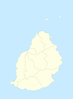
Moka is a village in Mauritius located mainly in the Moka District. The western part of the village lies in the Plaines Wilhems District. Since 1967 it forms part of Constituency No. 8 Quartier Militaire and Moka. The village is administered by the Moka Village Council under the aegis of the Moka District Council. According to the census made by Statistics Mauritius in 2011, the population was at 8,846. The elevation is 203 meters and can be up to 425 meters in some places. Moka is directly on the other side of the Moka Range from Port Louis. The village is close to the mountain Le Pouce and the town Beau-Bassin Rose-Hill. Réduit is a suburb of the village where the State House and University of Mauritius is situated. The village is also home to the Mauritius Broadcasting Corporation and the Mahatma Gandhi Institute.

<span class="mw-page-title-main">Isle de France (Mauritius)</span> 1715–1810 French colony in the Indian Ocean

Isle de France was a French colony in the Indian Ocean from 1715 to 1810, comprising the island now known as Mauritius and its dependent territories. It was governed by the French East India Company and formed part of the French colonial empire. Under the French, the island witnessed major changes. The increasing importance of agriculture led to the importation of slaves and the undertaking of vast infrastructural works that transformed the capital Port Louis into a major port, warehousing, and commercial centre.

<span class="mw-page-title-main">Mahébourg</span> Coastal town in Mauritius

Mahébourg is a small town on the south-eastern coast of the island of Mauritius, having a population of 15,457 as of 2015. It is considered the main town of the Grand Port District.

<span class="mw-page-title-main">Jodensavanne</span> Plantation community established in Suriname by Sephardi Jews

Jodensavanne was a Jewish plantation community in Suriname, South America, and was for a time the centre of Jewish life in the colony. It was established in the 1600s by Sephardi Jews and became more developed and wealthy after a group of Jews fleeing persecution in Brazil settled there in the 1660s. It was located in what is now Para District, about 50 km (31 mi) south of the capital Paramaribo, on the Suriname River. Sugarcane plantations were established by forcing Black African people to work as slaves. At its height in around 1700, Jodensavanne was home to roughly 500 plantation owners and 9000 enslaved people. The colony faced regular attacks from Indigenous people, slave revolts, and even raids from the French navy. The community eventually relocated to the capital of Paramaribo. Clearing of grave sites and maintenance of the synagogue ruins has been attempted at various times from the 1940s to the 21st century.

<span class="mw-page-title-main">Triolet, Mauritius</span>

Triolet is a medium-sized town in the north of the Mauritius district of Pamplemousses. It lies exactly 11 kilometres from Port Louis, the capital of the island. The town is nestled amidst green sugarcane fields, near the north-western coast of the island. As per the 2016 population census, Triolet had 24 073 inhabitants and a population density of 2764 inhabitants per km2, over an area of 8.71 m2. The population density is higher than that of the township of Vacoas-Phoenix which is at 1948 inhabitants per km2.

François de Peynier, vicomte de Souillac was born on 2 July 1732 in Périgord. He was Governor of Isle Bourbon, Governor General of the Mascarene Islands and Pondichéry.

The Islets of Mauritius include circa 130 tiny islets and rocks scattered around the coast of Mauritius, Rodrigues, Agalega and St Brandon.

<span class="mw-page-title-main">Outline of Mauritius</span> Overview of and topical guide to Mauritius

The following outline is provided as an overview of and topical guide to Mauritius:

<span class="mw-page-title-main">History of rail transport in Mauritius</span> Aspect of history

The history of rail transport in Mauritius began in the 1860s. The Mauritian rail network was quickly built and it soon provided service to most of the island. It was a key factor in the social-economic development of Mauritius during its period of operation. However, due to persistent unprofitability from 1948 to 1953, it was closed in 1964. In 2019, the Metro Express light rail system opened, bringing rail passenger traffic back to Mauritius.

<span class="mw-page-title-main">Christianity in Mauritius</span>

According to the 2011 census, Christianity was adhered to by 31.7% of the population of Mauritius; 80.3% of these were Roman Catholics.

<span class="mw-page-title-main">British Mauritius</span> British colony in Africa from 1810 to 1968

Mauritius was a Crown colony off the southeast coast of Africa. Formerly part of the French colonial empire, British rule in Mauritius was established de facto with the Invasion of Isle de France in November 1810, and de jure by the subsequent Treaty of Paris. British rule ended on 12 March 1968, when Mauritius became independent.

Pritam Singh Mattan, born in Mauritius in the village of Bois Cheri, was the Chief Executive of Rodrigues Island, Mauritius, from March 5 until August 24, 2010. Prior to this, he was the head of the island's Commission for Tourism since August 2006 and the Director of Rodrigues Tourism Office and Discovery Rodrigues Co Ltd. He worked in different managerial positions in the private and public sector in Mauritius in organizations such as the Compagnie Mauricienne De Textile Ltee, the Grand Port Savanne District Council, the Sugar Insurance Fund Board and the Wastewater Management Authority, before taking employment in Rodrigues with the Rodrigues Regional Assembly. He has a master's degree in Business Administration from the University of Mauritius. He also did his undergraduate studies in Management at the University of Mauritius where he topped his batch and faculty in 1997 and was awarded several bursaries and scholarships. He is also the co-founder of the Revengers Sports Club of Bois Cheri which plays football in the regional football league of Savanne in Mauritius.

<span class="mw-page-title-main">Chamarel</span> Village in Rivière Noire District, Mauritius

Chamarel is a village in Mauritius mainly located in Rivière Noire District. The eastern part of the village lies in the Savanne District. The village is administered by the Chamarel Village Council under the aegis of the Rivière Noire District Council.

The following is an index of Mauritius-related topics by alphabetical order. For a list by topic, see list of Mauritius-related topics

Rivière Du Poste is a village in the southern part of Mauritius located in both Savanne and Grand Port districts. The locality is about 19 miles south of Port Louis, the nation's capital. The village is administered by the Rivière du Poste Village Council under the aegis of the Savanne District Council. According to the census made by Statistics Mauritius in 2011, the population was 2,170. The neighboring villages are La Flora, Mare Tabac and Rose Belle and Camp Diable and Riviere Dragon in the south of the village.

The growing of sugar cane has been the dominant industry of Mauritius for most of its inhabited period. The island was totally uninhabited when first discovered by the Portuguese in 1507. Sugar was introduced during the period of Dutch Mauritius (1638–1710) mostly to make Arak and slaves were imported to work on sugar cane and other crops. After about 1735, during the period of French Mauritius (1715–1810), under the French East India Company, the industry developed considerably. In 1735 there were 638 slaves in a population of 838 inhabitants. Thereafter, some 1,200 to 1,300 slaves arrived annually; within five years the number of slaves had quadrupled to 2,612 and the number of French had doubled.

Paramhamsa Nababsing, more commonly known as Prem Nababsing, was a Mauritian politician and MMM minister.

References

  1. "Histoire". www.souillacjumelage.fr. Retrieved 2022-10-22.

20°31′S57°31′E / 20.517°S 57.517°E / -20.517; 57.517