The 1899 Atlantic hurricane season featured the longest-lasting tropical cyclone in the Atlantic basin on record. There were nine tropical storms, of which five became hurricanes. Two of those strengthened into major hurricanes, which are Category 3 or higher on the modern day Saffir–Simpson scale. The first system was initially observed in the northeastern Gulf of Mexico on June 26. The tenth and final system dissipated near Bermuda on November 10. These dates fall within the period with the most tropical cyclone activity in the Atlantic. In post-season analysis, two tropical cyclones that existed in October were added to HURDAT – the official Atlantic hurricane database. At one point during the season, September 3 through the following day, a set of three tropical cyclones existed simultaneously.

The 1897 Atlantic hurricane season was an inactive season, featuring only six known tropical cyclones, four of which made landfall. There were three hurricanes, none of which strengthened into major hurricanes, which are Category 3 or higher on the modern-day Saffir–Simpson hurricane wind scale. The first system was initially observed south of Cape Verde on August 31, an unusually late date. The storm was the strongest of the season, peaking as a Category 2 hurricane with winds of 100 mph (155 km/h). While located well north of the Azores, rough seas by the storm sunk a ship, killing all 45 crewmen. A second storm was first spotted in the Straits of Florida on September 10. It strengthened into a hurricane and tracked northwestward across the Gulf of Mexico, striking Louisiana shortly before dissipating on September 13. This storm caused 29 deaths and $150,000 (1897 USD) in damage.

The 1880 Atlantic hurricane season ran through the summer and fall of 1880. This is the period of each year when most tropical cyclones form in the Atlantic basin. In the 1880 Atlantic season there were two tropical storms, seven hurricanes, and two major hurricanes (Category 3+). However, in the absence of modern satellite and other remote-sensing technologies, only storms that affected populated land areas or encountered ships at sea were recorded, so the actual total could be higher. An undercount bias of zero to six tropical cyclones per year between 1851 and 1885 and zero to four per year between 1886 and 1910 has been estimated. Of the known 1880 cyclones, Hurricane Six was first documented in 1995 by José Fernández-Partagás and Henry Díaz. They also proposed large changes to the known tracks of several other storms for this year and 're-instated' Hurricane Ten to the database. A preliminary reanalysis by Michael Chenoweth, published in 2014, found thirteen storms, nine hurricanes, and four major hurricanes.
The decade of the 1830s featured the 1830s Atlantic hurricane seasons. While data is not available for every storm that occurred, some parts of the coastline were populated enough to give data of hurricane occurrences. Each season was an ongoing event in the annual cycle of tropical cyclone formation in the Atlantic basin. Most tropical cyclone formation occurs between June 1 and November 30.

Hurricane Diana was the first major hurricane to hit the East Coast of the United States in nearly 20 years. Diana was the ninth tropical cyclone, fourth named storm, first hurricane, and first major hurricane of the 1984 Atlantic hurricane season. It caused moderate damage in North Carolina while it looped offshore and after it made landfall as a Category 2 hurricane. Forming on September 8, Diana moved northward and wandered across North Carolina for a couple of days during mid-September, dropping heavy rainfall. Once it left the state and accelerated east-northeast, Diana quickly evolved into an extratropical cyclone. Watches and warnings were issued for the storm along the East coast between eastern Florida and Virginia. Damages to the United States totaled $65.5 million. Three indirect fatalities were caused by the cyclone.
The 1940 South Carolina hurricane was a Category 2 hurricane that struck the Georgia and South Carolina coast between August 11 and 12, 1940. After forming north of the Leeward Islands, the storm moved west-northwest, moving east of the Bahamas before resuming a west-northwest track towards the Southeastern United States. Hurricane warnings were in effect for the United States coastline near and north of where the center made landfall. A 13-foot storm tide was measured along the South Carolina coast, while over 15 inches (380 mm) of rain fell across northern North Carolina. Significant flooding and landslides struck Georgia, North Carolina, Tennessee, and Virginia during the system's slow trek as a weakening tropical storm, and then as an extratropical cyclone, through the Southeast. The landslides which struck North Carolina were considered a once in a century event. Damages relating to the storm totaled $13 million and 50 people perished.

The 1885 Atlantic hurricane season ran through the summer and the first half of fall in 1885. This is the period of each year when most tropical cyclones form in the Atlantic basin. In 1885 there were two tropical storms and six hurricanes in the Atlantic basin. However, in the absence of modern satellite monitoring and remote-sensing technologies, only storms that affected populated land areas or encountered ships at sea were recorded, so the actual total could be higher. An undercount bias of zero to six tropical cyclones per year between 1851 and 1885 and zero to four per year between 1886 and 1910 has been estimated.

Hurricane Able was a rare hurricane that formed outside the typical North Atlantic hurricane season. The second tropical storm and first hurricane of 1951, Able developed from a trough of low pressure on May 15 about 300 miles (480 km) south of Bermuda. Initially subtropical in nature, Able acquired tropical characteristics as it moved over the warm waters of the Gulf Stream and attained hurricane status on May 17 off the coast of Florida. This made Able one of only four May Atlantic hurricanes on record. On May 22 Able reached peak winds of 90 mph (140 km/h) about 70 miles (110 km) off Cape Hatteras, North Carolina. The hurricane weakened as it turned eastward, and became an extratropical cyclone on May 23, before dissipating on the next day.

Tropical Storm Gabrielle was a short-lived tropical cyclone that passed over North Carolina before tracking out to sea. The seventh named storm of the 2007 Atlantic hurricane season, Gabrielle developed as a subtropical cyclone on September 8 about 385 miles (620 km) southeast of Cape Lookout, North Carolina. Unfavorable wind shear impacted the storm for much of its duration, although a temporary decrease in the shear allowed the cyclone to become a tropical storm. On September 9, Gabrielle made landfall at Cape Lookout National Seashore in the Outer Banks of North Carolina with winds of 60 mph (97 km/h). Turning to the northeast, the storm quickly weakened and dissipated on September 11.

The Yankee hurricane of 1935 was a rare Category 2 hurricane that affected the Bahamas and South Florida in November. The sixth tropical cyclone and fifth hurricane of the 1935 Atlantic hurricane season, it developed 227 miles (365 km) east of Bermuda. It strengthened to a hurricane on November 1, initially posing a threat to the Carolinas. Subsequently, the cyclone turned southwest. It attained its peak intensity on November 3, and it made landfall near Miami Beach on November 4. The hurricane's unusual approach toward Florida and late arrival earned it the nickname of the Yankee Hurricane. The Yankee hurricane was one of three known November hurricanes to make landfall in Florida, with the others being Kate in 1985, and Nicole in 2022.

The 1924 Atlantic hurricane season featured the first officially recorded Category 5 hurricane, a tropical cyclone with maximum sustained winds exceeding 155 mph (249 km/h) on the modern-day Saffir–Simpson scale. The first system, Tropical Storm One, was first detected in the northwestern Caribbean Sea on June 18. The final system, an unnumbered tropical depression, dissipated on November 24. These dates fall within the period with the most tropical cyclone activity in the Atlantic. Of the 13 tropical cyclones of the season, six existed simultaneously. The season was average with 11 tropical storms, five of which strengthened into hurricanes. Further, two of those five intensified into major hurricanes, which are Category 3 or higher on the Saffir–Simpson scale.

Tropical Storm Arthur was the first tropical cyclone and named storm of the annual Atlantic hurricane season that caused minimal flooding in the Carolinas in mid-June 1996. Arthur originated from an area of increased convection east of the Bahamas on June 16. Gradually, the system increased in organization, and was designated as a tropical depression on June 17. The depression tracked north-northwest and became Tropical Storm Arthur while just offshore the Southeastern United States on June 19. Later that day, Arthur peaked with maximum sustained winds of 45 mph (75 km/h), but weakened slightly before making landfall in North Carolina early the following day. After striking North Carolina, Arthur tracked out to sea and weakened further to a tropical depression. By June 21, Arthur transitioned into an extratropical cyclone. Overall, impact from Arthur was minimal, limited to light rainfall and moderate surf in North and South Carolina, as well as a tornado in Florida. Total damage amounted to $1 million (1996 USD), but no fatalities were reported.

The 1852 Atlantic hurricane season was the first of only three Atlantic hurricane seasons in which every known tropical cyclone attained hurricane status, preceding 1858 and 1884. Five tropical cyclones were reported during the season, which lasted from late August to the middle of October. These dates fall within the range of most Atlantic tropical cyclone activity, and none of the storms coexisted with another. Though there were officially five tropical cyclones in the season, hurricane scholar Michael Chenoweth assessed two of the cyclones as being the same storm. There may have been other unconfirmed tropical cyclones during the season, as meteorologist Christopher Landsea estimated that up to six storms were missed each year from the official database. This is unusual due to tropical cyclones being smaller than average, sparse ship reports, and relatively unpopulated coastlines at the time.

The 1878 Atlantic hurricane season lasted from the summer through much of the fall. Records show that 1878 featured a relatively active hurricane season. A total of twelve storms were observed during the year. There were twelve tropical storms, eight hurricanes and two major hurricanes. However, in the absence of modern satellite and other remote-sensing technologies, only storms that affected populated land areas or encountered ships at sea were recorded, so the actual total could be higher. An undercount bias of zero to six tropical cyclones per year between 1851 and 1885 and zero to four per year between 1886 and 1910 has been estimated. Of the known 1878 cyclones, both Hurricane Three and Hurricane Four were first documented in 1995 by Jose Fernandez-Partagas and Henry Diaz, who also proposed large changes to the known tracks of Hurricanes Two, Seven and Eight. Further analysis from 2000 onwards extended the duration of Hurricane Three by one day and identified major track changes for Hurricane Five.

The 1925 Florida tropical storm was the deadliest tropical cyclone to impact the United States that did not become a hurricane. The fourth and final storm of the season, it formed as a tropical depression on November 27 near the Yucatán Peninsula, the system initially tracked southeastward before turning north as it gradually intensified. After skirting western Cuba on November 30, the storm reached peak winds of 65 mph (105 km/h) before striking central Florida on December 1. Within hours, the system transitioned into an extratropical cyclone and emerged into the Atlantic Ocean. The system moved onshore once more on December 2 in North Carolina before turning east, away from the United States. On December 5, the system is presumed to have dissipated offshore.

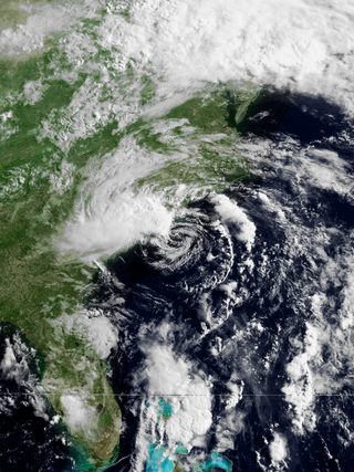
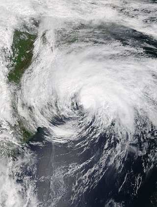
Subtropical Storm Alpha was an off-season subtropical cyclone that impacted Georgia in May 1972. It developed from a previously non-tropical cyclone in the western Atlantic Ocean, and initially it moved northeastward off the Carolinas. The storm turned southwestward due to a building ridge, and concurrently it intensified to become Subtropical Storm Alpha. It later moved ashore near Savannah, and it finally dissipated in the northeast Gulf of Mexico on May 29. It produced wave action and moderate rainfall along the coast. Damage totaled over $100,000 (1972 USD), and there were two associated deaths.

Hurricane How was the only tropical cyclone to make landfall on the United States in 1951. It was the eighth storm of the season, forming on September 28 in the northwest Caribbean and, after entering the Gulf of Mexico, turned eastward and became a tropical storm. The storm brought heavy rainfall to Florida, causing flooding and $2 million in damage. Tropical Storm How later became a hurricane, passing near the Outer Banks of North Carolina where it produced strong winds and high tides. A ship called the "Southern Isles" capsized off Cape Hatteras, killing 17 out of the crew of 23. Rains and high tides occurred in southeastern New England, before the hurricane moved out to sea and became extratropical.

Subtropical Storm Four brushed Florida and The Bahamas in October 1974. The eighteenth cyclone and fourth subtropical storm of the 1974 Atlantic hurricane season, the storm developed near eastern Cuba on October 4 from an area of disturbed weather. Shortly before striking Andros Island on October 6, the system strengthened into a subtropical storm. The storm made its closest approach to Florida early on October 7. Peaking with sustained winds of 50 mph (85 km/h), the system veered northward and then northeastward, but nonetheless caused heavy rainfall and coastal flooding on land in Florida. While paralleling offshore North Carolina and South Carolina, the storm began to slowly weaken. By late on October 8, the subtropical cyclone merged with a cold front while well east of Cape Hatteras.

The 1928 Fort Pierce hurricane devastated areas of Florida and the Southeastern United States in August 1928. The first tropical cyclone and hurricane of the annual hurricane season, the storm developed from a tropical wave first identified on August 3, 1928, north of the Virgin Islands. Slowly intensifying as it moved west-northwest, the system paralleled the Greater Antilles throughout much of its early existence. On August 5, the tropical storm strengthened to the equivalent of a Category 1 hurricane, while positioned over The Bahamas. The hurricane continued to intensify, and after reaching Category 2 hurricane strength, attained its peak intensity on August 7 with winds of 105 mph (169 km/h) and a minimum barometric pressure of 971 mbar. Shortly after, the hurricane made landfall as a slightly weaker storm just southeast of Fort Pierce, Florida at 0700 UTC on August 8. Weakening as it moved across the Florida peninsula over the course of the next day, the storm briefly moved over the Gulf of Mexico before recurving northwards. Thus, it made a second landfall on the Florida Panhandle on August 10 as a tropical storm. Once inland, the system continued to weaken, degenerating to tropical depression strength before transitioning into an extratropical storm later that day. The extratropical remnants progressed outwards into the Atlantic Ocean before entirely dissipating by August 14.

Tropical Storm Arthur was a strong off-season tropical cyclone that impacted the East Coast of the United States in May 2020. The first of thirty-one depressions and thirty named storms of the extremely active 2020 Atlantic hurricane season, Arthur marked the record sixth consecutive year in the Atlantic basin with a tropical cyclone forming before June. It was one of two off-season storms in the season, alongside short-lived Tropical Storm Bertha. Arthur originated from a front that stalled over the Straits of Florida on May 10, which slowly drifted south for two days. The system became a tropical depression on May 16 north of The Bahamas. A day later, the system intensified into a tropical storm and was named Arthur. Arthur gradually intensified while tracking towards the Outer Banks of North Carolina, attaining its peak intensity with maximum 1-minute sustained winds of 60 mph (97 km/h) and a minimum central pressure of 990 mbar (29 inHg) on May 19, before skirting the region and becoming an extratropical cyclone. The cyclone then accelerated towards Bermuda and dissipated on May 21.


