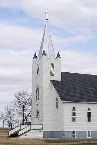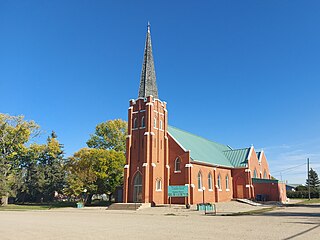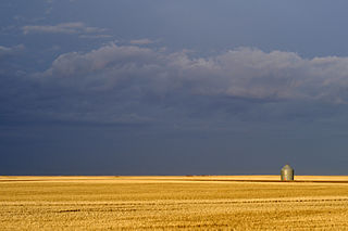
Weyburn is the tenth-largest city in Saskatchewan, Canada. The city has a population of 11,019. It is on the Souris River 110 kilometres (68 mi) southeast of the provincial capital of Regina and is 70 kilometres (43 mi) north from the North Dakota border in the United States. The name is reputedly a corruption of the Scottish "wee burn," referring to a small creek. The city is surrounded by the Rural Municipality of Weyburn No. 67.

The University of Regina is a public research university located in Regina, Saskatchewan, Canada. Founded in 1911 as a private denominational high school of the Methodist Church of Canada, it began an association with the University of Saskatchewan as a junior college in 1925, and was disaffiliated by the Church and fully ceded to the university in 1934; in 1961 it attained degree-granting status as the Regina Campus of the University of Saskatchewan. It became an autonomous university in 1974. The University of Regina has an enrolment of over 15,000 full and part-time students. The university's student newspaper, The Carillon, is a member of CUP.

Saskatchewan Polytechnic is Saskatchewan's primary public institution for post-secondary technical education and skills training, recognized nationally and internationally for its expertise and innovation. Through program and course registrations, Saskatchewan Polytechnic serves 26,000 distinct students with programs that touch every sector of the economy. It operates campuses in Moose Jaw, Prince Albert, Regina and Saskatoon; and provides a number of courses and programs through distance education.

Yellow Grass is a town in southern Saskatchewan, Canada. It is located in the Rural Municipality of Scott No. 98, approximately 25 km northwest of Weyburn, at the junction of provincial Highway 39 and 621. The town is located on the Canadian Pacific Railway Soo Line, at an elevation of 572 metres above sea level.

Western Christian College (WCC) was a private Christian college associated with the Churches of Christ located in Regina, Saskatchewan, Canada. WCC also had a high school program which results in the overall institution being known in many cases as Western Christian College and High School.

Weyburn-Big Muddy is a provincial electoral district for the Legislative Assembly of Saskatchewan, Canada. Located in southeastern Saskatchewan, the constituency was created for the 1995 general election by combining parts of Weyburn and Bengough-Milestone.
Assiniboia was a federal electoral district in Saskatchewan, Canada, that was represented in the House of Commons of Canada from 1908 to 1988. This riding was created in 1907 following the admission of Saskatchewan into the Canadian Confederation in 1905.

Radville is a small town in Canadian province of Saskatchewan, in the RM of Laurier No. 38. It was incorporated in 1911 after being settled in 1895. Highway 28 and Highway 377 pass through the town. Nearby communities include the village of Ceylon, 23 km to the west, and the city of Weyburn, 51 km to the north-east. Major nearby urban centres include Regina, which is 148 km to the north, and Moose Jaw, which is 143 km north-west.

Highway 35 is a paved undivided provincial highway in the Canadian province of Saskatchewan.. It runs from the US Border near Port of Oungre to a dead end near the north shore of Tobin Lake. Saskatchewan Highway 35 (SK Hwy 35) is about 569 kilometres (354 mi) long. The CanAm Highway comprises Saskatchewan Highways 35, SK Hwy 39, SK Hwy 6, SK Hwy 3, SK Hwy 2 and U.S. Route 85. 74.6 kilometres (46.4 mi) of SK Hwy 35 contribute to the CanAm Highway between Port of Oungre on the Canada – United States border and Weyburn. Mudslides, and spring flooding were huge road building and maintenance problems around Nipawin as well as along the southern portion of the route named the Greater Yellow Grass Marsh. Over 20 early dams were built until the problem was addressed with the Rafferty-Alameda Project on the Souris River and the construction of the Qu'Appelle River Dam which have helped to eliminate washed out roads and flooded communities. The highway through the homesteading community followed the Dominion Land Survey on the square until reaching the Saskatchewan River at Nipawin. The completion of the combined railway and traffic bridge over the Saskatchewan River at Nipawin in the late 1920s retired the ferry and basket crossing for traffic north of Nipawin. The E.B. Campbell Dam built in 1963 northeast of Nipawin created Tobin Lake, and Codette Lake was formed with the construction of the Francois-Finlay Hydroelectric dam at Nipawin. The railway/traffic bridge that formed part of Highway 35 was the only crossing utilized at Nipawin until a new traffic bridge was constructed in 1974. The new bridge then became part of the combined Highway 35 and 55 until the highway parts just east of White Fox. Highway 35 then continued north along the west side of Tobin Lake. The railway/traffic bridge continues to be utilized for one lane vehicle traffic controlled by traffic lights, and continues as the "old highway 35" on the west side of the river until it joins with the current Highway 35/55.

Goodwater is a village in the Canadian province of Saskatchewan within the Rural Municipality of Lomond No. 37 and Census Division No. 2. The village is located approximately 50 km (31 mi) south of the City of Weyburn. Goodwater is located on Treaty 4 land, negotiated between the Cree, Saulteaux, and Assiniboine first peoples, and Alexander Morris, second Lieutenant Governor of Manitoba (1872–1877). Goodwater is currently part of the Souris - Moose Mountain federal riding.

Sedley is a village in the Canadian province of Saskatchewan within the Rural Municipality of Francis No. 127 and Census Division No. 6. It is 40 km (25 mi) southeast of the City of Regina on Highway 33. This village is located at the intersection of Highway 33 and Highway 620. Sedley lies in a wheat-producing agricultural district.
Cedoux is an unincorporated community in the Rural Municipality of Wellington No. 97 in the province of Saskatchewan, Canada. It is held village status prior to July 21, 1913. Cedoux is located on Highway 35, approximately 25 km (16 mi) north of the City of Weyburn and approximately 91 km (57 mi) southeast of Regina.
Highway 39 is a provincial, paved, highway in the southern portion of the Canadian province of Saskatchewan connecting North Portal and Moose Jaw in the north. This is a primary Saskatchewan highway maintained by the provincial and national governments and providing a major trucking and tourism route between the United States via Portal, Burke County, North Dakota, and North Portal, Saskatchewan. On July 3, 2000, Highways and Transportation Minister Maynard Sonntag officiated at the ribbon cutting ceremony opening the new duty-free shop and the twinned highway at Saskatchewan's busiest border crossing. Highway 39 is one of Canada's busiest highways, facilitating transport for $6 billion in trade goods via approximately 100,000 trucks over the year. The entire length of highway 39 is paved. The CanAm Highway comprises Saskatchewan Highways Hwy 35, Hwy 39, Hwy 6, Hwy 3, as well as Hwy 2. 44.3 miles (71.3 km) of Saskatchewan Highway 39 contribute to the CanAm Highway between Weyburn and Corinne. Highway 39 is divided or twinned in two areas at North Portal as well as north of Weyburn for 1.7 kilometres (1.1 mi). The junction of Hwy 39 with the Trans–Canada divided four-lane highway is done via a "Parclo" or partial cloverleaf interchange.
The 1984 Centennial Cup is the 14th Junior "A" 1984 ice hockey National Championship for the Canadian Junior A Hockey League.

Midale is a town in the rural municipality of Cymri No. 36, in the Canadian province of Saskatchewan. It is located on Highway 39, midway between the cities of Weyburn and Estevan. It is 160 kilometres south-east of Regina, Saskatchewan.

The Rural Municipality of Weyburn No. 67 is a rural municipality (RM) in the Canadian province of Saskatchewan within Census Division No. 2 and SARM Division No. 1. It is located in the southeast portion of the province.

The Rural Municipality of Brokenshell No. 68 is a rural municipality (RM) in the Canadian province of Saskatchewan within Census Division No. 2 and SARM Division No. 2. It is located in the southeast portion of the province.

Lewvan is an unincorporated community in Scott Rural Municipality No. 98 in the province of Saskatchewan, Canada. Located on highway 306, approximately 53 km northwest of the city of Weyburn. The community was named by the Grand Trunk Railway after Louis W. Van Morristran, the original owner of the town site in 1902, in 1911 the Grand Trunk laid out the town of Lewvan.


