
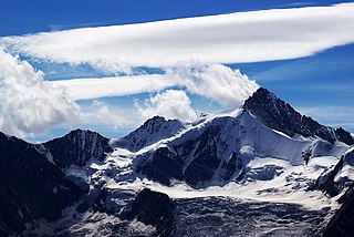
The Tödi, is a mountain massif and with the mountain peak Piz Russein the highest mountain in the Glarus Alps and the highest summit in the canton of Glarus, Switzerland. It is located on the border between the cantons of Graubünden, to the south, and Glarus, to the north, close to the point where those two cantons meet the canton of Uri, to the west. Although not the culminating point of Graubünden, it is its highest peak outside the Bernina range.

Aconcagua, with a summit elevation of 6,960.8 metres (22,837 ft), is the highest mountain in both the Southern and Western Hemispheres. It is located in the Andes mountain range, in the Mendoza Province, Argentina, and lies 112 km (70 mi) northwest of its capital, the city of Mendoza, about five km (3.1 mi) from San Juan Province and 15 km (9.3 mi) from the international border with Chile. The mountain itself lies entirely within Argentina, immediately east of Argentina's border with Chile. Its nearest higher neighbor is Tirich Mir in the Hindu Kush, 16,520 kilometres (10,270 mi) away. It is one of the Seven Summits.

The Aletsch Glacier or Great Aletsch Glacier is the largest glacier in the Alps. It has a length of about 23 km (14 mi) (2014), has about a volume of 15.4 km3 (3.7 cu mi) (2011), and covers about 81.7 km2 (2011) in the eastern Bernese Alps in the Swiss canton of Valais. The Aletsch Glacier is composed of four smaller glaciers converging at Concordia Place, where its thickness was measured by the ETH to be still near 1 km (3,300 ft). It then continues towards the Rhône valley before giving birth to the Massa. The Aletsch Glacier is – like most glaciers on this world – a retreating glacier. As of 2016, since 1980 it lost 1.3 kilometres (0.81 mi) of its length, since 1870 3.2 kilometres (2.0 mi), and lost also more than 300 metres (980 ft) of its thickness.
The Rongbuk Glacier is located in the Himalaya of southern Tibet. Two large tributary glaciers, the East Rongbuk Glacier and the West Rongbuk Glacier, flow into the main Rongbuk Glacier. It flows north and forms the Rongbuk Valley north of Mount Everest. The famous Rongbuk Monastery is located at the northern end of the Rongbuk valley. Mount Everest is the source of the Rongbuk Glacier and East Rongbuk Glacier.

Pico de Orizaba, also known as Citlaltépetl, is a stratovolcano, the highest mountain in Mexico and the third highest in North America, after Denali of Alaska in the United States and Mount Logan of Canada. It rises 5,636 metres (18,491 ft) above sea level in the eastern end of the Trans-Mexican Volcanic Belt, on the border between the states of Veracruz and Puebla. The volcano is currently dormant but not extinct, with the last eruption taking place during the 19th century. It is the second most prominent volcanic peak in the world after Africa's Mount Kilimanjaro.

Mount Hubbard is one of the major mountains of the Saint Elias Range. It is located on the Alaska/Yukon border; the Canadian side is within Kluane National Park and Reserve, and the American side is part of Wrangell–St. Elias National Park. The mountain was named in 1890 by U.S. Geological Survey geologist Israel Russell after Gardiner Greene Hubbard, first president of the National Geographic Society, which had co-sponsored Russell's expedition.

Monte Rosa is a mountain massif located in the eastern part of the Pennine Alps. It is located between Italy and Switzerland (Valais). Monte Rosa is the second highest mountain in the Alps and western Europe, after Mont Blanc.

The Dom is a mountain of the Pennine Alps, located between Randa and Saas-Fee in the canton of Valais. With its 4,545 m (14,911 ft) summit it is the third highest mountain in the Alps and the second highest in Switzerland, after Monte Rosa. The Dom is the main summit of the Mischabel group, which is the highest massif lying entirely in Switzerland.

The Grand Combin is a mountain massif in the western Pennine Alps in Switzerland. With its 4,314 metres (14,154 ft) highest summit, the Combin de Grafeneire, it is one of the highest peaks in the Alps and the second most prominent of its range. The Grand Combin is also a large glaciated massif consisting of several summits, among which three are above 4000 metres.

Marmolada is a mountain in northeastern Italy and the highest mountain of the Dolomites. It lies between the borders of Trentino and Veneto.

Titlis is a mountain of the Uri Alps, located on the border between the cantons of Obwalden and Bern. At 3,238 metres (10,623 ft) above sea level, it is the highest summit of the range north of the Susten Pass, between the Bernese Oberland and Central Switzerland. It is mainly accessed from Engelberg (OW) on the north side and is famous as the site of the world's first rotating cable car. The cable car system connects Engelberg to the summit of Klein Titlis through the three stages of Gerschnialp, Trübsee and Stand.

The Schreckhorn is a mountain in the Bernese Alps. It is the highest peak located entirely in the canton of Berne. The Schreckhorn is the northernmost Alpine four-thousander and the northernmost summit rising above 4,000 metres in Europe.
The Zinalrothorn is a mountain in the Pennine Alps in Switzerland. Its name comes from the village of Zinal lying on the north side and from the German word Rothorn which means Red Peak. When it was first climbed in 1864 the mountain was known locally as Moming.
The Nesthorn is a mountain in the Bernese Alps. It is located in the Swiss canton of Valais north of Brig. The mountain lies between the Oberaletsch Glacier on the north and east side and the Gredetschtal on the south side. It is part of the subrange of the Bernese Alps that culminates at the Aletschhorn.

The Oberaletsch Glacier is a valley glacier on the south side of the Bernese Alps, in the canton of Valais. It had a length of 9 km (5.6 mi) with an average width of just under 1 km (0.62 mi) and an area of about 22 km2 (8.5 sq mi) in 1973.

The Hohstock is a mountain of the Bernese Alps, located north of Belalp in the Swiss canton of Valais. It lies on the range east of the Unterbächhorn, between the valley of the Oberaletsch Glacier and the cirque of Belalp.

Asperity Mountain is a mountain located in British Columbia, Canada, rising to 3,716 metres (12,192 ft). It is located between Tellot and Tiedemann Glaciers on the north and south respectively, in the Waddington Range, a subrange of the Pacific Ranges. The gorge of the Homathko River runs north to south on the east side of the mountain, carrying runoff from the mountain and glaciers to the Pacific Ocean.


