
Deuel County is a county in the U.S. state of South Dakota. As of the 2020 census, the population was 4,295. Its county seat is Clear Lake. The county was created in 1862, and was organized in 1878. It is named for Jacob Deuel, a legislator in 1862.

Yellow Medicine County is a county in the State of Minnesota. Its eastern border is formed by the Minnesota River. As of the 2020 United States Census, the population was 9,528. Its county seat is Granite Falls.

The Salt River is a river in Gila and Maricopa counties in Arizona, United States, that is the largest tributary of the Gila River. The river is about 200 miles (320 km) long. Its drainage basin is about 13,700 square miles (35,000 km2) large. The longest of the Salt River's many tributaries is the 195-mile (314 km) Verde River. The Salt's headwaters tributaries, the Black River and East Fork, increase the river's total length to about 300 miles (480 km). The name Salt River comes from the fact that the river flows over large salt deposits shortly after the merging of the White and Black Rivers.

The Kankakee River is a tributary of the Illinois River, approximately 133 miles (214 km) long, in the Central Corn Belt Plains of northwestern Indiana and northeastern Illinois in the United States. At one time, the river drained one of the largest wetlands in North America and furnished a significant portage between the Great Lakes and the Mississippi River. Significantly altered from its original channel, it flows through a primarily rural farming region of reclaimed cropland, south of Lake Michigan.
The Driftless Area, a region in the American Midwest, comprises southwestern Wisconsin, southeastern Minnesota, northeastern Iowa, and the extreme northwestern corner of Illinois. It was never covered by ice during the last ice age, and therefore lacks glacial deposits, also termed drift. Its landscape is characterized by steep hills, forested ridges, deeply carved river valleys, and karst geology with spring-fed waterfalls and cold-water trout streams. Ecologically, the Driftless Area's flora and fauna are more closely related to those of the Great Lakes region and New England than those of the broader Midwest and central Plains regions. The steep riverine landscape of both the Driftless Area proper and the surrounding Driftless-like region are the result of early glacial advances that forced preglacial rivers that flowed into the Great Lakes southward, causing them to carve a gorge across bedrock cuestas, thereby forming the modern incised upper Mississippi River valley. The region has elevations ranging from 603 to 1,719 feet at Blue Mound State Park, and together with the Driftless-like region, covers 24,000 square miles (62,200 km2).

Lake Oahe is a large reservoir behind Oahe Dam on the Missouri River; it begins in central South Dakota and continues north into North Dakota in the United States. The lake has an area of 370,000 acres (1,500 km2) and a maximum depth of 205 ft (62 m). By volume, it is the fourth-largest reservoir in the US. Lake Oahe has a length of approximately 231 mi (372 km) and has a shoreline of 2,250 mi (3,620 km). 51 recreation areas are located along Lake Oahe, and 1.5 million people visit the reservoir every year. The lake is named for the 1874 Oahe Indian Mission.

Big Stone Lake is a long, narrow freshwater lake and reservoir on the border between western Minnesota and northeastern South Dakota in the United States.

Pymatuning State Park is a Pennsylvania state park covering 21,122 acres (8,548 ha) in Conneaut, North Shenango, Pine, Sadsbury, South Shenango, West Fallowfield and West Shenango Townships, Crawford County, Pennsylvania, in the United States. Pymatuning State Park is the largest state park in Pennsylvania and contains the 17,088 acres (6,915 ha) of Pymatuning Lake, three-quarters of which is in Pennsylvania and one-quarter of which is in Ohio. A three-mile (5 km) causeway extends between Pennsylvania and Ohio near the center of the lake. The lake provides fishing and boating year round. There are two natural areas, Clark Island and Blackjack in the park. The park is also home to the University of Pittsburgh's Pymatuning Laboratory of Ecology. Like all Pennsylvania state parks, admission to the Pymatuning State Park is free. The northern access for Pymatuning State Park can be reached from U.S. Route 6 and the southern access is reached from U.S. Route 322.

Lewis and Clark Lake is a 31,400 acre (130 km²) reservoir located on the border of the U.S. states of Nebraska and South Dakota on the Missouri River. The lake is approximately 25 miles (40 km) in length with over 90 miles (140 km) of shoreline and a maximum water depth of 45 feet (14 m). The lake is impounded by Gavins Point Dam and is managed by the U.S. Army Corps of Engineers, Omaha District.

The Minnesota Department of Natural Resources, or Minnesota DNR, is the agency of the U.S. state of Minnesota charged with conserving and managing the state's natural resources. The agency maintains areas such as state parks, state forests, recreational trails, and recreation areas as well as managing minerals, wildlife, and forestry throughout the state. The agency is divided into six divisions - Ecological & Water Resources, Enforcement, Fish & Wildlife, Forestry, Lands & Minerals, and Parks & Trails.

Sleepy Hollow State Park is a public recreation area covering 2,678 acres (1,084 ha) in the townships of Ovid and Victor in Clinton County, Michigan. The state park is located off US-127 nine miles southeast of St. Johns and four miles northwest of Laingsburg and centers on man-made, 410-acre (170 ha) Lake Ovid.

William W. Powers State Recreation Area is an Illinois state park administered by the Illinois Department of Natural Resources on 580 acres (230 ha) in the Hegewisch community area of the City of Chicago in Cook County, Illinois, United States. The area includes 419 acres (170 ha) of water in Wolf Lake that provides about 6 miles (10 km) of shoreline to fishermen. The park hosts about half a million visitors annually. The park contains numerous species, and is one of the most important biological sites in the Chicago region.

Lake Phalen is an urban lake located in Saint Paul, Minnesota and in its suburb of Maplewood. It is one of the largest lakes in Saint Paul and is the centerpiece of the Phalen Regional Park System. The lake drains into the Mississippi River after traveling through Phalen Creek. The lake and surrounding 494-acre (2.00 km2) park receive around 500,000 visitors each year.

Lake Hudson State Recreation Area is a public recreation area located within southwestern Lenawee County in the U.S. state of Michigan. It is mostly located within Hudson Township with a very small portion extending south into neighboring Medina Township.
Crescent Lake is a lake located in Tofte Township and Lutsen Township, Cook County, Minnesota.
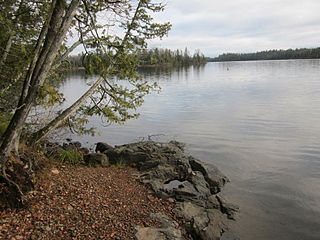
Brule Lake is a lake in Cook County, Minnesota. It is situated between two long sills in the Superior Upland, causing the lake to be eight times longer east and west than it is north and south. Out of the opposite ends flow the Temperance River and the South Brule, a tributary of the Brule River. Brule Lake was logged heavily in the early 1900s, and the region around it was consumed in 1929 by a logging-related forest fire which bears Brule Lake's name. Now the lake is part of the protected Boundary Waters Canoe Area, a federal wilderness area for which Brule Lake serves as an entrance point.
There are three Manistique Lakes in the Upper Peninsula of Michigan. The lakes include North Manistique Lake, Big Manistique Lake, and South Manistique Lake. The towns surrounding the lakes are Curtis Township, Germfask, and Helmer. The lakes are known for vacationing and fishing. They are also in close proximity to other natural sights such as the Great Lakes, rivers, and smaller lakes as well as tourist attractions including the Canada–US border, the Soo Locks, Mackinac Island, parks, and museums.
Iowa Lake is a 30-acre lake in Cook County, Minnesota which is tributary to the Poplar River. It has a maximum depth of 13 feet and is clear down to 7 feet. Water access is provided by a portage trail leading to its northeast shore. The lake is fed primarily by a stream on its northwest shore, with secondary intake coming from a pond of less than 100 feet to the north and an intermittent stream located to the south of the portage trail. Its outlet, on the south, empties into Corny Lake through a wetland area. A 1972 survey by Minnesota's DNR indicated the presence of a beaver lodge on the south outlet, and multiple beaver dams along the course of the creek have converted patches of the marsh into open water. A 1971 survey by the fisheries department indicated the lake was home to populations of northern pike, white sucker, and yellow perch.
Green Lake is a lake in Chisago City, Minnesota, United States. This lake is sometimes also referred to as "Big Green Lake" because it is connected to Little Green Lake by a channel. Green Lake was named from the fact its waters are green from the high algae content.
Medicine Lake is an inland lake located approximately 8 miles northwest of downtown Minneapolis, Minnesota. The lake lies within Hennepin County and is surrounded by two municipalities. At 902 acres, it is Hennepin County's second largest lake behind Lake Minnetonka and is popular among boaters, sailors, and fishers. Medicine Lake's most significant tributary is Plymouth Creek, which enters the lake at West Medicine Lake Park. The lake is also fed by rain and drainage from nearby cities, including Medicine Lake, Plymouth, New Hope, Golden Valley and Minnetonka.

