Spring Valley is an unincorporated community in Colbert County, Alabama, United States. Spring Valley is located at the junction of County Highways 57 and 61, 6.7 miles (10.8km) south-southeast of Muscle Shoals.[2] Spring Valley was the site of the former Spring Valley grade school and hosted many things, such as the Miss Spring Valley Pageant. One of the winners was Miss Doris (Hunter) Lowery. Spring Valley school hosted large political rallies in the 1960s, on the Saturday before the spring primary elections. Big Jim Folsom appeared one night thinking everyone had come out to see him.
In law, an unincorporated area is a region of land that is not governed by a local municipal corporation; similarly an unincorporated community is a settlement that is not governed by its own local municipal corporation, but rather is administered as part of larger administrative divisions, such as a township, parish, borough, county, city, canton, state, province or country. Occasionally, municipalities dissolve or disincorporate, which may happen if they become fiscally insolvent, and services become the responsibility of a higher administration. Widespread unincorporated communities and areas are a distinguishing feature of the United States and Canada. In most other countries of the world, there are either no unincorporated areas at all, or these are very rare; typically remote, outlying, sparsely populated or uninhabited areas.
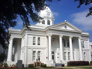
Colbert County is a county of the U.S. state of Alabama. As of the 2010 census the county's population was 54,428. The county seat is Tuscumbia. Its name is in honor of brothers George and Levi Colbert, Chickasaw Indian chiefs.
Alabama is a state in the southeastern region of the United States. It is bordered by Tennessee to the north, Georgia to the east, Florida and the Gulf of Mexico to the south, and Mississippi to the west. Alabama is the 30th largest by area and the 24th-most populous of the U.S. states. With a total of 1,500 miles (2,400 km) of inland waterways, Alabama has among the most of any state.
Spring Valley is home to several churches, including Spring Valley Church of Christ, Spring Valley Baptist, Spring Valley Church of God, and Mt Moriah Baptist. Spring Valley is home to Bobby Wright, who since the 1970s has provided a Christmas light spectacle along his circular drive and is visited by thousands from Thanksgiving to new years.
Spring Valley has been home to country stores through the years, including stores owned by Wallace Rutland, Dewey Isbell, Hubert Stanley, Rube Mitchell, and Mr. Elmer "Ford" and Mrs. Wylodean McDaniel Fuller. Mr. Mitchell also operated a cotton gin behind the store.
The Rogers Group has operated a limestone quarry located between the Three Mile Lane and Gargis Lane since the 1950s. Known back in the day as the "rock crusher", blasts from the quarry could be felt across Spring Valley as the quarry was expanded. A more recent company calling Spring Valley home is Sims Bark Co., located at the intersection of 3 Mile Lane and Spring Valley Road. The company sells mulch, soil, and landscaping material. Spring Valley is also home to the Colbert base for AirEvac Helicopter Service.
This page is based on this Wikipedia article Text is available under the CC BY-SA 4.0 license; additional terms may apply. Images, videos and audio are available under their respective licenses.
Related Research Articles
Montgomery is the capital city of the U.S. state of Alabama and the county seat of Montgomery County. Named for Richard Montgomery, it stands beside the Alabama River, on the coastal Plain of the Gulf of Mexico. In the 2010 Census, Montgomery's population was 205,764. It is the second most populous city in Alabama, after Birmingham, and is the 118th most populous in the United States. The Montgomery Metropolitan Statistical Area's population in 2010 was estimated at 374,536; it is the fourth largest in the state and 136th among United States metropolitan areas.
Birmingham is a city located in the north central region of the U.S. state of Alabama. With an estimated 2017 population of 210,710, it is the most populous city in Alabama. Birmingham is the seat of Jefferson County, Alabama's most populous and fifth largest county. As of 2017, the Birmingham-Hoover Metropolitan Statistical Area had a population of 1,149,807, making it the most populous in Alabama and 49th-most populous in the United States. Birmingham serves as an important regional hub and is associated with the Deep South, Piedmont, and Appalachian regions of the nation.
Locust Fork is a town in Blount County, Alabama, United States. At the 2010 census the population was 1,186 people, up from 1,016 in 2000.
Cherokee is a town in west Colbert County, Alabama, United States. It is part of the Florence–Muscle Shoals metropolitan area, known as "The Shoals". As of the 2010 census, the population of the town was 1,048.
The city of Douglasville is the county seat of Douglas County, Georgia, United States. As of the 2010 census, the city had a population of 30,961, up from 20,065 in 2000.
Utica is a town in Hinds County, Mississippi, United States. The population was 820 at the 2010 census, down from 966 at the 2000 census. Utica is part of the Jackson Metropolitan Statistical Area.
Belgreen is a census-designated place and unincorporated community in Franklin County, Alabama, United States, located west of Russellville and around east of Red Bay on Alabama Highway 24. As of the 2010 census, its population was 129. Belgreen is a small district, composed of a condensed area of residency, the school, a small gas station, car wash,and a new Dollar General.
Powell is an unincorporated community in Knox County, Tennessee, United States. The area is located in the Emory Road corridor, just north of Knoxville, southeast of Clinton, and east of Oak Ridge. The United States Geographic Names System classifies Powell as a populated place. It is included in the Knoxville, Tennessee Metropolitan Statistical Area.
State Route 150 (SR 150) is a 11.833-mile-long (19.043 km) state highway that connects the Birmingham suburbs of Bessemer and Hoover in Jefferson County in the central part of the U.S. state of Alabama. The western terminus of the highway is at an intersection with U.S. Route 11 (US 11) and SR 5 in Bessemer. The eastern terminus of the highway is at an intersection with US 31 in Hoover.
The Anniston–Oxford metropolitan statistical area is the most populated metropolitan area in Northeast Alabama next to Huntsville. At the 2000 census, it had a population of 112,249. The MSA is anchored by significant jobs at Jacksonville State University, the Northeast Alabama Regional Medical Center, Stringfellow Hospital, the Anniston Army Depot, and the Department of Homeland Security at McClellan. McClellan has transitioned from being a closed military base, to becoming the home of hundreds of residents, new retail growth such as a Lowe's Home Improvement Store, and now more than 3,000 jobs spread out over more than 20 employers. Anniston remains strong in health care, legal, financial services and manufacturing. Oxford, with Interstate 20 running right through it, has developed a number of retail and restaurant establishments including the Oxford Exchange which is anchored by Target.
Hamptonville is an unincorporated community located in southwestern Yadkin County, North Carolina, United States. Hamptonville is named for Henry Hampton (1750–1832), a colonel in the Revolutionary Army. Hampton set aside land for a town in 1806.
Courtney is an unincorporated community in southeastern Yadkin County, North Carolina, United States.
Adger is an unincorporated crossroads community in Jefferson County, Alabama, southwest of Birmingham.
Belle Mont is a historic Jeffersonian-style plantation house near Tuscumbia in Colbert County, Alabama. It was added to the National Register of Historic Places on February 23, 1982, due to its architectural significance.
Wisdom is an unincorporated community located in Metcalfe County, Kentucky, United States. It was also known as Nicols and Old Randolph.
Flippin is an unincorporated community located in Monroe County, Kentucky, United States. A small residential village is located on Highway 249, approximately 3.6 miles south of the Monroe-Barren County line. The village and community surround the intersection of Highway 249, Highway 678, and Highway 100. Flippin is situated northwest of Gamaliel, west of Tompkinsville, and east of Fountain Run.
Cooks Springs is an unincorporated community in St. Clair County, Alabama, United States. Cooks Springs is located along Interstate 20 and U.S. Route 78, 6.3 miles (10.1 km) west of Pell City. Cooks Springs had a post office until November 19, 2011; it still has its own ZIP code, 35052. Cooks Springs was named for William Proctor Cooke, who settled here in 1854.
Magnet is an unincorporated community in southeast Wharton County, in the U.S. state of Texas. The rural community is situated at the intersection of State Highway 60 (SH 60) and County Road 102 a short distance north of the Matagorda County line. Founded in the first decade of the 20th Century by a land developer, the town prospered for a time but eventually lost its school, post office, railroad and businesses. Magnet is identified by road signs on SH 60 and by a tall broadcasting tower. A nearby oil field takes its name from the community.