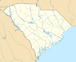
Springville is a ghost town in Darlington County, South Carolina, United States. There was a post office in operation from 1826 until 1832. [1]
A ghost town is an abandoned village, town, or city, usually one that contains substantial visible remains. A town often becomes a ghost town because the economic activity that supported it has failed, or due to natural or human-caused disasters such as floods, prolonged droughts, government actions, uncontrolled lawlessness, war, pollution, or nuclear disasters. The term can sometimes refer to cities, towns, and neighbourhoods that are still populated, but significantly less so than in past years; for example, those affected by high levels of unemployment and dereliction.
Darlington County is a county in the U.S. state of South Carolina. As of 2016, its estimated population was 67,234. Its county seat is Darlington. Hartsville is the largest city in the county. Darlington County is home to the Darlington Raceway, which hosts the annual NASCAR Southern 500. Darlington County is also home to Coker College in Hartsville. Darlington County was named by an act in March 1785.
South Carolina is a state in the Southeastern United States and the easternmost of the Deep South. It is bordered to the north by North Carolina, to the southeast by the Atlantic Ocean, and to the southwest by Georgia across the Savannah River.
It is the location given in the National Register of Historic Places for six places (all registered on October 10, 1985):
The National Register of Historic Places (NRHP) is the United States federal government's official list of districts, sites, buildings, structures, and objects deemed worthy of preservation for their historical significance. A property listed in the National Register, or located within a National Register Historic District, may qualify for tax incentives derived from the total value of expenses incurred preserving the property.
Arthur Goodson House, also known as John M. Lide House, is a historic home located at Springville, Darlington County, South Carolina. It was built in the 1850s, and is a 1 1/2 story, three bay, rectangular, central hall, weatherboard-clad, frame residence. The front façade features a full-width, hipped roof porch. Also on the property are two outbuildings, one weatherboard-clad, braced-frame building dating from the antebellum period and one tobacco barn constructed in the late-19th or early-20th century.
John L. Hart House, also known as Goodson House, is a historic home located at Springville, Darlington County, South Carolina. It was built about 1856 and is a two-story rectangular frame house with a central block and telescoping wings. It is clad in weatherboard and features a hip-roofed, one-story porch across the front façade. At the outbreak of the American Civil War, Hart was commissioned an officer in the Confederate Army and was killed in action.
Evan J. Lide House, also known as Meade House, is a historic home located at Springville, Darlington County, South Carolina. It was built about 1839, and is a rectangular, two-story gable-roofed weatherboard-clad dwelling. It is set on a brick pier foundation and has a central hall plan. The front façade features a full-width, one-story, shed-roofed porch supported by square, solid pine posts.
This is a list of items on the National Register of Historic Places listings in Darlington County, South Carolina.
Darlington is a city located in Darlington County, South Carolina, United States. In 2016, its population was 6,117. It is the county seat of Darlington County. It is part of the Florence, South Carolina Metropolitan Statistical Area.
Society Hill is a town in Darlington County, South Carolina, United States. It is the oldest community in Darlington County. The population was 563 at the 2010 census, down from 700 in 2000. It is part of the Florence Metropolitan Statistical Area.
Haydenville is an unincorporated community and census-designated place (CDP) in southern Green Township, Hocking County, Ohio, United States. As of the 2010 census the population of the CDP was 381.
Farrington is an unincorporated community in Chatham County, North Carolina, United States. It is now part of the Fearrington Village census-designated place.
Bells is an unincorporated community in Chatham County, North Carolina, south of Farrington. It lies at an elevation of 226 feet.
Wilton is an unincorporated community in southern Granville County, North Carolina, north of Grissom, North Carolina. Former home of Wilton High School. It was declared no longer a city in 1985 when the state removed its post office charter.
Mountain Rest is an unincorporated community near the Chattooga River in northwestern Oconee County, South Carolina in southeastern United States. The community is on South Carolina Highway 28 adjacent to a lake on Taylor Creek.
Wheeler is an unincorporated community in Lawrence County, Alabama, United States. Wheeler had a post office at one time, but it no longer exists. Wheeler has two sites on the National Register of Historic Places, the Tidewater-type cottage known as Bride's Hill and the former home of Joseph Wheeler, Pond Spring.
Hickory Tavern, is an unincorporated community in Laurens County, South Carolina, United States. It is classified by the federal government as a class U6 populated place. It is centered at the intersection of US Route 76 and South Carolina Highway 101.
Glendale is a census-designated place located in Spartanburg County in the U.S. State of South Carolina. According to the 2010 United States Census, the population was 307.
Cross Keys is an unincorporated community in Union County, South Carolina. Historically, it was the site of the "large and prosperous" Cross Keys plantation. A post office was established at Cross Keys in 1809 and operated until 1909. Cross Keys House, the plantation house built in 1812–1814, stood at the intersection of two important early highways and was a stop for early travelers. It is listed on the National Register of Historic Places. Also listed is Padgett's Creek Baptist Church.
The U.S. Post Office-Springville Main at 309 South Main Street in Springville, Utah, United States was built in 1941. It was built in Colonial Revival style and credited to supervising architect Louis A. Simon. It has also been known as Springville Main Post Office. It was listed on the National Register of Historic Places in 1989.
Bingham was a historical community in Dillon County, South Carolina, in operation 1892 to 1941.
John W. Lide House, also known as Atkinson House, is a historic home located at Springville, Darlington County, South Carolina. It was built about 1830-1840, and is a two-story, rectangular, central-hall, frame residence with a low-pitched hip roof. The house features two massive, stuccoed brick, interior chimneys. It is sheathed in weatherboard and sits on a brick pier foundation with brick fill. A full-width, one-story, hip roof porch extends across the entire façade and wraps both side elevations. Also on the property is an antebellum outbuilding.
White Plains, also known as the Thomas P. Lide House and Blackmon House, is a historic home located at Springville, Darlington County, South Carolina. It was built about 1822, and is a two-story, square, frame, weatherboard-clad residence with a low-pitched hip roof. The house was substantially remodeled in about 1839 and in the late 1840s or early 1850s. Also on the property is a contributing single-pen log corn crib. Thomas Lide was one of the most active and involved members of the Springville community.
Wilds Hall, also known as the Peter A. Wilds House and Wilson House, is a historic home located at Springville, Darlington County, South Carolina. It was built about 1839, and enlarged to its present size about 1850. It is a 2 1/2-story, rectangular, weatherboard clad, frame residence with gabled roof. It sits on a low stuccoed brick pier foundation. Also on the property are four associated outbuildings. Peter Wilds was a wealthy planter owning 111 slaves in 1860. This house was lived in by four generations of the Wilds family over a 130-year period.
Lavender is an unincorporated community in Floyd County, in the U.S. state of Georgia.
This South Carolina state location article is a stub. You can help Wikipedia by expanding it. |
Coordinates: 34°20′28″N79°51′16″W / 34.34111°N 79.85444°W
A geographic coordinate system is a coordinate system that enables every location on Earth to be specified by a set of numbers, letters or symbols. The coordinates are often chosen such that one of the numbers represents a vertical position and two or three of the numbers represent a horizontal position; alternatively, a geographic position may be expressed in a combined three-dimensional Cartesian vector. A common choice of coordinates is latitude, longitude and elevation. To specify a location on a plane requires a map projection.