Society Hill, South Carolina | |
|---|---|
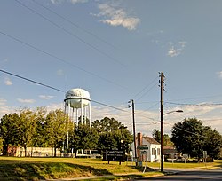 Water tower and buildings in Society Hill | |
 Location of Society Hill, South Carolina | |
| Coordinates: 34°30′25″N79°51′16″W / 34.50694°N 79.85444°W [1] | |
| Country | United States |
| State | South Carolina |
| County | Darlington |
| Area | |
• Total | 2.15 sq mi (5.56 km2) |
| • Land | 2.15 sq mi (5.56 km2) |
| • Water | 0 sq mi (0.00 km2) |
| Elevation | 157 ft (48 m) |
| Population | |
• Total | 438 |
| • Density | 203.9/sq mi (78.72/km2) |
| Time zone | UTC-5 (Eastern (EST)) |
| • Summer (DST) | UTC-4 (EDT) |
| ZIP code | 29593 |
| Area codes | 843, 854 |
| FIPS code | 45-67435 [4] |
| GNIS feature ID | 2407364 [1] |
Society Hill is a town in Darlington County, South Carolina, United States alongside the Pee Dee River. It is the oldest community in Darlington County and one of the first towns founded in South Carolina. The town was once the intellectual center of the Pee Dee region. However, the town's fortunes declined in the 19th century after rivers became less important as means of transportation. It is part of the Florence Metropolitan Statistical Area.
Contents
In the 2020 census, the population of Society Hill was 438, down from 563 in 2010, 700 in 2000 and 848 in 1980. Society Hill was originally settled in the 18th century by a colony of Baptists, who named the community after their "St. David's Society," the predecessor to the Society Hill Library Society.
