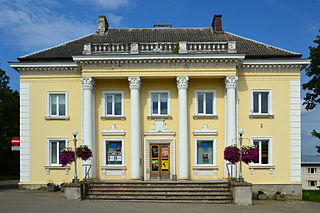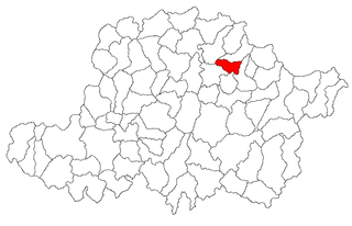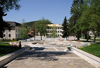
Perushtitsa or Perushtitza is a Bulgarian town located in Perushtitsa Municipality, Plovdiv Province at the foot of the Rhodopes, 22 kilometers south of Plovdiv.

Otepää Parish is a rural municipality in Valga County, southern Estonia. It includes the town of Otepää.

Tutrakan is a town in northeastern Bulgaria, an administrative centre of the homonymous municipality, part of Silistra Province. It is situated on the right bank of the Danube opposite the Romanian town of Oltenița, in the very west of Southern Dobruja, 58 km east of Rousse and 62 km west of Silistra. As of December 2009, the town has a population of 9,476 inhabitants.

Archiș is a commune in Arad County, Romania. It is situated in the northern part of the Sebiș Basin, at the foot of the Codru Moma Mountains, and its surface is 68.07 km2. It is composed of four villages: Archiș, Bârzești (Barzafalva), Groșeni (Tönköd) and Nermiș (Nermegy).

Godech is a small town located in the Sofia Province, of Bulgaria. The town is founded in a valley on the far west of Stara Planina, where the Nishava River passes. The settlement is about 20 km east of the Serbian border and has its highest peak Kom to the north. Godech is officially a town with 4,663 inhabitants. It is the administrative center of the Godech municipality.
Asturianos is a municipality located in the Sanabria comarca, province of Zamora, Castile and León, Spain. According to the 2009 census (INE), the municipality had a population of 267 inhabitants. The Leonese language is still spoken here. It is on the Sanabres variant of the Via de la Plata pilgrim camino to Santiago de Compostela.

Selnik is a village in the Republic of Macedonia. It belongs to the Delčevo municipality and is situated on one of the mountains next to the town of Delčevo. Parts of the village are named after Sezotove's old family clans who settled there long time ago, for example Lesovci.

Sungurlare is a town in southeastern Bulgaria, part of Burgas Province. It is the administrative centre of Sungurlare municipality, which lies in the northwestern part of Burgas Province.
Nagyrécse is a village in Zala County, Hungary.
Volno is a village in Petrich Municipality, in Blagoevgrad Province, Bulgaria.
Kozare is a village in Karnobat Municipality, in Burgas Province, in southeastern Bulgaria.

Sennik is a village in the municipality of Sevlievo, in Gabrovo Province, in northern central Bulgaria.
Zlatopole, Haskovo Province is a village in the municipality of Dimitrovgrad, in Haskovo Province, in southern Bulgaria.
Krum, Haskovo Province is a village in the municipality of Dimitrovgrad, in Haskovo Province, in southern Bulgaria.
Georgi Dobrevo is a village in the municipality of Lyubimets, in Haskovo Province, in southern Bulgaria. It was known as Bunaklı before 1934
Kostilkovo is a village in the municipality of Ivaylovgrad, in Haskovo Province, in southern Bulgaria. It was known as "Çekirdekli" during Ottoman rule
Odrintsi, Haskovo Province is a village in the municipality of Ivaylovgrad, in Haskovo Province, in southern Bulgaria. Its former name was "Hallaçlı" before 1934
Siv Kladenets is a village in the municipality of Ivaylovgrad, in Haskovo Province, in southern Bulgaria. It was known as "Gökçepınar" during Ottoman rule and was taken present name in 1934
Bukovets (Буковец) is a village in Veliko Tarnovo Municipality, Veliko Tarnovo Province, Bulgaria. Bukovets's population is about 52 people.
The official language of Bulgaria is Bulgarian. According to the 2001 census, 84.5% of the country's population speak Bulgarian natively.


