St. Edmund's Chapel, Lyng

Last updated

St. Edmund's Chapel
St Edmund's Chapel, Lyng 2.jpg
The fragmentary ruins of the chapel
Religion
Affiliation Christianity
StatusRuin
Location
Location Lyng, Norfolk
Country UK
Geographic coordinates 52°42′49″N1°04′35″E / 52.7135°N 1.0764°E / 52.7135; 1.0764

The ruins of St. Edmund's Chapel are located in a field to the east of the village of Lyng in the English county of Norfolk. It was one of two religious buildings in Lyng, the other being St. Margaret's Church.

Contents

The chapel was part of a Benedictine nunnery, purportedly founded to commemorate a battle with the Danes during their 9th century campaign which would end with the death of Edmund the Martyr. [1] The nunnery was transferred to Thetford in 1176. The chapel was not abandoned until at least 1250, and a fair was held on the site by the Prioress of St. George's Priory, Thetford in 1287. [2] The nuns retained a messuage and 90 acres (36 ha) of land at Lyng, paying for a chaplain to service the chapel from the profits. A lawsuit is recorded in 1438 between the prioress and the rector of Lyng, after which date the land was transferred to the village church. [3]

There is a reference to the chapel in the Bodleian MS 240. [4] This dates from the 1370s, when in the space of five years there were seven miracles connected with the chapel. These mostly involved incidents in the surrounding villages, such as Bylaugh, Scarning and Sparham, but one involved a man from Kent whose wife was cured of paralysis.

The chapel was in ruins by 1730. [2] The brickwork in the remaining ruins is probably fifteenth century in date, and it is possible that the site remained in use until the Reformation, possibly as a chapel of ease for the hamlet of Lyng Eastaugh to the east. The ruins of the chapel which remain are described as "fragmentary" [5] although Nikolaus Pevsner recorded a surviving arch during the 1950s, possibly the north doorway. [6] Only part of the arch remains, and the ruins are largely obscured by vegetation. [5] Objects ranging from Roman to post-medieval in date have been found on the site. [5] During the 19th century human skeletons were found between the chapel and the road to the south. [2]

In folklore

The Great Stone of Lyng The Great Stone of Lyng.jpg
The Great Stone of Lyng

A newspaper article from 1939 [7] records a tradition concerning the chapel. It was said that it was founded for the nuns to pray for the souls of those killed in a battle between the Danes and King Edmund's Anglo-Saxons which may have occurred near to the site of the chapel. [8] The Grove, an area of woodland, which appears on maps from the 18th century as King's Grove, lies to the south of the chapel. An "ancient" hollow way runs through the wood connecting the hamlet of Collen's Green to the road. [8] [9] A boulder known as the Great Stone of Lyng – a glacial erratic of conglomerate stone, left in the moraine of a retreating glacier – lies alongside the track. The stone is about 2 metres long by 1 metre wide and has been associated in folklore with "druids, devils, sounds, the stone moving or growing, burials and treasure" as well as the stone bleeding "if pricked with a pin". [8] [10] [11]

When the nuns left Lyng in the twelfth century they retained the income derived from holding the annual fair on 20 November (St Edmund's day). This fair long outlived the nunnery; it survived into the last quarter of the nineteenth century and is mentioned in Parson Woodforde's diary. [12] There was also a guild of St Edmund in the village.

Sources

Related Research Articles

<span class="mw-page-title-main">River Little Ouse</span> River in east England

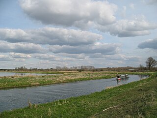
The River Little Ouse, also known as the Brandon River, is a river in the east of England, a tributary of the River Great Ouse. For much of its length it defines the boundary between Norfolk and Suffolk.

<span class="mw-page-title-main">Thetford</span> Human settlement in England

Thetford is a market town and civil parish in the Breckland District of Norfolk, England. It is on the A11 road between Norwich and London, just east of Thetford Forest. The civil parish, covering an area of 29.55 km2 (11.41 sq mi), in 2011 had a population of 24,340.

<span class="mw-page-title-main">Lower Catesby</span> Human settlement in England

Lower Catesby is a hamlet in the civil parish of Catesby, Northamptonshire, about 4 miles (6.4 km) southwest of Daventry. Lower Catesby is beside the nascent River Leam, which rises about 1 mile (1.6 km) to the south in the parish of Hellidon. The Jurassic Way long-distance footpath passes through Lower Catesby. The population of the hamlet is included in the civil parish of Hellidon.

Sopwell Priory was a Benedictine nunnery founded around 1140 on the site of an ancient hermitage in Sopwell, Hertfordshire, England. After the Dissolution, the priory was torn down and a Tudor manor house constructed in its place.

<span class="mw-page-title-main">Lyng, Norfolk</span> Human settlement in England

Lyng is a village and civil parish in the English county of Norfolk. It is situated on the River Wensum, some 10 km (6.2 mi) north-east of the town of East Dereham and 20 km (12 mi) north-west of the city of Norwich.

<span class="mw-page-title-main">Thetford Priory</span> Monastic house in Norfolk, England

Thetford Priory is a Cluniac monastic house in Thetford, Norfolk, England. Founded in 1103 by Roger Bigod of Norfolk, Thetford was one of the most important monasteries of East Anglia.

<span class="mw-page-title-main">St Julian's, Norwich</span> Medieval church in Norwich, Norfolk

St Julian's is a Grade I listed parish church in the Church of England in Norwich, England. It is part of the Diocese of Norwich. During the Middle Ages, when the city was prosperous and possibly the second largest city in medieval England, the anchoress Julian of Norwich lived in a cell attached to the church. The cell was demolished during the 1530s.

<span class="mw-page-title-main">Iona Nunnery</span>

The Iona Nunnery was an Augustinian convent of nuns located on the island of Iona in the Inner Hebrides of Scotland. It was established sometime after the foundation of the nearby Benedictine monastery in 1203 by Ranald, son of Somerled. Bethóc, daughter of Somerled, and sister of Ranald, was first prioress. The ruins of the nunnery stand in a peaceful precinct adjacent to Iona's main village, Baile Mor. They form the most complete remains of a medieval nunnery extant in Scotland. After the Reformation, the priory was dissolved and reduced to a ruin.

<span class="mw-page-title-main">Rosedale Abbey</span> Village in North Yorkshire, England

Rosedale Abbey is a village in the Ryedale district of North Yorkshire, England. It is approximately 8 miles (13 km) north-west of Pickering, 8 miles south-east of Castleton and within Rosedale, part of the North York Moors National Park.

<span class="mw-page-title-main">Old Hunstanton</span> Human settlement in England

Old Hunstanton is a village and civil parish in the English county of Norfolk. It covers an area of 5.35 km2 (2.07 sq mi) and had a population of 47 in 25 households at the 2001 census. The population had risen to 628 at the 2011 Census. For the purposes of local government, it falls within the district of King's Lynn and West Norfolk.

<span class="mw-page-title-main">King's Mead Priory</span>

King's Mead Priory was a Benedictine Priory situated west of Derby, in the area currently known as Nun's Street, or Nun's Green. It was the only Benedictine Nunnery in Derbyshire.

<span class="mw-page-title-main">Swine Priory</span>

Swine Priory was a priory in the village of Swine in the East Riding of Yorkshire, England. The site of the Cistercian nunnery is a Scheduled Monument.

<span class="mw-page-title-main">Crabhouse Priory</span>

Crabhouse Priory was a medieval monastic house in Norfolk, England.

St. George's Priory, Thetford was a Benedictine priory on the Suffolk side of Thetford, England. It was located at the current site of the British Trust for Ornithology, South of Nuns Bridges Road.

Blackfriars, Thetford was a priory in Norfolk, England, which belonged to the Dominican Order. It was one of several religious houses in Thetford closed at the time of the Dissolution of the Monasteries. The site is now occupied by Thetford Grammar School.

<span class="mw-page-title-main">Carrow Abbey</span> Benedictine priory in Norfolk, England

Carrow Abbey is a former Benedictine priory in Bracondale, southeast Norwich, England. The village on the site used to be called Carrow and gives its name to Carrow Road, the football ground of Norwich F.C., located just metres to the north. Granted by charter of King Stephen, the abbey was founded ca. 1146, and became a Grade I listed building in 1954.

Campsey Priory,, was a religious house of Augustinian canonesses at Campsea Ashe, Suffolk, about 1.5 miles (2.5 km) south east of Wickham Market. It was founded shortly before 1195 on behalf of two of his sisters by Theobald de Valoines, who, with his wife Avice, had previously founded Hickling Priory in Norfolk for male canons in 1185. Both houses were suppressed in 1536.

<span class="mw-page-title-main">Kirklees Priory</span>

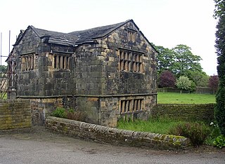
Kirklees Priory was a Cistercian nunnery whose site is in the present-day Kirklees Park, Clifton near Brighouse, Calderdale, West Yorkshire, England. It was originally in the ancient ecclesiastical parish of Dewsbury. The priory dedicated to the Virgin Mary and St James was founded by Reiner le Fleming, Lord of the manor of Wath upon Dearne, in 1155 during the reign of Henry II.

Richard Fulmerston, of Ipswich, Suffolk and Thetford, Norfolk, was an English politician, entrepreneur, and philanthropist.

References

  1. Pinner, Rebecca (2015). The cult of St Edmund in medieval East Anglia. Woodbridge: Boydell Press. pp. 185–6. ISBN   978-1-78204-533-5. OCLC   914165854.
  2. 1 2 3 Ruins of St Edmund's Chapel, Lyng and multi-period finds, Norfolk Heritage Explorer. Retrieved 2018-12-03.
  3. The nunnery of St George, Thetford in Page W (ed) (1906) A History of the County of Norfolk: Volume 2. London: Victoria County History. (Available online. Retrieved 2018-12-06.)
  4. T. Arnold (ed.) Memorials of St Edmund’s Abbey; Vol. III (London, 1896) pp. 327-35
  5. 1 2 3 Parish Summary: Lyng, Norfolk Heritage Explorer. Retrieved 2018-12-03.
  6. Knott S (2006) St Edmund, Lyng, Norfolk Churches. Retrieved 2018-12-06.
  7. In the Eastern Daily Press 13 March 1939, p.13.
  8. 1 2 3 Lyng Heritage Trail, Norfolk Heritage Explorer. Retrieved 2018-12-03.
  9. The Grove, King's Grove, Norfolk Heritage Explorer. Retrieved 2018-12-03.
  10. The Great Stone of Lyng, Norfolk Heritage Explorer. Retrieved 2018-12-03.
  11. Briggs S, Connor S (2017) Weird Norfolk: The great stone of Lyng, Eastern Daily Press , 2017-12-15. Retrieved 2018-12-06.
  12. John Beresford (ed.), The Diary of a Country Parson, the Reverend James Woodforde vol.III (Oxford, 1927) p.228.