Mainistir Mhuire | |
Monastery information | |
---|---|
Order | Order of Saint Benedict (846–1139) Congregation of Savigny (1139–1147) Cistercian Order (1147–1539) |
Established | AD 846 |
Disestablished | 1539 |
Dedicated to | Mary, mother of Jesus |
Diocese | Dublin |
People | |
Founder(s) | Máel Sechnaill mac Máele Ruanaid |
Abbot | Walter Champfleur (c.1468-99), John Orum (1499-?) |
Architecture | |
Functional status | Museum |
Heritage designation | National Monument |
Style | Cistercian |
Site | |
Location | Abbey Street, Dublin, Ireland |
Coordinates | 53°20′51″N6°16′09″W / 53.3475°N 6.269167°W |
Public access | yes |
Official name | St. Mary's Abbey |
Reference no. | 401 [1] |
St. Mary's Abbey (Irish : Mainistir Mhuire) was a former Cistercian abbey located near the junction of Abbey Street and Capel Street in Dublin, Ireland. Its territory stretched from the district known as Oxmanstown down along the River Liffey until it met the sea. It also owned large estates in other parts of Ireland. It was one of several liberties that existed in Dublin since the arrival of the Anglo-Normans in the 12th century, which gave it jurisdiction over its lands.
The abbey was founded by the Irish king Máel Sechnaill mac Máele Ruanaid (died 862) in 846, according to the Annals of the Four Masters. It was originally Benedictine, but in 1139 was given by Malachy O'Morga, the legate of the Pope, to monks belonging to the Congregation of Savigny, which in 1147 joined the Cistercian order. [2]
In 1303, a great part of the abbey and church was destroyed by fire but was reconstructed. However, many of the city records and Court pleadings in the chancery stored in the abbey were destroyed. [3] The abbey was one of the largest and richest in Ireland at that time. A series of charters and statutes of the Parliament of Ireland increased its liberties, including the right to claim goods salvaged from shipwrecks on the coast of County Dublin, and the right to deal with their lands in territories controlled by the "hostile Irish" without incurring the usual penalties. [4]
In 1316, Robert de Nottingham, then Mayor of Dublin, attacked the abbey where the Earl of Ulster, Richard Óg de Burgh, was visiting. De Burgh was suspected of having brought Edward Bruce, who was then marching on Dublin, to Ireland. Several of de Burgh's men were killed before he was captured, and as the monks were suspected of supporting Bruce, the abbey was laid waste.
In the fifteenth century Walter Champfleur became Abbot of St Mary's in 1467, and held office for more than thirty years. He was a political figure of some importance, due partly to his close association with Thomas Butler, 7th Earl of Ormond, to whom he acted as a political and financial adviser. He was briefly Keeper of the Great Seal of Ireland in 1482-3. He died around 1498, much mourned by his Order as an "aged, prudent and learned man".
At a meeting of the Privy Council in the Chapter House, Silken Thomas started his rebellion of 1534 here, by throwing down his Sword of State. [5]
After the Dissolution of the Monasteries in 1539 the property was given over to John Travers and the church became an arsenal and part of a quarry. The spacious lands which had been owned by the monks came in time to be let to persons who desired to build residences or places of business thereon. [2]
In 1619, Sir Gerald Moore of Mellifont, Drogheda, received from King James I of England a grant of the abbey, together with its tithes and lands. He later became Viscount Moore of Mellifont. The family of Moore made the Abbey their Dublin residence up to the close of the 17th century, and it was Henry Moore, 1st Earl of Drogheda, who built himself a mansion on what is now O'Connell Street and developed Henry, Moore and Earl streets. [2]
In 1676, stone from the ruins of the Abbey was used in the building of Essex Bridge (now Grattan Bridge, leading to Parliament Street). [2]
There were two non-conformist chapels on the St. Mary's Abbey site. Meeting House Lane gets its name from the non-conformist chapel. One is known as Burghers (Capel Street) and the other is Seceders or Non-Burghers. The Capel Street Congregation, which became the Abbey Presbyterian Church now on Parnell Square, and the Union Chapel which moved in 1836 to Lower Abbey Street. The Capel Street Congregation Chapel was incorporated into Bolands Bakery, [6] following its move to Rutland (Parnell) Square.
Following the closure of Stafford Street Synagogue, in 1836, the congregation under Rabbi Issac Davidson, purchased the former non-conformist chapel (used by the Union Chapel before they moved to Lower Abbey Street, the sale caused a major conflict within the church) [7] on part of the old abbey (at 12 Mary's Abbey). Davidson was succeeded as Rabbi by Julius Sandheim. [8] The synagogue operated until 1892 when it moved to Adelaide Road.
Dr.Charles Lindsay, Dean of Christ Church Cathedral (1804–46) and afterwards Bishop of Kildare, acquired the old monastic lands of Glasnevin, which had once belonged to the abbey. These were purchased around 1832 to form what is now Glasnevin Cemetery. [2]
The abbey was only rediscovered, 7 feet (2 m) underground and underneath a bakery, in the 1880s, by an amateur archaeologist. His findings were publicized by John Thomas Gilbert. Parts of the old adjoining walls can still be seen. The building is now in the care of Heritage Ireland. The Chapter House is ordinarily open to visitors, by descending a stone staircase. [9]
In 2023, as part of the excavation of the area for the construction of a hotel, the remains of over 100 skeletons dating back to the early 11th century were found on the site. [10]
In 2014, Trinity College Dublin paid almost €250,000 for a manuscript produced at the abbey dated from 1304. [11] [12]
The Northside in an informal but commonly used term to describe the part of the city of Dublin that lies to the north of the River Liffey, and extending into part of North County Dublin. The part outside the city is within the county of Fingal, a local government area established in 1994. While it is sometimes regarded as less wealthy than the city's Southside, the Northside was originally the home of the city's upper classes and the more privileged of the two. Today, some of the wealthiest areas in Ireland, such as Malahide, Howth, Clontarf, and Castleknock, lie north of the river.
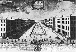
The Wide Streets Commission was established by an Act of Parliament in 1758, at the request of Dublin Corporation, as a body to govern standards on the layout of streets, bridges, buildings and other architectural considerations in Dublin. The commission was abolished by the Dublin Improvement Act of 1849, with the final meeting of the Commission taking place on 2 January 1851.
Kilmacduagh Monastery is a ruined abbey near the town of Gort in County Galway, Ireland. It was the birthplace of the Diocese of Kilmacduagh. It was reportedly founded by Saint Colman, son of Duagh in the 7th century, on land given him by his cousin King Guaire Aidne mac Colmáin of Connacht.
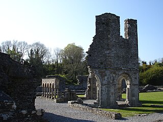
Mellifont Abbey, was a Cistercian abbey located close to Drogheda in County Louth, Ireland. It was the first abbey of the order to be built in Ireland. In 1152, it hosted the Synod of Kells-Mellifont. After its dissolution in 1539, the abbey became a private manor house. This saw the signing of the Treaty of Mellifont in 1603 and served as William of Orange's headquarters in 1690 during the Battle of the Boyne.
Mornington is a coastal village on the estuary of the River Boyne in County Meath, Ireland approximately 5 km downriver from the centre of Drogheda. Together with the neighbouring villages of Laytown, Bettystown and Donacarney, it comprises the urban area of Laytown–Bettystown–Mornington–Donacarney with a combined population of 15,642 at the 2022 census.
Sir William Robinson PC(I) was a British architect, military engineer and politician. He held several posts in the Dublin Castle administration, including as Surveyor General of Ireland from 1671 until 1700. He was an influential figure in the development of classical architecture in Ireland, designing many buildings in the English Baroque-style, particularly in Dublin.
The Liberty of Thomas Court and Donore was one of several manors, or liberties, that existed in County Dublin, Ireland since the arrival of the Anglo-Normans in the 12th century. They were adjacent to Dublin city, and later entirely surrounded by it, but still preserving their own separate jurisdiction.
Abbey Presbyterian Church is a church located at Parnell Square, Dublin. Designed by architect Andrew Heiton of Perth, Scotland, it is a decorated Gothic building, with a spire 180 feet (54.9 m) high. The church was erected in 1864 with funding from Alexander Findlater (1797–1873), a Dublin merchant and philanthropist, and is known colloquially as "Findlater's church", and it is referred to in two of James Joyce's novels as Findlater's Church.
Charles Moore, 2nd Viscount Moore of Drogheda (1603-1643) was an Irish aristocrat noted for his leadership of Irish Royalist forces in northern Leinster during the early stages of the Irish Confederate Wars.
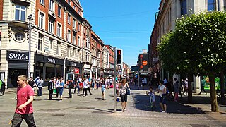
North Earl Street is a short stretch of city-centre street located on Dublin's Northside and formerly a major shopping area. It runs from Marlborough Street in the west to O'Connell Street beside the Spire.
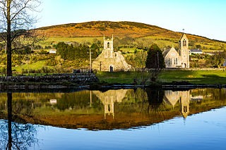
Baltinglass Abbey is a ruined medieval Cistercian abbey in Baltinglass, County Wicklow, Ireland. Founded by Diarmait Mac Murchada in 1148, the abbey was suppressed in 1536. It is today a National Monument.
Humphrey Jervis (1630–1707) was one of the first notable private developers in the history of Dublin.
The Unitarian Church in Ireland presently consists of two Congregations, Dublin and Cork, part of the Synod of Munster, in the Republic of Ireland, which has itself been part of the Non-Subscribing Presbyterian Church of Ireland since 1935. Some congregations remain closely associated with the General Assembly of Unitarian and Free Christian Churches. These churches would abide by the traditional Unitarian principles of Freedom, Reason, and Tolerance.
Killaghaduff is a townland in the civil parish of Kinawley, barony of Tullyhaw, County Cavan, Ireland.
Capel Street is a predominantly commercial street in Dublin, Ireland, laid out in the 17th century by Humphrey Jervis.
Cathedral Street is a street in central Dublin, Ireland, formerly known as Elephant Lane and Tyrone Place.