Related Research Articles

Slidell is a city on the northeast shore of Lake Pontchartrain in St. Tammany Parish, Louisiana, United States. The population was 28,781 at the 2020 census. It is part of the New Orleans−Metairie−Kenner metropolitan statistical area.

Alexandria International Airport is a public use airport located four nautical miles west of the central business district of Alexandria, in Rapides Parish, Louisiana, United States. The airport is operated by the England Authority, also known as the England Economic and Industrial Development District, an independent political subdivision of the State of Louisiana. Although international commercial flight operations are not conducted, charter flights for the U.S. military to international destinations are routinely conducted from the airfield with this activity including the transportation of U.S. troops to overseas locations.
Shreveport Regional Airport is a public use airport in Shreveport, Louisiana, United States. It is owned by the City of Shreveport and located four nautical miles (7 km) southwest of its central business district.
Natchitoches Regional Airport is a city-owned public-use airport located two nautical miles (4 km) south of the central business district of Natchitoches, a parish seat of Natchitoches Parish, Louisiana, United States.

Iliamna Airport is a state-owned public-use airport located three nautical miles (5.5 km) west of the central business district of Iliamna, in the Lake and Peninsula Borough of the U.S. state of Alaska.

St. Clair County Airport is a public use airport located three nautical miles southeast of the central business district of Pell City, in St. Clair County, Alabama, United States. It is owned by the St. Clair County Airport Authority. According to the FAA's National Plan of Integrated Airport Systems for 2009–2013, it is categorized as a reliever airport for the Birmingham-Shuttlesworth International Airport.

WYLK, also known as Lake 94.7, is a hot adult contemporary radio station serving the St. Tammany Parish area. Owned by former Mississippi congressman C. Wayne Dowdy under the company name North Shore Broadcasting Co., Inc., the station is licensed to Lacombe, Louisiana, and broadcasts at 94.7 MHz with an ERP of 2,900 watts.
Ruston Regional Airport is a public use airport in Lincoln Parish, Louisiana, United States. It is owned by the City of Ruston and is located three nautical miles (6 km) east of its central business district.
Minden Airport is a public use airport in Webster Parish, Louisiana, United States. The airport is owned by the City of Minden and located two nautical miles (4 km) northwest of its central business district. It was formerly known as Minden-Webster Airport.
Baraboo–Wisconsin Dells Airport is a public use airport located three nautical miles (6 km) northwest of the central business district of Baraboo, in Sauk County, Wisconsin, United States. The airport is located between Baraboo and Lake Delton, Wisconsin, on US 12, and is adjacent to the Ho-Chunk Casino.
Hammond Northshore Regional Airport is a city-owned, public-use, joint civil-military, general aviation airport located three nautical miles (6 km) northeast of the central business district of Hammond, a city in Tangipahoa Parish, Louisiana, United States. The airport was previously an uncontrolled facility utilizing VHF-band UNICOM as a Common Traffic Advisory Frequency (CTAF). As a result of the relocation of Army National Guard flight operations from Lakefront Airport to Hammond, a new control tower was constructed at the airport. This tower, staffed by military air traffic controllers from the Air Operations Department of the Louisiana Army National Guard's Army Aviation Support Facility #1 at the airport, became operational on 15 December 2014.
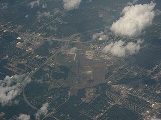
Slidell Airport is a city-owned public-use airport located four nautical miles (7 km) northwest of the central business district of Slidell, a city in St. Tammany Parish, Louisiana, United States.
Abbeville Chris Crusta Memorial Airport is a city-owned, public-use airport located three nautical miles east of the central business district of Abbeville, a city in Vermilion Parish, Louisiana, United States.
Shreveport Downtown Airport is a public use airport located in the Bossier Parish portion of Shreveport, Louisiana, United States. It is closer to downtown Shreveport than the larger Shreveport Regional Airport. It is owned by the Shreveport Airport Authority.
Acadiana Regional Airport is a public use airport in Iberia Parish, Louisiana, United States. It is owned by Iberia Parish, managed by the Iberia Parish Airport Authority and is located four nautical miles (7 km) northwest of the central business district of New Iberia, Louisiana near U.S. 90.
False River Regional Airport is a public use airport located two nautical miles northwest of the central business district of New Roads, a city in Pointe Coupee Parish, Louisiana, United States. The airport is owned by New Roads and Pointe Coupee Parish. According to the FAA's National Plan of Integrated Airport Systems for 2009–2013, it was classified as a general aviation airport.
Monticello Airport is a city-owned, public-use airport located three nautical miles (6 km) north of the central business district of Monticello, a city in San Juan County, Utah, United States. The airport's current site on the east side of U.S. Route 191 opened in 2011, replacing the former Monticello Airport which was located on the west side of the highway.
Arcadia–Bienville Parish Airport is a public-use airport located two nautical miles southwest of the central business district of Arcadia, in Bienville Parish, Louisiana, United States. It is owned by the City of Arcadia.
Kirk Field is a city-owned public-use airport located one nautical mile northwest of the central business district of Paragould, in Greene County, Arkansas, United States.
Caldwell Parish Airport is a public use airport in Caldwell Parish, Louisiana, United States. It is owned by the Caldwell Parish Police Jury and located two nautical miles (4 km) northeast of the central business district of Columbia, Louisiana. It was formerly known as Columbia Airport.