
Francesville is a town in Salem Township, Pulaski County, in the U.S. state of Indiana. The population was 879 at the 2010 census. The motto for Francesville is “A small town with a big heart.”
California is a home rule-class city in Campbell County, Kentucky, United States. The population was 90 at the 2010 census.

Worthville is a home rule-class city in Carroll County, Kentucky, United States. The population was 185 at the 2010 census.
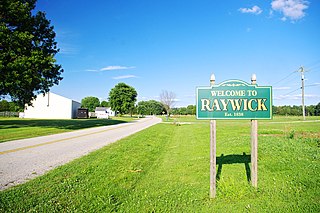
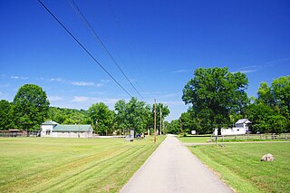
Raywick is a home rule-class city in Marion County, Kentucky, United States. The population was 144 at the 2000 census.

Burnside is a home rule-class city in Pulaski County, Kentucky, in the United States. The population was 611 at the 2010 census. In 2004, Burnside became the only town in Pulaski County or any adjoining county to allow the sale of alcoholic beverages in qualified establishments. Since then, Burnside has annexed about eight miles of shoreline along Lake Cumberland in order to include Lee's Ford Marina on Fishing Creek, allowing it to sell alcohol.

Ferguson is a home rule-class city just south of downtown Somerset in Pulaski County, Kentucky, United States. It had a population of 924 as of the 2010 census, up from 881 in 2000.

Science Hill is a home rule-class city in Pulaski County, Kentucky, in the United States. The population was 693 as of the 2010 U.S. Census.

Sparta is a home rule-class city in Gallatin and Owen counties in the U.S. state of Kentucky. The population was 231 at the 2010 census.

The Pulaski Bridge in New York City connects Long Island City in Queens to Greenpoint in Brooklyn over Newtown Creek. It was named after Polish military commander and American Revolutionary War fighter Casimir Pulaski because of the large Polish-American population in Greenpoint. It connects 11th Street in Queens to McGuinness Boulevard in Brooklyn.
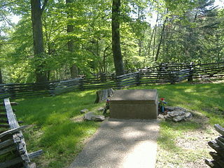
The Confederate Mass Grave Monument in Somerset in Pulaski County, Kentucky, near Nancy, Kentucky, honors the Confederate soldiers who are buried here who died at the Battle of Mill Springs. These soldiers were from Alabama, Mississippi, and Tennessee, and number over one hundred in total.
Democrat is an unincorporated community in Letcher County, in the U.S. state of Kentucky.

Armuchee is an unincorporated community in both Floyd County and Chattooga County, Georgia, United States. The community is located along U.S. Route 27, 9 miles (14 km) north of Rome. Armuchee has a post office with ZIP code 30105. Armuchee also has the Richard B. Russell Airport. On November 1, 2020 this was the location of a Trump rally hosted by Donald Trump, the 45th President of the United States. The only such visit by a sitting President for Floyd County, Georgia.
Millersburg is an unincorporated community in Callaway County, in the U.S. state of Missouri. It is located near the Boone-Callaway county line on the Owl Creek tributary of Cedar Creek. The Little Dixie Lake and Little Dixie Wildlife Management Area lie on Owl Creek just north of the community. It is on Missouri Route J about four miles south of I-70.

Pulaski is an unincorporated rural village located in Pulaski County, in the U.S. state of Indiana.
Kentucky Route 1247 (KY 1247) is a 41.340-mile-long (66.530 km) secondary state highway in southeast-central Kentucky. It traverses Pulaski and Lincoln counties. The highway was formerly signed as U.S. Route 27 (US 27).
Franks is an unincorporated community in Pulaski County, in the U.S. state of Missouri.
Hawkeye is an unincorporated community in the northwest corner of Pulaski County, in the U.S. state of Missouri. The Pulaski-Camden county line is one-half mile to the west and the Pulaski-Miller county line is one mile to the north. Missouri Route U passes through the community. The community is on a ridge at an elevation of 1106 feet at the head of the north flowing Barren Fork, the northeast flowing Clinkingbeard Creek to the east and tributaries of west flowing Deane Creek to the south and west.


