Stahnsdorf

Last updated
Stahnsdorf
Dorfkirche Stahnsdorf 2.jpg
Stahnsdorf village church
DE-BB 12-0-69-604 Stahnsdorf COA.png
Location of Stahnsdorf within Potsdam-Mittelmark district
Stahnsdorf in PM.pngBeetzseeGolzowRosenauSchwielowseeWollin
Germany adm location map.svg
Red pog.svg
Stahnsdorf
Brandenburg location map.svg
Red pog.svg
Stahnsdorf
Coordinates: 52°23′32″N13°13′00″E / 52.39222°N 13.21667°E / 52.39222; 13.21667
Country Germany
State Brandenburg
District Potsdam-Mittelmark
Subdivisions4 Quarters
Government
   Mayor (202432) Bernd Albers [1]
Area
  Total49.07 km2 (18.95 sq mi)
Elevation
44 m (144 ft)
Population
 (2022-12-31) [2]
  Total16,203
  Density330/km2 (860/sq mi)
Time zone UTC+01:00 (CET)
  Summer (DST) UTC+02:00 (CEST)
Postal codes
14532
Dialling codes 03329
Vehicle registration PM
Website stahnsdorf.de

Stahnsdorf is a municipality in the Potsdam-Mittelmark district, in Brandenburg, Germany.

Contents

Geography

It is situated on the Teltow plateau, about 20 km (12 mi) southwest of the Berlin city centre, and 12 km (7.5 mi) east of Potsdam. Neighbouring municipalities are the town of Teltow in the east and Kleinmachnow in the north, both immediately bordering the Berlin city limits.

The municipal area is bound by the Teltow Canal in the north. It comprises Stahnsdorf proper and the villages of Güterfelde, Schenkenhorst, and Sputendorf.

History

Stahnsdorf in the Margraviate of Brandenburg was first documented in a 1264 purchase contract of Margrave Otto III and the Brandenburg bishop. It originally consisted only of its old village green on a formerly important merchant road from Leipzig in Saxony via Güterfelde and Stahnsdorf, crossing the Bäke creek (the present-day Teltow Canal) at Kleinmachnow, and running northwards to Spandau.

With the construction of the Teltow Canal in the early 20th century, the opening of the large Stahnsdorf South-Western Cemetery in April 1909, the Wilmersdorfer Waldfriedhof and Friedenauer Waldfriedhof in 1913, and the opening of the S-Bahn route from Berlin-Wannsee station in June 1913 the development in a Berlin suburb began. In the following decades, the current site was created by the development of privately owned homes, the connection to Berlin-Lichterfelde by a tram and building a settlement for workers at the Bosch manufactures in Kleinmachnow.

In 1920 the Stahnsdorf Military Cemetery was formalised. It contains 1175 graves, mainly of British POWs who died in captivity. [3] It was designed by Sir Robert Lorimer. [4]

1931 Stahnsdorf WWTP was put into operation, where waste water from the south of Berlin was treated. It was one of the first plants to produce biogas.

The construction of the Berlin Wall on 13 August 1961 severed the connections to the bordering Berlin. In the communist era, the place was dominated economically, especially through the semiconductor business as a major operation and farms. The fall of the Berlin Wall set a renewing development by inflows, opening new home communities, and in recent years by commercial development, particularly in "Green Park", a large industrial park.

On 1 January 2002 Stahnsdorf in its present form was formed by the incorporation of the towns Güterfelde, Schenkenhorst and Sputendorf.

Demography

Stahnsdorf: Population development
within the current boundaries (2020) [5]
YearPop.±% p.a.
1875 1,488    
1890 1,495+0.03%
1910 2,746+3.09%
1925 3,399+1.43%
1939 8,391+6.67%
1950 8,900+0.54%
1964 8,820−0.06%
YearPop.±% p.a.
1971 8,869+0.08%
1981 8,341−0.61%
1985 8,120−0.67%
1990 7,938−0.45%
1995 9,431+3.51%
2000 11,506+4.06%
2005 13,235+2.84%
YearPop.±% p.a.
2010 14,210+1.43%
2015 15,127+1.26%
2016 15,240+0.75%
2017 15,270+0.20%
2018 15,243−0.18%
2019 15,371+0.84%
2020 15,756+2.50%

Politics

Town hall Stahnsdorf town hall.JPG
Town hall

Seats in the municipal assembly (Gemeindevertretung) as of 2014 local elections:

Sports

Stahnsdorf is one of the three home towns of the basketball team TKS 49ers.

Related Research Articles

<span class="mw-page-title-main">Havelland (district)</span> District in Brandenburg, Germany

Havelland is a district or county in Brandenburg, Germany. It is bounded by the districts of Ostprignitz-Ruppin and Oberhavel, the city-state of Berlin, the district of Potsdam-Mittelmark, the city of Brandenburg and the state of Saxony-Anhalt.

<span class="mw-page-title-main">Potsdam-Mittelmark</span> District in Brandenburg, Germany

Potsdam-Mittelmark is a Kreis (district) in the western part of Brandenburg, Germany. Its neighbouring administrative units are the district of Havelland, the free cities of Brandenburg and Potsdam, the state of Berlin, the district of Teltow-Fläming, and the districts of Wittenberg, Anhalt-Bitterfeld and Jerichower Land in Saxony-Anhalt.

<span class="mw-page-title-main">Teltow-Fläming</span> District in Brandenburg, Germany

Teltow-Fläming is a Kreis (district) in the southwestern part of Brandenburg, Germany. Neighboring districts are Dahme-Spreewald, Elbe-Elster, the districts Wittenberg in Saxony-Anhalt, the district Potsdam-Mittelmark, and the Bundesland Berlin.

<span class="mw-page-title-main">Kloster Lehnin</span> Municipality in Brandenburg, Germany

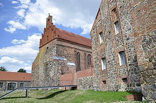
Kloster Lehnin, or just Lehnin, is a municipality in the German state of Brandenburg. It lies about 24 km (15 mi) west-south-west of Potsdam.

<span class="mw-page-title-main">Ludwigsfelde</span> Town in Brandenburg, Germany

Ludwigsfelde is a town in the north of the district Teltow-Fläming in Brandenburg.

<span class="mw-page-title-main">Blankenfelde-Mahlow</span> Municipality in Brandenburg, Germany

Blankenfelde-Mahlow is a municipality in the Teltow-Fläming district of Brandenburg, Germany. It is situated approximately 3 kilometres south of Berlin.

<span class="mw-page-title-main">Teltow</span> Town in Brandenburg, Germany

Teltow [German pronunciation:['tɛltoː] ] is a town in the Potsdam-Mittelmark district, in Brandenburg, Germany.

<span class="mw-page-title-main">Kleinmachnow</span> Municipality in Brandenburg, Germany

Kleinmachnow is a municipality of about 20,000 inhabitants in the Potsdam-Mittelmark district, in Brandenburg, Germany. It is situated south-west of the borough of Steglitz-Zehlendorf and east of Potsdam.

<span class="mw-page-title-main">Wiesenburg</span> Municipality in Brandenburg, Germany

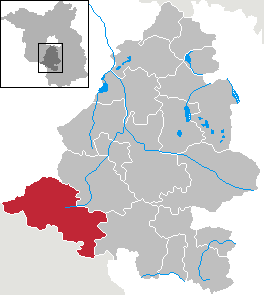
Wiesenburg is a municipality in the Potsdam-Mittelmark district, in Brandenburg, Germany. It is situated 10 km west of Bad Belzig, and 34 km southwest of Brandenburg. It is located in the High Fläming Nature Park.

<span class="mw-page-title-main">Groß Kreutz</span> Municipality in Brandenburg, Germany

Groß Kreutz is a municipality in the Potsdam-Mittelmark district, in Brandenburg, Germany.

<span class="mw-page-title-main">Michendorf</span> Municipality in Brandenburg, Germany

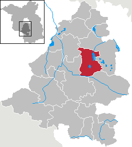
Michendorf is a municipality in the Potsdam-Mittelmark district, in Brandenburg, Germany.

<span class="mw-page-title-main">Nuthetal</span> Municipality in Brandenburg, Germany

Nuthetal is a municipality in the Potsdam-Mittelmark district, in Brandenburg, Germany.

<span class="mw-page-title-main">Schwielowsee (municipality)</span> Municipality in Brandenburg, Germany

Schwielowsee is a municipality in the Potsdam-Mittelmark district, in Brandenburg, Germany. It is situated on the shore of the Schwielowsee lake, through which the River Havel flows. The municipality was founded on December 31, 2002 in merger of the three villages Caputh, Geltow and Ferch. The Caputh Ferry, a cable ferry across the Havel, links Caputh and Geltow. In the east Schwielowsee shares border with the City of Potsdam, in the west with the town of Werder (Havel).

<span class="mw-page-title-main">Seddiner See</span> Municipality in Brandenburg, Germany

Seddiner See is a municipality in the Potsdam-Mittelmark district, in Brandenburg, Germany.

<span class="mw-page-title-main">Am Mellensee</span> Municipality in Brandenburg, Germany

Am Mellensee is a municipality in the Teltow-Fläming district of Brandenburg, Germany. The municipality, south of Berlin, is the home of the Benedictine Abbey of St. Gertrud. An Associated Press story appearing in the August 1, 2011 online version of the St. Louis Post-Dispatch detailed the breadmaking there. The nuns make Communion wafers for Eastern Germany's Catholics, including those in the Berlin area, and some Lutheran communities. They will provide the bread for the Communion wafers during the Eucharist for Papal Masses at Erfurt's Cathedral and in Berlin's Olympic Stadium to be celebrated by Pope Benedict XVI for his September 2011 visit to Germany, his third visit as Pope.

<span class="mw-page-title-main">Niedergörsdorf</span> Municipality in Brandenburg, Germany

Niedergörsdorf is a municipality in the Teltow-Fläming district of Brandenburg, Germany.

Amt Brück is an Amt in the district of Potsdam-Mittelmark, in Brandenburg, Germany. Its seat is in Brück.

Amt Niemegk is an Amt in the district of Potsdam-Mittelmark, in Brandenburg, Germany. Its seat is in Niemegk.

Amt Wusterwitz is an Amt in the district of Potsdam-Mittelmark, in Brandenburg, Germany. Its seat is in Wusterwitz.

<span class="mw-page-title-main">Amt Ziesar</span> Amt in Brandenburg, Germany

Amt Ziesar is an Amt in the district of Potsdam-Mittelmark, in Brandenburg, Germany. Its seat is in Ziesar.

References

  1. Landkreis Potsdam-Mittelmark Wahl der Bürgermeisterin / des Bürgermeisters. Retrieved 10 July 2024.
  2. "Bevölkerungsentwicklung und Bevölkerungsstandim Land Brandenburg Dezember 2022" (PDF). Amt für Statistik Berlin-Brandenburg (in German). June 2023.
  3. "Cemetery Details | CWGC".
  4. Dictionary of Scottish Architects: Robert Lorimer
  5. Detailed data sources are to be found in the Wikimedia Commons.Population Projection Brandenburg at Wikimedia Commons