Stanley Island

Last updated

Stanley Island
StanleyIslandRockArt NorthWall.png
The northern wall of Yintayin rock shelter
Geography
Location Coral Sea
ArchipelagoFlinders Group
Administration
Australia
State Queensland
Local government area Shire of Cook

Stanley Island is part of the Great Barrier Reef Marine Park at the tip of Cape Melville, Queensland in Bathurst Bay. It is located North of Denham Island and Flinders Island in the Flinders Group National Park in Princess Charlotte Bay. The island is a popular tourist destination with fine anchorage between the islands and along various coastal stretches. Stanley Island was first declared a national park in 1939. [1]

Great Barrier Reef Marine Park Protected area in Queensland, Australia

The Great Barrier Reef Marine Park protects a large part of Australia's Great Barrier Reef from damaging activities. It is a vast multiple-use Marine Park which supports a wide range of uses, including commercial marine tourism, fishing, ports and shipping, recreation, scientific research and Indigenous traditional use. Fishing and the removal of artefacts or wildlife is strictly regulated, and commercial shipping traffic must stick to certain specific defined shipping routes that avoid the most sensitive areas of the park. The Great Barrier Reef is the largest and best known coral reef ecosystem in the world. Its reefs, almost 3000 in total, represent about 10 per cent of all the coral reef areas in the world. It supports an amazing variety of biodiversity, providing a home to thousands of coral and other invertebrate species, bony fish, sharks, rays, marine mammals, marine turtles, sea snakes, as well as algae and other marine plants.

Cape Melville point in Australia

Cape Melville is a headland on the eastern coast of the Cape York Peninsula in Australia. To its west lies Princess Charlotte Bay. It is part of the Cape Melville National Park.

Bathurst Bay Bay in Queensland, Australia

Bathurst Bay is a bay in the localities of Lakefield and Starcke in the Shire of Cook, Queensland, Australia. In the 19th century it was the base for the pearling fleet. It is now a tourist attraction on Cape York Peninsula in northern Queensland, Australia, near the Great Barrier Reef.

Contents

Cape Flinders is the name of the northern tip of Stanley Island and the ship Frederick was wrecked there in 1818. [1]

Frederick was a sailing ship built in 1807 at Batavia. She made four voyages to Australia and was wrecked at Cape Flinders on Stanley Island, Queensland, Australia in 1818.

Rock art

Stanley island is an integral part of the mythological complex of the Flinders Group. There are several spectacular rock art sites on Stanley Island, the best known being the huge Yintayin rock shelter (Tindale's "Endaen") known as the "Ship" rock shelter. Other islands in the group also contain rock art, all of which are considered to be of international significance. [1]

Rock art human-made markings on natural stone

In archaeology, rock art is human-made markings placed on natural stone; it is largely synonymous with parietal art. A global phenomenon, rock art is found in many culturally diverse regions of the world. It has been produced in many contexts throughout human history, although the majority of rock art that has been ethnographically recorded has been produced as a part of ritual. Such artworks are often divided into three forms: petroglyphs, which are carved into the rock surface, pictographs, which are painted onto the surface, and earth figures, formed on the ground. The oldest known rock art dates from the Upper Palaeolithic period, having been found in Europe, Australia, Asia and Africa. Archaeologists studying these artworks believe that they likely had magico-religious significance.

The rock art covering the walls of the Ship shelter shows ships from a number of nations, painted in red and white ochre on the red sandstone: sailing ships rigged in the distinctive styles of the European lugger and the Macassan (Indonesian) prau; a dugout canoe with a figure standing upright in it, hands outstretched. Some construe the images of European vessels with high sterns to be 16th or 17th century (Portuguese) ships, which is historically notable as the first reports of exploration of this coast to reach Europe are those from Captain James Cook's voyage aboard HMS Endeavour in 1770.

Ochre painting material and color

Ochre (English) or ocher is a natural clay earth pigment which is a mixture of ferric oxide and varying amounts of clay and sand. It ranges in colour from yellow to deep orange or brown. It is also the name of the colours produced by this pigment, especially a light brownish-yellow. A variant of ochre containing a large amount of hematite, or dehydrated iron oxide, has a reddish tint known as "red ochre".

Lugger ship type

A lugger is a class of boat, widely used as traditional fishing boats, particularly off the coasts of France, England and Scotland. It is a small sailing vessel with lug sails set on two or more masts and perhaps lug topsails.

James Cook 18th-century British explorer

Captain James Cook was a British explorer, navigator, cartographer, and captain in the Royal Navy. He made detailed maps of Newfoundland prior to making three voyages to the Pacific Ocean, during which he achieved the first recorded European contact with the eastern coastline of Australia and the Hawaiian Islands, and the first recorded circumnavigation of New Zealand.

In shelters on nearby Castle Peak there are similar paintings: of a steam ship, and a detailed image of a lugger, identifiable as the Mildred, towing a dinghy. An important mythological site occurs at Muyu-Walin figuring in the major Itjibiya mythic cycle.

See also

Related Research Articles

Lincoln National Park Protected area in South Australia

Lincoln National Park is a protected area in the Australian state of South Australia located about 249 kilometres (155 mi) west of the state capital of Adelaide and about 9.5 kilometres (5.9 mi) south of the municipal seat of Port Lincoln. It consists of a mainland area on the Jussieu Peninsula on the south eastern tip of Eyre Peninsula and a number of nearby islands. The national park contains significant sites of natural, indigenous and early European heritage.

Moreton Island island

Moreton Island is an island on the eastern side of Moreton Bay on the coast of South East Queensland, Australia. The Coral Sea lies on the east coast of the island. Moreton Island lies 58 kilometres (36 mi) northeast of the Queensland capital, Brisbane. 95% of the island is contained within a national park and a popular destination for day trippers, four wheel driving, camping, recreational angling and whale watching and a 75-minute ferry ride from Brisbane. It is the third largest sand island in the world. Together with Fraser Island, Moreton Island forms the largest sand structure in the world. It was the traditional country of the Ngugi before the onset of colonization.

Flinders may refer to:

Cape Moreton Point in Australia

Cape Moreton is a rocky headland at the north eastern tip of Moreton Island in South East Queensland, Australia. The surrounding area is part of the Moreton Island National Park. Flinders Reef is 5 kilometres (3 mi) north-west of Cape Moreton.

Cape Leeuwin The most south-westerly mainland point of the Australian continent

Cape Leeuwin is the most south-westerly mainland point of the Australian continent, in the state of Western Australia.

Princess Charlotte Bay bay in Queensland, Australia

Princess Charlotte Bay is a large bay on the east coast of Far North Queensland at the base of Cape York Peninsula, 350 km north northwest of Cairns. Princess Charlotte Bay is a part of the Great Barrier Reef Marine Park and it is a habitat for the dugong.

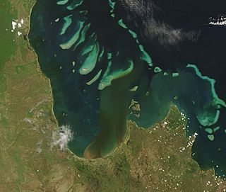
Denham Island is part of the Great Barrier Reef Marine Park at the tip of Cape Melville, Queensland in Bathurst Bay.

Maclear Island is part of the Great Barrier Reef Marine Park at the tip of Cape Melville, Queensland in Bathurst Bay.

Flinders Island (Queensland) Queensland, Australia

Flinders Island is the name given to an island that forms part of the Great Barrier Reef Marine Park at the tip of Cape Melville, Queensland in Bathurst Bay. The original indigenous name was Wurriima.

King Island is part of the Great Barrier Reef Marine Park at the tip of Cape Melville, Queensland in Bathurst Bay.

Clack Island is part of the Great Barrier Reef Marine Park at the tip of Cape Melville, Queensland in Bathurst Bay, Australia.

Blackwood Island is part of the Great Barrier Reef Marine Park at the tip of Cape Melville, Queensland in Bathurst Bay.

Albany Island island

Albany Island or Pabaju is an island at the very tip of Cape York Peninsula in the Adolphus Channel and part of the Manar Group of islands Queensland, Australia, in the Cape York Peninsula about 20 km (12 mi) East of Bamaga, and 6 km (3.7 mi) southeast of the tip of Cape York.

Booby Island (Queensland) island in Queensland, Australia

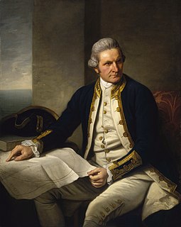
Booby Island is located 45 km (28 mi) northwest of Muttee Heads at the tip of Cape York Peninsula in Queensland, Australia. This island is in the Torres Strait, 32 km (20 mi) west of Thursday Island and 23 km (14 mi) west of Prince of Wales Island. Booby Island is also known as Ngiangu by the Kuarareg people of the western Torres Strait, its traditional owners, named for the giant Ngiangu who was forced from a neighbouring island It has been called Booby Island by a number of European explorers, including Captain Cook, for the presence of the Booby birds.

Flinders Reef is a small isolated reef near Moreton Island, 5 kilometres (3 mi) north-east of Cape Moreton in South East Queensland, Australia. It has the highest number of coral species of any subtropical reef system along Australia's east coast and is the nearest true coral reef to Brisbane. Flinders Reef is one of Queensland's most popular dive sites. The reef is located within the Moreton Bay Marine Park and is monitored by the Reef Check conservation program.

Sydney rock engravings

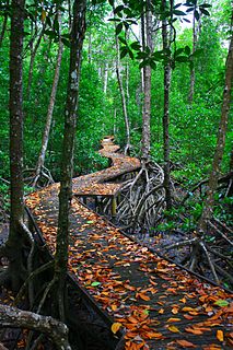
Sydney rock engravings, or Sydney rock art, are a form of Australian Aboriginal rock art in the sandstone around Sydney, New South Wales, Australia, that consist of carefully drawn images of people, animals, or symbols. Many thousands of such engravings are known to exist in the Sydney region, although the locations of most are not publicised to prevent damage by vandalism, and to retain their sanctity, as they are still regarded as sacred sites by Indigenous Australians. There are two art environments in Sydney Basin, rock shelters and engraving sites.

Hibbs Pyramid island in Tasmania, Australia

The Hibbs Pyramid is a pyramidal dolerite island, located in the Indian Ocean, off the south western coast of Tasmania, Australia. The island is contained within the Southwest National Park, part of the Tasmanian Wilderness World Heritage Site.

Lucky Bay bay near Esperance, Western Australia

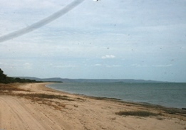
Lucky Bay is a bay located at 33°59′40″S122°13′57″E on the south coast of Western Australia, in the Cape Le Grand National Park. Located to the west of Esperance, the bay is a tourist spot known for its bright white sands and turquoise-coloured waters.

Colony of Queensland colony of the British Empire from 1859 to 1901

The Colony of Queensland was a colony of the British Empire from 1859 to 1901, when it became a State in the federal Commonwealth of Australia on 1 January 1901. At its greatest extent, the colony included the present-day State of Queensland, the Territory of Papua and the Coral Sea Islands Territory.

The Walmbaria are an indigenous Australian people of Cape York Peninsula in northern Queensland.

References

  1. 1 2 3 "Flinders Group National Park: Nature, culture and history". Department of Environment and Resource Management. The State of Queensland. Retrieved 22 May 2010.

Coordinates: 14°09′11″S144°14′06″E / 14.153°S 144.235°E / -14.153; 144.235

Geographic coordinate system Coordinate system

A geographic coordinate system is a coordinate system that enables every location on Earth to be specified by a set of numbers, letters or symbols. The coordinates are often chosen such that one of the numbers represents a vertical position and two or three of the numbers represent a horizontal position; alternatively, a geographic position may be expressed in a combined three-dimensional Cartesian vector. A common choice of coordinates is latitude, longitude and elevation. To specify a location on a plane requires a map projection.