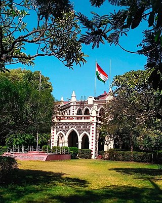
Jalgaon district is a district in Maharashtra, India. Its headquarters is the Jalgaon city.

Chopda or Chopra is a city and municipal council in the Jalgaon district in the state of Maharashtra, India.
Chandgad is a small city and tehsil headquarters of chandgad taluka, of Kolhapur district that is in the Indian state of Maharashtra.
State Highway 10, commonly referred to as MH SH 10, is a normal state highway that runs south through Pune, Ahmednagar, Nashik and Dhule districts in the state of Maharashtra, India. This state highway touches the cities of Dondaicha, Shevade, Mehergaon, Kusumbe, Malegaon, Manmad, Yeola, Kopargaon, Shirdi Rahata, Rahuri, Ahmednagar, Kashti, and Daund.
Maharashtra State Highway 151, commonly referred to as SH 151, is a state highway that runs south through Solapur district in the state of Maharashtra. This state highway touches the cities of Barshi – Vairag – Solapur – Akkalkot and then proceeds south towards Maharashtra-Karnataka state border.
Khandala is a town and taluka in the Satara district in the Indian state of Maharashtra.
Malkapur Assembly constituency is one of the seven constituencies of Maharashtra Legislative Assembly located in the Buldhana district.
Maharashtra Major State Highway 1, commonly referred to as MH MSH 1, is a major state highway that runs south through Dhule and Nandurbar districts in the state of Maharashtra. This state highway touches numerous cities and villages, namely Songir, Chimthane, Dondaicha, Nimgul, Shahada, Dhadgaon, Kathi, Molgi, Wadifali and then proceeds south-west towards Maharashtra-Gujarat state border. This highway enters Gujarat State near Wadifali village which is on border of Nandurbar district of Maharashtra and Narmada district of Gujarat and ends at Dumkhal village which is just 15 km South-East of Sardar Sarovar Dam.
Maharashtra State Highway 2,, is a state highway in northern Maharashtra. This nomenclature is adopted for a short 55-kilometer state highway; the route is as follows : Mhasavad – Islampur – Lakkadkot – Ranipur – Nagziri – Toranmal. It connects the above-mentioned villages to the tehsil headquarter at Shahada. The traffic on the route being limited, it's designed for light two-way traffic only.
Nagaon BK is a small but prosperous village in Amalner Taluka, Jalgaon District, Maharashtra, India.

Parner taluka is a taluka in Ahmednagar district in the state of Maharashtra in western India.

Ambegaon taluka is a taluka in Shirur subdivision of Pune district of state of Maharashtra in India. One of the twelve most revered Shiva temples or Jyotirlinga, the Bhimashankar Temple is in Khed taluka. But due to Bhimashankar Sanctuary, the road is through Ambegaon taluka.
Aner Dam, is an earthfill dam on Aner river in Shirpur taluka, Dhule district in state of Maharashtra in India. The dam is 8 km from Hisale village which is situated near Shirpur-Chopda state highway in Shirpur Tehsil.

Gadhinglaj is a taluka in Maharashtra. The city of Gadhinglaj is the taluka headquarters and Gadhinglaj subdivision headquarters as well. As of 2011, the taluka had a population of 874,015, of which 35% were urban. Languages spoken in this area are Marathi, Kannada, Hindi and English also. But the most-spoken language is Marathi, as Marathi is a state language.
Maharashtra State Highway 134, commonly referred to as MH SH 134, is a normal state highway that runs south through Kolhapur district and Sindhudurg district in the state of Maharashtra, India. This state highway touches the cities of Sankeshwar-Gadhinglaj-Kadgaon-Ajra-Amboli and then proceeds from Maharashtra-Karnataka state border from East-West towards Sawantvadi in Sindhudurg. It covers a distance of over 110 km.
Bijapur Taluk, officially Vijayapura Taluka, is a taluka in the Indian state of Karnataka. It is located in the Bijapur district. The administrative centre for Bijapur Taluka is in the city of Bijapur. The taluka is located in the southwest quadrant of the district. In the 2011 census there were forty-six panchayat villages in Bijapur Taluka. The main river in the taluka is the Don River.
Vadade Navapur Taluka is a taluka in Nandurbar District of the Indian state of Maharashtra. Its headquarters is in the municipality of Navapur.
Maharashtra Major State Highway 9 also MSH 9 is a Major State Highway that runs south through Nagpur, and Chandrapur districts in the state of Maharashtra. This state highway touches numerous cities and villages VIZ. Nagpur, Umred, Nagbhid, Mul and Chandrapur. Tadoba Andhari Tiger Project and Umred Karhandla Wildlife Sanctuary are along with this highway.
Maharashtra Major State Highway 10, commonly referred to as MH or MSH-10, is a major state highway that runs north east through Amravati districts in the state of Maharashtra. This state highway touches numerous cities and villages Viz. Nandgoan, Morshi, Warud and then proceeds north-west towards Maharashtra-Madhya Pradesh state border. This highway enters in Madhya Pradesh State near Bangoan village which is on border of Amravati district of Maharashtra and Chhindwara district of Madhya Pradesh and ends at Bangoan village which is just 15 km East of Pandhurna in Madhya Pradesh.
Kingaon is a village in Yawal taluka of Jalgaon district, Maharashtra, India. It is located between the foot hill of Satpura mountain and the bank of Tapti River. Kingaon is 25 km from the city of Jalgaon. Majority of the population consisting of farmers with banana & onion as the major product.


