
Jamshedpur, also known as Tatanagar, is the largest and the most populous city in Jharkhand and the first planned industrial city of India. It is a Notified Area Council and Municipal Corporation and also the headquarter of the East Singhbhum district. It is a popular tourist destination known for its forests, ancient temples and royal palaces. It was ranked as the fifth cleanest city of India in the year 2023.

The Subarnarekha River flows through the Indian states of Jharkhand, West Bengal and Odisha.
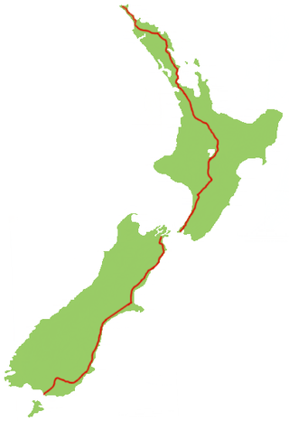
State Highway 1 is the longest and most significant road in the New Zealand road network, running the length of both main islands. It appears on road maps as SH 1 and on road signs as a white number 1 on a red shield, but it has the official designations SH 1N in the North Island, SH 1S in the South Island.
Baharagora is a town in the Baharagora CD block in the Ghatshila subdivision of the East Singhbhum district, in the Indian state of Jharkhand.
Bundu is a subdivisional town, a notified area, in the Bundu subdivision of Ranchi district in the state of Jharkhand, India. Situated about 40 km from the city of Ranchi and 83 km from the industrial city of Jamshedpur.
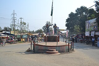
Jadugora is a census town in the Musabani CD block in the Ghatshila subdivision of the East Singhbhum district in the Indian state of Jharkhand.
Muri is a census town in the Silli CD block in the Ranchi Sadar subdivision of Ranchi district in the Indian state of Jharkhand. It is an important railway junction and is famous for Hindalco's alumina refinery.
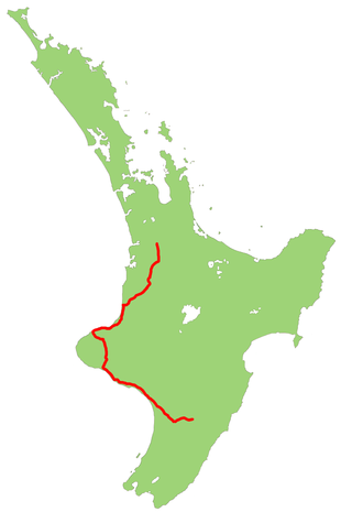
State Highway 3 (SH 3) is one of New Zealand's eight national state highways. It serves the west coast of the country's North Island and forms a link between State Highway 1 and State Highway 2. Distances are measured from north to south.

State Highway 2 runs north–south through eastern parts of the North Island of New Zealand from the outskirts of Auckland to Wellington. It runs through Tauranga, Gisborne, Napier, Hastings and Masterton. It is the second-longest highway in the North Island, after State Highway 1, which runs the length of both of the country's main islands.
Baghmundi is a village, with a police station, in the Baghmundi CD block in the Jhalda subdivision of the Purulia district in the state of West Bengal, India.
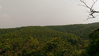
Jhargram is a district in the state of West Bengal, India.The district lies between the Kangsabati River in the north and the Subarnarekha in the south. Jhargram has one of the lowest population densities among the districts of West Bengal, with almost all its population living in rural areas. It is a popular tourist destination known for its sal forests, elephants, ancient temples and royal palaces. The district was formed on 4 April 2017, after bifurcation from the Paschim Medinipur district as the 22nd district of West Bengal. The district has its headquarters at Jhargram.
Silli is a village in the Silli CD block in the Ranchi Sadar subdivision of the Ranchi district in the Indian state of Jharkhand.
Tamar is a village in the Tamar CD block in the Bundu subdivision of the Ranchi district in the Indian state of Jharkhand.
Namkum is a neighbourhood of Ranchi in the Ranchi Sadar subdivision of the Ranchi district in the Indian state of Jharkhand.
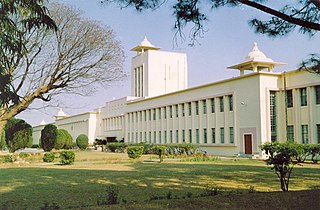
Mesra is a town in the Kanke CD block in the Ranchi Sadar subdivision of the Ranchi district in the Indian state of Jharkhand.
Pithoria is a village in the Kanke CD block in the Ranchi Sadar subdivision of the Ranchi district in the Indian state of Jharkhand.

Chandil Dam was built across the Subarnarekha, in Bihar, as a part of the Subarnarekha Multipurpose Project.
Gobindpur is a village in the Gobindpur CD block in the Seraikela Sadar subdivision of the Seraikela Kharsawan district in the Indian state of Jharkhand.
Potka is a village in the Potka CD block in the Dhalbhum subdivision of the East Singhum district in the Indian state of Jharkhand.
Hata is a village in the Potka CD block in the Dhalbhum subdivision of the East Singhbhum district in the Indian state of Jharkhand.


